TopoQuest Logo
Do you find TopoQuest useful?
Help keep TopoQuest running and adding new maps/features by donating!
Bitcoin:  19c7KJd3qBynnjoSw5npx9KScwjBe4ifkT
Litecoin:  LXs6TkuXGGXo1vDsWCkWVdjQX94eUKd6ui
Home View Maps Find Maps Find Places Resources & Links


Moore Station, Texas Topographic Map

USGS Map Title: Moore Station, TX
USGS Map MRC: 32095B5
DRG (GeoTIFF) Download: o32095b5.tif


Neighboring USGS Topographic Map Quads:


  Murchinson East, TX  
32095C6
 

  Brownsboro, TX  
32095C5
 

  Chandler, TX  
32095C4
 

  Leagueville, TX  
32095B6
 

  Moore Station, TX  
32095B5
 

  Saline Bay, TX  
32095B4
 

  LaRue, TX  
32095A6
 

  Poynor, TX  
32095A5
 

  Berryville, TX  
32095A4


Map MRC Location:

N33°
W96°
N33°
W95°
H8 H7 H6 H5 H4 H3 H2 H1
G8 G7 G6 G5 G4 G3 G2 G1
F8 F7 F6 F5 F4 F3 F2 F1
E8 E7 E6 E5 E4 E3 E2 E1
D8 D7 D6 D5 D4 D3 D2 D1
C8 C7 C6 C5 C4 C3 C2 C1
B8 B7 B6 B5 B4 B3 B2 B1
A8 A7 A6 A5 A4 A3 A2 A1
N32°
W96°
N32°
W95°

Moore Station, TX USGS 1:24K Topographic Map Preview:
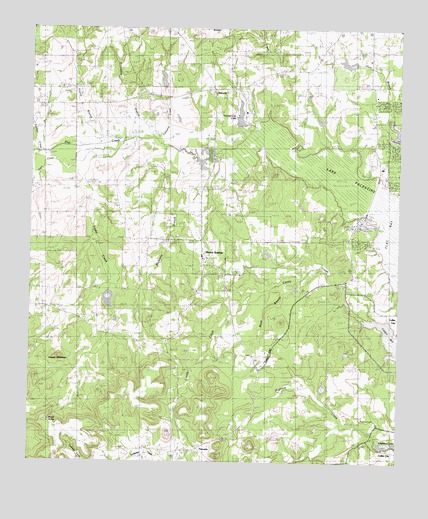
Moore Station, TX USGS Topographic Map
Click on map above to begin viewing in our Map Viewer.

This topographic map contains these locations and features:
Feature Name Type Latitude Longitude GNIS ID View Map
Anderson MarshLakeN32.1803°W95.5985°1329524View Map
AntiochPopulated PlaceN32.2324°W95.5641°1377943View Map
Bagley LakeReservoirN32.2418°W95.5119°1854601View Map
Bagley Lake DamDamN32.2418°W95.5119°1854600View Map
Bethel CemeteryCemeteryN32.1493°W95.5288°1330480View Map
Bethel ChurchChurchN32.1490°W95.5475°1330497View Map
Boggy CreekStreamN32.2110°W95.5402°1372662View Map
Central Community CenterBuildingN32.1849°W95.5677°1388181View Map
Central High School (historical)SchoolN32.1849°W95.5677°1387804View Map
City of Moore StationCivilN32.1906°W95.5704°2411156View Map
Cooper MountainSummitN32.1557°W95.6155°1333300View Map
Dunn CreekStreamN32.2138°W95.6241°1334796View Map
FincastlePopulated PlaceN32.1293°W95.5677°1378292View Map
Friendship BranchStreamN32.2168°W95.5961°1336220View Map
Friendship CemeteryCemeteryN32.2321°W95.5886°1336222View Map
Frontier City LakeLakeN32.2251°W95.5545°1890034View Map
Frontier City LakeReservoirN32.2218°W95.5536°1854607View Map
Frontier City Lake DamDamN32.2218°W95.5536°1854606View Map
Gum BranchStreamN32.2196°W95.5002°1334246View Map
Highsaw CreekStreamN32.1321°W95.5058°1374071View Map
Hurts LakeLakeN32.1469°W95.5254°1338329View Map
Kidd LakeReservoirN32.2354°W95.5806°1854593View Map
Kidd Lake DamDamN32.2335°W95.5802°1854592View Map
LaRue-Poynor DivisionCivilN32.1353°W95.6073°1938911View Map
Lone Star ChurchChurchN32.1896°W95.5677°1340394View Map
Lonestar Baptist ChurchChurchN32.1993°W95.5677°2021047View Map
Moore SpringSpringN32.1368°W95.6185°1889906View Map
Moore StationPopulated PlaceN32.1818°W95.5669°1341888View Map
Moore Station City HallBuildingN32.1848°W95.5670°2753823View Map
Mulberry BranchStreamN32.2154°W95.5741°1342238View Map
Myrtle Springs CemeteryCemeteryN32.1374°W95.6200°1342340View Map
Panther CreekStreamN32.2143°W95.6233°1375351View Map
Putegnat SchoolStreamN32.2124°W95.6088°1375557View Map
Rodgers LakeReservoirN32.1794°W95.5970°1854595View Map
Rodgers Lake DamDamN32.1785°W95.5969°1854594View Map
Tex Iron Incorporated Dam Number 1DamN32.1335°W95.6019°1863797View Map
Tex Iron Incorporated Dam Number 2DamN32.1335°W95.6069°1863799View Map
Tex Iron Incorporated Reservoir Number 1ReservoirN32.1330°W95.6031°1863798View Map
Tex Iron Incorporated Reservoir Number 2ReservoirN32.1338°W95.6054°1863800View Map
Tindel CreekStreamN32.2121°W95.6113°1348585View Map
Tonyard CreekStreamN32.2168°W95.5830°1348642View Map
Union Station African Methodist Episcopal ChurchChurchN32.1802°W95.5586°2021033View Map
Westside Volunteer Fire DepartmentBuildingN32.2144°W95.5067°2655167View Map

Note: Coordinates in the location and feature list above are referenced to NAD83 datum.


Copyright (C) 2008-2024 Ryan Niemi / Sunset Dynamics ... All Rights Reserved