TopoQuest Logo
Do you find TopoQuest useful?
Help keep TopoQuest running and adding new maps/features by donating!
Bitcoin:  19c7KJd3qBynnjoSw5npx9KScwjBe4ifkT
Litecoin:  LXs6TkuXGGXo1vDsWCkWVdjQX94eUKd6ui
Home View Maps Find Maps Find Places Resources & Links


Bee Branch, Arkansas Topographic Map

USGS Map Title: Bee Branch, AR
USGS Map MRC: 35092D4
DRG (GeoTIFF) Download: o35092d4.tif


Neighboring USGS Topographic Map Quads:


  Scotland, AR  
35092E5
 

  Clinton, AR  
35092E4
 

  Fairfield Bay, AR  
35092E3
 

  Formosa, AR  
35092D5
 

  Bee Branch, AR  
35092D4
 

  Morganton, AR  
35092D3
 

  Springfield, AR  
35092C5
 

  Damascus, AR  
35092C4
 

  Guy, AR  
35092C3


Map MRC Location:

N36°
W93°
N36°
W92°
H8 H7 H6 H5 H4 H3 H2 H1
G8 G7 G6 G5 G4 G3 G2 G1
F8 F7 F6 F5 F4 F3 F2 F1
E8 E7 E6 E5 E4 E3 E2 E1
D8 D7 D6 D5 D4 D3 D2 D1
C8 C7 C6 C5 C4 C3 C2 C1
B8 B7 B6 B5 B4 B3 B2 B1
A8 A7 A6 A5 A4 A3 A2 A1
N35°
W93°
N35°
W92°

Bee Branch, AR USGS 1:24K Topographic Map Preview:
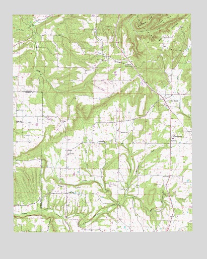
Bee Branch, AR USGS Topographic Map
Click on map above to begin viewing in our Map Viewer.

This topographic map contains these locations and features:
Feature Name Type Latitude Longitude GNIS ID View Map
B B Ranch LakeReservoirN35.4567°W92.4371°79626View Map
B B Ranch Lake DamDamN35.4567°W92.4385°79625View Map
Bee BranchPopulated PlaceN35.4509°W92.3946°76277View Map
Bee Branch Baptist ChurchChurchN35.4473°W92.3927°68644View Map
Bee Branch CemeteryCemeteryN35.4470°W92.3929°68645View Map
Bee Branch Post OfficePost OfficeN35.4511°W92.3935°84429View Map
Bee Branch Volunteer Fire DepartmentBuildingN35.4490°W92.3937°2116123View Map
Bethlehem ChurchChurchN35.4706°W92.4174°46481View Map
Black Ward RidgeRidgeN35.4990°W92.4013°46681View Map
Blackwell CemeteryCemeteryN35.4323°W92.4257°46698View Map
Duke CreekStreamN35.4048°W92.4435°48695View Map
East Mountain (historical)Populated PlaceN35.4923°W92.3821°68662View Map
Grassy CreekStreamN35.3906°W92.4265°49566View Map
Harmony MountainSummitN35.4720°W92.4290°57889View Map
Hickory Grove ChurchChurchN35.4381°W92.4940°50067View Map
Hopewell Church (historical)ChurchN35.4442°W92.4793°78883View Map
Johnson BranchStreamN35.3958°W92.3953°2709543View Map
Kill Dead CreekStreamN35.4056°W92.4179°50839View Map
Lloyd CemeteryCemeteryN35.3998°W92.4254°51352View Map
Lunsford PointCapeN35.4959°W92.3946°51514View Map
Pine Mountain CreekStreamN35.3826°W92.4640°53463View Map
Pleasant Valley ChurchChurchN35.4195°W92.4621°53615View Map
Quattlebaum CemeteryCemeteryN35.4737°W92.4215°53860View Map
Rabbit RidgePopulated PlaceN35.3973°W92.4635°68690View Map
Rabbit RidgeRidgeN35.4004°W92.4618°53865View Map
Rabbit Ridge ChurchChurchN35.3976°W92.4577°53866View Map
Roberts MountainSummitN35.3826°W92.4752°58502View Map
Slick Rock CreekStreamN35.4940°W92.4857°54907View Map
South Side Elementary SchoolSchoolN35.4297°W92.3878°68701View Map
South Side High SchoolSchoolN35.4285°W92.3881°68702View Map
SouthsidePopulated PlaceN35.4265°W92.3899°58664View Map
Southside ChurchChurchN35.4070°W92.3918°55045View Map
Southside SchoolsSchoolN35.4301°W92.3871°55047View Map
Steele Hopewell United Methodist ChurchChurchN35.4265°W92.4360°78455View Map
Tater HillSummitN35.4023°W92.4013°58730View Map
Township of BarnettCivilN35.3889°W92.4099°69760View Map
Township of BradleyCivilN35.4458°W92.4044°69761View Map
Ward CreekStreamN35.3948°W92.4221°56045View Map
WhipplePopulated PlaceN35.4220°W92.4621°58863View Map
Wolf Fall HollowValleyN35.4979°W92.4127°56492View Map

Note: Coordinates in the location and feature list above are referenced to NAD83 datum.


Copyright (C) 2008-2024 Ryan Niemi / Sunset Dynamics ... All Rights Reserved