TopoQuest Logo
Do you find TopoQuest useful?
Help keep TopoQuest running and adding new maps/features by donating!
Bitcoin:  19c7KJd3qBynnjoSw5npx9KScwjBe4ifkT
Litecoin:  LXs6TkuXGGXo1vDsWCkWVdjQX94eUKd6ui
Home View Maps Find Maps Find Places Resources & Links


Springfield, Arkansas Topographic Map

USGS Map Title: Springfield, AR
USGS Map MRC: 35092C5
DRG (GeoTIFF) Download: o35092c5.tif


Neighboring USGS Topographic Map Quads:


  Cleveland, AR  
35092D6
 

  Formosa, AR  
35092D5
 

  Bee Branch, AR  
35092D4
 

  Solgohachia, AR  
35092C6
 

  Springfield, AR  
35092C5
 

  Damascus, AR  
35092C4
 

  Morrilton East, AR  
35092B6
 

  Menifee, AR  
35092B5
 

  Greenbrier, AR  
35092B4


Map MRC Location:

N36°
W93°
N36°
W92°
H8 H7 H6 H5 H4 H3 H2 H1
G8 G7 G6 G5 G4 G3 G2 G1
F8 F7 F6 F5 F4 F3 F2 F1
E8 E7 E6 E5 E4 E3 E2 E1
D8 D7 D6 D5 D4 D3 D2 D1
C8 C7 C6 C5 C4 C3 C2 C1
B8 B7 B6 B5 B4 B3 B2 B1
A8 A7 A6 A5 A4 A3 A2 A1
N35°
W93°
N35°
W92°

Springfield, AR USGS 1:24K Topographic Map Preview:
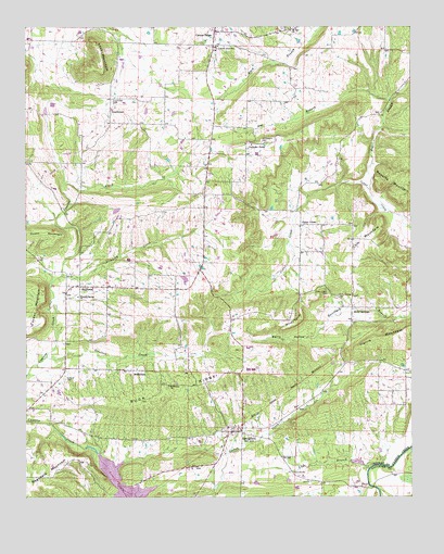
Springfield, AR USGS Topographic Map
Click on map above to begin viewing in our Map Viewer.

This topographic map contains these locations and features:
Feature Name Type Latitude Longitude GNIS ID View Map
Berry HollowValleyN35.3001°W92.5213°46410View Map
BethlehemPopulated PlaceN35.2837°W92.5877°57368View Map
Bethlehem ChurchChurchN35.2795°W92.5788°46479View Map
BirdtownPopulated PlaceN35.3062°W92.6077°57382View Map
Birdtown Fire StationBuildingN35.3060°W92.5946°2116154View Map
Brindley CreekStreamN35.3090°W92.6135°46959View Map
Buck RidgeRidgeN35.2787°W92.5765°47136View Map
Catholic PointPopulated PlaceN35.3442°W92.5529°57527View Map
Cedar CreekPopulated PlaceN35.3226°W92.5354°56953View Map
Cedar Creek CemeteryCemeteryN35.3054°W92.5279°47600View Map
Center RidgePopulated PlaceN35.3740°W92.5629°76571View Map
Center Ridge Post OfficePost OfficeN35.3734°W92.5635°84361View Map
Cole MountainSummitN35.3167°W92.5196°57569View Map
GrandviewPopulated PlaceN35.3531°W92.5974°57839View Map
Grandview CemeteryCemeteryN35.3565°W92.5957°49550View Map
Harris MountainSummitN35.2912°W92.5135°57891View Map
Heifer Creek Ranch AirportAirportN35.3000°W92.5755°2650721View Map
Hog BranchStreamN35.3309°W92.5129°50164View Map
Holly SpringsPopulated PlaceN35.2987°W92.5193°57934View Map
Holly Springs CemeteryCemeteryN35.3034°W92.5238°50245View Map
Huett MountainSummitN35.3209°W92.6196°57955View Map
Kilgore CemeteryCemeteryN35.2815°W92.6124°50837View Map
Lick BranchStreamN35.2584°W92.5121°51127View Map
Lost MountainSummitN35.3642°W92.5999°51475View Map
Mount Zion ChurchChurchN35.3748°W92.5388°52481View Map
Nemo Vista Elementary SchoolSchoolN35.3695°W92.5637°2039133View Map
Nemo Vista High SchoolSchoolN35.3696°W92.5622°83471View Map
Pleasant Springs ChurchChurchN35.3034°W92.6079°53604View Map
Saint Josephs CemeteryCemeteryN35.3445°W92.5482°54376View Map
SpringfieldPopulated PlaceN35.2676°W92.5577°55130View Map
Springfield Fire Department District 1BuildingN35.2649°W92.5608°2117166View Map
Springfield Post OfficePost OfficeN35.2673°W92.5582°84368View Map
Stratton CreekStreamN35.2876°W92.6185°55266View Map
Township of BirdCivilN35.3079°W92.6142°66435View Map
Township of Catholic PointCivilN35.3417°W92.5293°66436View Map
Township of UnionCivilN35.2646°W92.5367°66450View Map
Tucker MountainSummitN35.3048°W92.6204°58762View Map
Windy PointCapeN35.2965°W92.5363°56457View Map

Note: Coordinates in the location and feature list above are referenced to NAD83 datum.


Copyright (C) 2008-2025 Ryan Niemi / Sunset Dynamics ... All Rights Reserved