TopoQuest Logo
Do you find TopoQuest useful?
Help keep TopoQuest running and adding new maps/features by donating!
Bitcoin:  19c7KJd3qBynnjoSw5npx9KScwjBe4ifkT
Litecoin:  LXs6TkuXGGXo1vDsWCkWVdjQX94eUKd6ui
Home View Maps Find Maps Find Places Resources & Links


Morgan, Wyoming Topographic Map

USGS Map Title: Morgan, WY
USGS Map MRC: 41106D2
DRG (GeoTIFF) Download: o41106d2.tif


Neighboring USGS Topographic Map Quads:


  White Rock Canyon, WY  
41106E3
 

  Arlington, WY  
41106E2
 

  Bengough Hill, WY  
41106E1
 

  Sand Lake, WY  
41106D3
 

  Morgan, WY  
41106D2
 

  Strouss Hill, WY  
41106D1
 

  Medicine Bow Peak, WY  
41106C3
 

  Centennial, WY  
41106C2
 

  Rex Lake, WY  
41106C1


Map MRC Location:

N42°
W107°
N42°
W106°
H8 H7 H6 H5 H4 H3 H2 H1
G8 G7 G6 G5 G4 G3 G2 G1
F8 F7 F6 F5 F4 F3 F2 F1
E8 E7 E6 E5 E4 E3 E2 E1
D8 D7 D6 D5 D4 D3 D2 D1
C8 C7 C6 C5 C4 C3 C2 C1
B8 B7 B6 B5 B4 B3 B2 B1
A8 A7 A6 A5 A4 A3 A2 A1
N41°
W107°
N41°
W106°

Morgan, WY USGS 1:24K Topographic Map Preview:
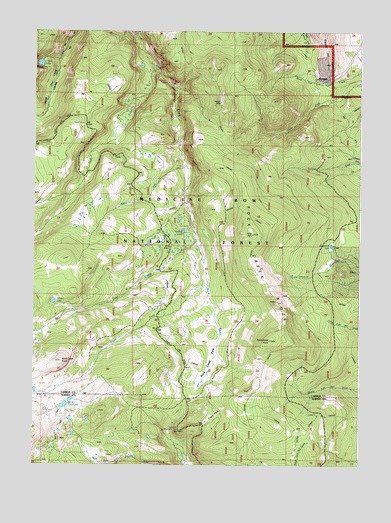
Morgan, WY USGS Topographic Map
Click on map above to begin viewing in our Map Viewer.

This topographic map contains these locations and features:
Feature Name Type Latitude Longitude GNIS ID View Map
Arlington Pack TrailTrailN41.4825°W106.1775°1597801View Map
Clark ParkLocaleN41.3883°W106.1822°1598773View Map
Cooper HillSummitN41.4908°W106.1383°1598894View Map
Crater LakeLakeN41.4905°W106.2478°1599005View Map
Firebox LakeLakeN41.4424°W106.1927°1704433View Map
Golden LakeLakeN41.4220°W106.2424°1704436View Map
Lulu RidgeRidgeN41.4833°W106.1672°1704456View Map
Middle Fork Rock CreekStreamN41.4614°W106.1906°1601408View Map
Morrisey (historical)Populated PlaceN41.4866°W106.1417°1601558View Map
North Fork Observation PointLocaleN41.3847°W106.1942°1601801View Map
North Fork Rock CreekStreamN41.4889°W106.2025°1601808View Map
North Twin LakesLakeN41.3937°W106.2356°1601871View Map
Rat LakeLakeN41.4458°W106.1945°1704449View Map
Rock Creek KnollSummitN41.4050°W106.2392°1602589View Map
Rock Creek ParkFlatN41.4041°W106.1808°1602590View Map
Rock Creek PointSummitN41.4111°W106.1589°1602592View Map
Rock Creek RidgeRidgeN41.4416°W106.1658°1602593View Map
Sevenmile LakeLakeN41.4384°W106.1362°1602804View Map
Snow Bank LakeLakeN41.3792°W106.2474°1763997View Map
South Fork Rock CreekStreamN41.4272°W106.1828°1603170View Map
Trail CreekStreamN41.4402°W106.1867°1603731View Map

Note: Coordinates in the location and feature list above are referenced to NAD83 datum.


Copyright (C) 2008-2025 Ryan Niemi / Sunset Dynamics ... All Rights Reserved