TopoQuest Logo
Do you find TopoQuest useful?
Help keep TopoQuest running and adding new maps/features by donating!
Bitcoin:  19c7KJd3qBynnjoSw5npx9KScwjBe4ifkT
Litecoin:  LXs6TkuXGGXo1vDsWCkWVdjQX94eUKd6ui
Home View Maps Find Maps Find Places Resources & Links


Bengough Hill, Wyoming Topographic Map

USGS Map Title: Bengough Hill, WY
USGS Map MRC: 41106E1
DRG (GeoTIFF) Download: o41106e1.tif


Neighboring USGS Topographic Map Quads:


  McFadden, WY  
41106F2
 

  Pierce Reservoir, WY  
41106F1
 

  Rock River, WY  
41105F8
 

  Arlington, WY  
41106E2
 

  Bengough Hill, WY  
41106E1
 

  Big Judson, WY  
41105E8
 

  Morgan, WY  
41106D2
 

  Strouss Hill, WY  
41106D1
 

  James Lake, WY  
41105D8


Map MRC Location:

N42°
W107°
N42°
W106°
H8 H7 H6 H5 H4 H3 H2 H1
G8 G7 G6 G5 G4 G3 G2 G1
F8 F7 F6 F5 F4 F3 F2 F1
E8 E7 E6 E5 E4 E3 E2 E1
D8 D7 D6 D5 D4 D3 D2 D1
C8 C7 C6 C5 C4 C3 C2 C1
B8 B7 B6 B5 B4 B3 B2 B1
A8 A7 A6 A5 A4 A3 A2 A1
N41°
W107°
N41°
W106°

Bengough Hill, WY USGS 1:24K Topographic Map Preview:
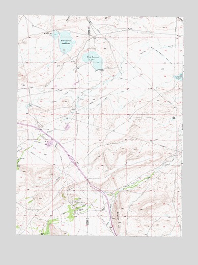
Bengough Hill, WY USGS Topographic Map
Click on map above to begin viewing in our Map Viewer.

This topographic map contains these locations and features:
Feature Name Type Latitude Longitude GNIS ID View Map
Beaver PondsLakeN41.5395°W106.1247°1585329View Map
Bengough HillSummitN41.5077°W106.0475°1585379View Map
Bosler DamDamN41.6150°W106.0939°1606150View Map
Bosler ReservoirReservoirN41.6098°W106.0889°1585793View Map
Cooper Cove Oil FieldOilfieldN41.5186°W106.0767°1586961View Map
Dunn RanchLocaleN41.5677°W106.0075°1587927View Map
Dutton Creek DitchCanalN41.5791°W106.0550°1587951View Map
Dutton Creek Oil FieldOilfieldN41.5594°W106.1075°1587952View Map
Dutton Creek Reservoir Supply DitchCanalN41.6100°W106.0275°1587954View Map
East Fork Dutton CreekStreamN41.5422°W106.1236°1599469View Map
Fry MineMineN41.6230°W106.0786°1726100View Map
J F White ProspectMineN41.6206°W106.0892°1726101View Map
Jankovsky RanchLocaleN41.5144°W106.0781°1590059View Map
Jimmie CreekStreamN41.5739°W106.1156°1600626View Map
King Number 1 DamDamN41.5933°W106.0639°1606140View Map
King Reservoir Number OneReservoirN41.6000°W106.0677°1605327View Map
McFadden Number 3 DamDamN41.6150°W106.0939°1606168View Map
McFadden Reservoir Number ThreeReservoirN41.6139°W106.0973°1605366View Map
North Fork Cooper CreekStreamN41.5039°W106.1003°1601750View Map
Northrop Ditch Number 5CanalN41.5458°W106.0050°1605407View Map
Northrop Ditch Number 7CanalN41.5300°W106.0364°1605408View Map
Seepage CreekStreamN41.5814°W106.0745°1594088View Map
Seepage DamDamN41.5950°W106.1239°1606172View Map
Seepage ReservoirReservoirN41.5950°W106.1239°1606173View Map
Sheep CreekStreamN41.5658°W106.0861°1602831View Map
South Fork Cooper CreekStreamN41.5241°W106.0492°1604350View Map
Terry MineMineN41.6241°W106.0845°1726088View Map

Note: Coordinates in the location and feature list above are referenced to NAD83 datum.


Copyright (C) 2008-2024 Ryan Niemi / Sunset Dynamics ... All Rights Reserved