TopoQuest Logo
Do you find TopoQuest useful?
Help keep TopoQuest running and adding new maps/features by donating!
Bitcoin:  19c7KJd3qBynnjoSw5npx9KScwjBe4ifkT
Litecoin:  LXs6TkuXGGXo1vDsWCkWVdjQX94eUKd6ui
Home View Maps Find Maps Find Places Resources & Links


Morgan Butte, Oregon Topographic Map

USGS Map Title: Morgan Butte, OR
USGS Map MRC: 42120E5
DRG (GeoTIFF) Download: o42120e5.tif


Neighboring USGS Topographic Map Quads:


  Slide Mountain, OR  
42120F6
 

  Paisley, OR  
42120F5
 

  Coglan Buttes, OR  
42120F4
 

  Coffeepot Creek, OR  
42120E6
 

  Morgan Butte, OR  
42120E5
 

  Tucker Hill, OR  
42120E4
 

  Coleman Point, OR  
42120D6
 

  Shoestring Butte, OR  
42120D5
 

  Clover Flat, OR  
42120D4


Map MRC Location:

N43°
W121°
N43°
W120°
H8 H7 H6 H5 H4 H3 H2 H1
G8 G7 G6 G5 G4 G3 G2 G1
F8 F7 F6 F5 F4 F3 F2 F1
E8 E7 E6 E5 E4 E3 E2 E1
D8 D7 D6 D5 D4 D3 D2 D1
C8 C7 C6 C5 C4 C3 C2 C1
B8 B7 B6 B5 B4 B3 B2 B1
A8 A7 A6 A5 A4 A3 A2 A1
N42°
W121°
N42°
W120°

Morgan Butte, OR USGS 1:24K Topographic Map Preview:
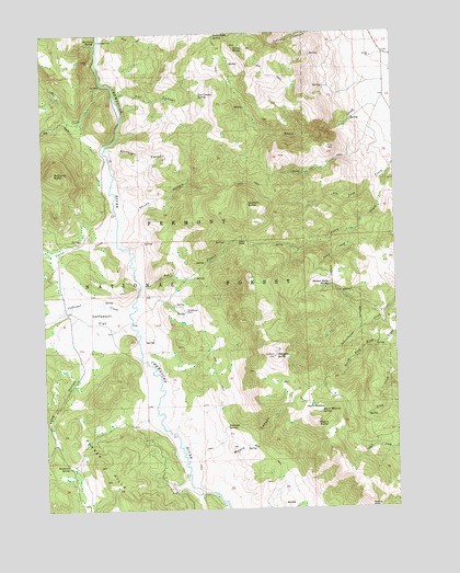
Morgan Butte, OR USGS Topographic Map
Click on map above to begin viewing in our Map Viewer.

This topographic map contains these locations and features:
Feature Name Type Latitude Longitude GNIS ID View Map
Antelope CreekStreamN42.5165°W120.5789°1153338View Map
Antelope SpringSpringN42.5216°W120.5617°1137246View Map
Avery CreekStreamN42.5877°W120.5039°1137353View Map
Avery PassGapN42.5702°W120.5541°1137355View Map
Bear CreekStreamN42.6115°W120.6050°1137675View Map
Brattain ButteSummitN42.5804°W120.5544°1138575View Map
Buckaroo SpringSpringN42.5112°W120.6176°1138840View Map
Burford CanyonValleyN42.5946°W120.6030°1138965View Map
Cat CanyonValleyN42.6093°W120.6002°1139451View Map
Cat Canyon SpringSpringN42.6086°W120.5696°1139453View Map
Chewaucan Crossing TrailheadLocaleN42.6121°W120.6041°1952920View Map
Coffeepot CreekStreamN42.5535°W120.5950°1139892View Map
Coffeepot FlatFlatN42.5504°W120.6100°1139895View Map
Corral CreekStreamN42.5754°W120.5994°1140141View Map
Dog CreekStreamN42.6029°W120.6111°1141131View Map
Ennis ButteSummitN42.6207°W120.5527°1141882View Map
Ennis Butte SpringSpringN42.6240°W120.5642°1161361View Map
Fisher CreekStreamN42.5729°W120.5161°1142173View Map
Jones Crossing Recreation SiteLocaleN42.6082°W120.5994°1952929View Map
Jones TrailTrailN42.6207°W120.5858°1156435View Map
Long HollowValleyN42.5424°W120.6161°1145407View Map
Marsters SpringSpringN42.6233°W120.6062°1145834View Map
Marsters Spring Recreation SiteLocaleN42.6232°W120.6052°1156461View Map
McComb ButteSummitN42.5885°W120.6219°1145940View Map
Morgan ButteSummitN42.5402°W120.5447°1146447View Map
Morgan Butte LookoutTowerN42.5400°W120.5443°2548254View Map
Morgan Butte SpringSpringN42.5585°W120.5247°1146449View Map
Myers ButteSummitN42.5221°W120.5294°1146703View Map
Myers CanyonValleyN42.5043°W120.5672°1146704View Map
Myers MeadowFlatN42.5252°W120.5339°1146707View Map
Myers Meadow SpringSpringN42.5253°W120.5282°1146708View Map
Parker HillsSummitN42.5079°W120.6036°1147451View Map
Rye BranchStreamN42.5590°W120.5916°1148876View Map
Skunk HollowValleyN42.5802°W120.6002°1149647View Map
Upper Jones Recreation SiteLocaleN42.6088°W120.5994°1952941View Map
Upper Marsters Spring Recreation SiteLocaleN42.6174°W120.6066°1952942View Map
Whitehouse PlaceLocaleN42.5521°W120.5761°1152264View Map

Note: Coordinates in the location and feature list above are referenced to NAD83 datum.


Copyright (C) 2008-2025 Ryan Niemi / Sunset Dynamics ... All Rights Reserved