TopoQuest Logo
Do you find TopoQuest useful?
Help keep TopoQuest running and adding new maps/features by donating!
Bitcoin:  19c7KJd3qBynnjoSw5npx9KScwjBe4ifkT
Litecoin:  LXs6TkuXGGXo1vDsWCkWVdjQX94eUKd6ui
Home View Maps Find Maps Find Places Resources & Links


Morgan Springs, Alabama Topographic Map

USGS Map Title: Morgan Springs, AL
USGS Map MRC: 32087F4
DRG (GeoTIFF) Download: o32087f4.tif


Neighboring USGS Topographic Map Quads:


  Ingram, AL  
32087G5
 

  Hogglesville, AL  
32087G4
 

  Heiberger, AL  
32087G3
 

  Greensboro, AL  
32087F5
 

  Morgan Springs, AL  
32087F4
 

  Marion North, AL  
32087F3
 

  Newbern, AL  
32087E5
 

  Scott Station, AL  
32087E4
 

  Marion South, AL  
32087E3


Map MRC Location:

N33°
W88°
N33°
W87°
H8 H7 H6 H5 H4 H3 H2 H1
G8 G7 G6 G5 G4 G3 G2 G1
F8 F7 F6 F5 F4 F3 F2 F1
E8 E7 E6 E5 E4 E3 E2 E1
D8 D7 D6 D5 D4 D3 D2 D1
C8 C7 C6 C5 C4 C3 C2 C1
B8 B7 B6 B5 B4 B3 B2 B1
A8 A7 A6 A5 A4 A3 A2 A1
N32°
W88°
N32°
W87°

Morgan Springs, AL USGS 1:24K Topographic Map Preview:
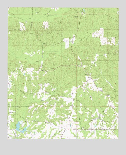
Morgan Springs, AL USGS Topographic Map
Click on map above to begin viewing in our Map Viewer.

This topographic map contains these locations and features:
Feature Name Type Latitude Longitude GNIS ID View Map
Cleveland Store (historical)LocaleN32.6349°W87.4306°149857View Map
Crawford School (historical)SchoolN32.7474°W87.4181°149883View Map
Curry CemeteryCemeteryN32.6537°W87.4683°149859View Map
DeYampert CemeteryCemeteryN32.6376°W87.4472°149858View Map
Elvins CemeteryCemeteryN32.6632°W87.4317°149854View Map
Fairview CemeteryCemeteryN32.6562°W87.4297°118134View Map
Fairview Presbyterian Church (historical)ChurchN32.6562°W87.4286°149856View Map
Fellowship Baptist ChurchChurchN32.6918°W87.4489°118245View Map
FolsomPopulated PlaceN32.6826°W87.4058°156363View Map
Griffin CemeteryCemeteryN32.7196°W87.4653°119405View Map
Harmony Church (historical)ChurchN32.7057°W87.4675°146278View Map
Harper CemeteryCemeteryN32.6904°W87.4642°119769View Map
Hopewell CemeteryCemeteryN32.6426°W87.4056°149853View Map
Hopewell ChurchChurchN32.6412°W87.4047°146280View Map
Hopewell ChurchChurchN32.6435°W87.4044°120373View Map
Hopewell School (historical)SchoolN32.6340°W87.3872°149886View Map
MacMillian Bloedell LakeReservoirN32.6601°W87.4983°130879View Map
MacMillian Bloedell Lake DamDamN32.6601°W87.4983°130878View Map
Morgan SpringsPopulated PlaceN32.7454°W87.4158°155156View Map
Morgan Springs Lookout TowerTowerN32.7412°W87.4206°164386View Map
Morgan Springs Post Office (historical)Post OfficeN32.7451°W87.4156°166744View Map
Morning Star Baptist ChurchChurchN32.6707°W87.3969°123062View Map
Morning Star School (historical)SchoolN32.6712°W87.3969°149889View Map
Mount Carmel (historical)LocaleN32.7062°W87.4589°146284View Map
Mount Carmel ChurchChurchN32.6899°W87.4578°123173View Map
Oak Grove ChurchChurchN32.6418°W87.4722°124090View Map
Oak Grove School (historical)SchoolN32.6418°W87.4725°146287View Map
Pineview ChurchChurchN32.6951°W87.4228°124860View Map
Turner CemeteryCemeteryN32.6868°W87.4100°128192View Map
Turpin CemeteryCemeteryN32.6271°W87.4986°128207View Map
Walthill CemeteryCemeteryN32.6501°W87.4978°128566View Map
Watershed Structure Number TwelveReservoirN32.6320°W87.4843°130820View Map
West High SchoolSchoolN32.6662°W87.3864°153943View Map
West Perry School (historical)SchoolN32.6621°W87.4253°149855View Map

Note: Coordinates in the location and feature list above are referenced to NAD83 datum.


Copyright (C) 2008-2025 Ryan Niemi / Sunset Dynamics ... All Rights Reserved