TopoQuest Logo
Do you find TopoQuest useful?
Help keep TopoQuest running and adding new maps/features by donating!
Bitcoin:  19c7KJd3qBynnjoSw5npx9KScwjBe4ifkT
Litecoin:  LXs6TkuXGGXo1vDsWCkWVdjQX94eUKd6ui
Home View Maps Find Maps Find Places Resources & Links


Heiberger, Alabama Topographic Map

USGS Map Title: Heiberger, AL
USGS Map MRC: 32087G3
DRG (GeoTIFF) Download: o32087g3.tif


Neighboring USGS Topographic Map Quads:


  Payne Lake, AL  
32087H4
 

  Pondville, AL  
32087H3
 

  Centreville West, AL  
32087H2
 

  Hogglesville, AL  
32087G4
 

  Heiberger, AL  
32087G3
 

  Harrisburg, AL  
32087G2
 

  Morgan Springs, AL  
32087F4
 

  Marion North, AL  
32087F3
 

  Sprott, AL  
32087F2


Map MRC Location:

N33°
W88°
N33°
W87°
H8 H7 H6 H5 H4 H3 H2 H1
G8 G7 G6 G5 G4 G3 G2 G1
F8 F7 F6 F5 F4 F3 F2 F1
E8 E7 E6 E5 E4 E3 E2 E1
D8 D7 D6 D5 D4 D3 D2 D1
C8 C7 C6 C5 C4 C3 C2 C1
B8 B7 B6 B5 B4 B3 B2 B1
A8 A7 A6 A5 A4 A3 A2 A1
N32°
W88°
N32°
W87°

Heiberger, AL USGS 1:24K Topographic Map Preview:
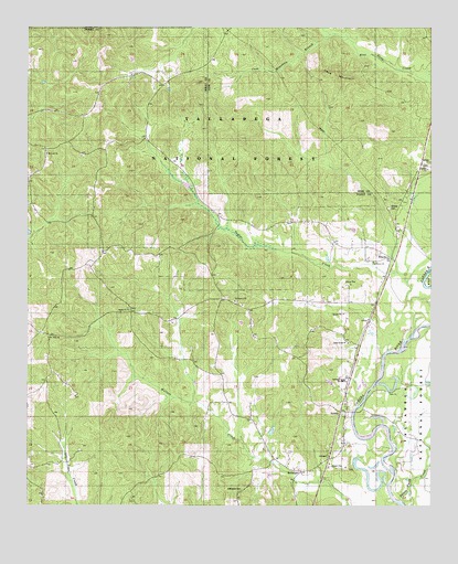
Heiberger, AL USGS Topographic Map
Click on map above to begin viewing in our Map Viewer.

This topographic map contains these locations and features:
Feature Name Type Latitude Longitude GNIS ID View Map
Bethesda CemeteryCemeteryN32.7546°W87.3086°162647View Map
Bethesda Presbyterian Church (historical)ChurchN32.7546°W87.3081°163022View Map
Bethlehem Baptist ChurchChurchN32.8035°W87.3108°162649View Map
Cave MountainSummitN32.8632°W87.2792°161889View Map
Cave Mountain BranchStreamN32.8735°W87.2808°161890View Map
Ellard School (historical)SchoolN32.8140°W87.2625°163026View Map
EllardsPopulated PlaceN32.8148°W87.2608°159565View Map
HeibergerPopulated PlaceN32.7582°W87.2867°159751View Map
Heiberger CemeteryCemeteryN32.7743°W87.2775°163020View Map
Heiberger DivisionCivilN32.7839°W87.3631°165918View Map
Heiberger Elementary SchoolSchoolN32.7829°W87.2775°165636View Map
Heiberger Methodist ChurchChurchN32.7749°W87.2767°163021View Map
Heiberger Post Office (historical)Post OfficeN32.7612°W87.2833°166758View Map
Heiberger Volunteer Fire DepartmentBuildingN32.7590°W87.2905°2691348View Map
IronvillePopulated PlaceN32.8007°W87.3428°162667View Map
JerichoPopulated PlaceN32.7740°W87.2753°159860View Map
Little Rock ChurchChurchN32.7926°W87.2758°162670View Map
Mount Ivah ChurchChurchN32.8421°W87.3692°162675View Map
Mount Nebo ChurchChurchN32.7937°W87.3686°162676View Map
Nichols (historical)Populated PlaceN32.8432°W87.2522°1952359View Map
Pine Grove Baptist ChurchChurchN32.8137°W87.2681°162687View Map
Potato Patch CreekStreamN32.7510°W87.2583°162689View Map
Sardis Baptist ChurchChurchN32.8012°W87.3439°162693View Map
Walter C Givhan BridgeBridgeN32.7746°W87.2739°162699View Map
Williams BranchStreamN32.8110°W87.2606°1952361View Map
Wooley CemeteryCemeteryN32.8279°W87.2630°162701View Map

Note: Coordinates in the location and feature list above are referenced to NAD83 datum.


Copyright (C) 2008-2025 Ryan Niemi / Sunset Dynamics ... All Rights Reserved