TopoQuest Logo
Do you find TopoQuest useful?
Help keep TopoQuest running and adding new maps/features by donating!
Bitcoin:  19c7KJd3qBynnjoSw5npx9KScwjBe4ifkT
Litecoin:  LXs6TkuXGGXo1vDsWCkWVdjQX94eUKd6ui
Home View Maps Find Maps Find Places Resources & Links


Hogglesville, Alabama Topographic Map

USGS Map Title: Hogglesville, AL
USGS Map MRC: 32087G4
DRG (GeoTIFF) Download: o32087g4.tif


Neighboring USGS Topographic Map Quads:


  Moundville East, AL  
32087H5
 

  Payne Lake, AL  
32087H4
 

  Pondville, AL  
32087H3
 

  Ingram, AL  
32087G5
 

  Hogglesville, AL  
32087G4
 

  Heiberger, AL  
32087G3
 

  Greensboro, AL  
32087F5
 

  Morgan Springs, AL  
32087F4
 

  Marion North, AL  
32087F3


Map MRC Location:

N33°
W88°
N33°
W87°
H8 H7 H6 H5 H4 H3 H2 H1
G8 G7 G6 G5 G4 G3 G2 G1
F8 F7 F6 F5 F4 F3 F2 F1
E8 E7 E6 E5 E4 E3 E2 E1
D8 D7 D6 D5 D4 D3 D2 D1
C8 C7 C6 C5 C4 C3 C2 C1
B8 B7 B6 B5 B4 B3 B2 B1
A8 A7 A6 A5 A4 A3 A2 A1
N32°
W88°
N32°
W87°

Hogglesville, AL USGS 1:24K Topographic Map Preview:
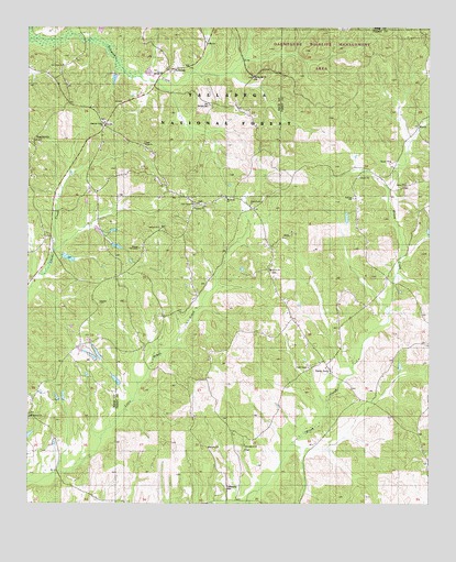
Hogglesville, AL USGS Topographic Map
Click on map above to begin viewing in our Map Viewer.

This topographic map contains these locations and features:
Feature Name Type Latitude Longitude GNIS ID View Map
Antioch Baptist ChurchChurchN32.8226°W87.4589°162644View Map
Bethany ChurchChurchN32.7649°W87.4436°162646View Map
Brush CreekPopulated PlaceN32.7912°W87.4636°162653View Map
Faith Chapel Baptist ChurchChurchN32.7860°W87.4125°162660View Map
Faith Chapel CemeteryCemeteryN32.7865°W87.4122°1805712View Map
Fellowship CemeteryCemeteryN32.7546°W87.4383°162661View Map
Fellowship Church (historical)ChurchN32.7549°W87.4361°162662View Map
HogglesvillePopulated PlaceN32.8543°W87.4917°159785View Map
J B Thomas DamDamN32.7885°W87.4767°161325View Map
J B Thomas LakeReservoirN32.7893°W87.4780°161324View Map
Joe Glover DamDamN32.8151°W87.4883°161329View Map
Joe Glover LakeReservoirN32.8146°W87.4873°161328View Map
Lake Payne ChurchChurchN32.8290°W87.4472°162668View Map
Mike Wurm DamDamN32.7885°W87.4833°161326View Map
Morgan TabernacleChurchN32.8173°W87.4653°162673View Map
Mount Herman CemeteryCemeteryN32.7723°W87.4994°158578View Map
Mount Herman ChurchChurchN32.7729°W87.4992°161941View Map
Mount Herman School (historical)SchoolN32.7821°W87.4936°161942View Map
New Hope CemeteryCemeteryN32.8635°W87.4900°158583View Map
New Shiloh CemeteryCemeteryN32.8451°W87.4636°158584View Map
North PerryPopulated PlaceN32.7849°W87.4056°162678View Map
North Perry ChurchChurchN32.8285°W87.4306°162679View Map
North Perry School (historical)SchoolN32.7885°W87.4078°163031View Map
North Perry Volunteer Fire DepartmentBuildingN32.7951°W87.4147°2691346View Map
Oak Grove ChurchChurchN32.8118°W87.4250°162682View Map
Old Shiloh CemeteryCemeteryN32.8546°W87.4436°161944View Map
Pleasant Valley CemeteryCemeteryN32.8504°W87.4764°158589View Map
Pleasant Valley ChurchChurchN32.8501°W87.4764°161951View Map
Providence CemeteryCemeteryN32.7643°W87.4322°163023View Map
Providence Methodist ChurchChurchN32.7654°W87.4325°162691View Map
Salem ChurchChurchN32.8337°W87.3825°162692View Map
Spring Hill ChurchChurchN32.8623°W87.4300°161957View Map
Thomas LakeReservoirN32.7893°W87.4841°161327View Map
Valley School (historical)SchoolN32.8510°W87.4764°161962View Map
WateroakPopulated PlaceN32.8640°W87.4542°161963View Map
Waycross Bible Methodist ChurchChurchN32.8304°W87.4383°162700View Map
Waycross CemeteryCemeteryN32.8301°W87.4383°1805714View Map

Note: Coordinates in the location and feature list above are referenced to NAD83 datum.


Copyright (C) 2008-2025 Ryan Niemi / Sunset Dynamics ... All Rights Reserved