TopoQuest Logo
Do you find TopoQuest useful?
Help keep TopoQuest running and adding new maps/features by donating!
Bitcoin:  19c7KJd3qBynnjoSw5npx9KScwjBe4ifkT
Litecoin:  LXs6TkuXGGXo1vDsWCkWVdjQX94eUKd6ui
Home View Maps Find Maps Find Places Resources & Links


Morony Dam, Montana Topographic Map

USGS Map Title: Morony Dam, MT
USGS Map MRC: 47111E1
DRG (GeoTIFF) Download: o47111e1.tif


Neighboring USGS Topographic Map Quads:


  Flick Lake, MT  
47111F2
 

  Floweree, MT  
47111F1
 

  Lander Crossing, MT  
47110F8
 

  Northeast Great Falls, MT  
47111E2
 

  Morony Dam, MT  
47111E1
 

  Waltham, MT  
47110E8
 

  Southeast Great Falls, MT  
47111D2
 

  Fife, MT  
47111D1
 

  Belt, MT  
47110D8


Map MRC Location:

N48°
W112°
N48°
W111°
H8 H7 H6 H5 H4 H3 H2 H1
G8 G7 G6 G5 G4 G3 G2 G1
F8 F7 F6 F5 F4 F3 F2 F1
E8 E7 E6 E5 E4 E3 E2 E1
D8 D7 D6 D5 D4 D3 D2 D1
C8 C7 C6 C5 C4 C3 C2 C1
B8 B7 B6 B5 B4 B3 B2 B1
A8 A7 A6 A5 A4 A3 A2 A1
N47°
W112°
N47°
W111°

Morony Dam, MT USGS 1:24K Topographic Map Preview:
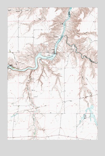
Morony Dam, MT USGS Topographic Map
Click on map above to begin viewing in our Map Viewer.

This topographic map contains these locations and features:
Feature Name Type Latitude Longitude GNIS ID View Map
20N05E10BADC01 WellWellN47.5075°W111.0878°823468View Map
Belt CreekStreamN47.5980°W111.0486°802025View Map
Big FallsFallsN47.5700°W111.1230°768786View Map
Blackfeet GulchValleyN47.6225°W111.1194°768992View Map
Box Elder CreekStreamN47.5666°W111.0919°780330View Map
Hower CouleeValleyN47.6100°W111.0461°772590View Map
Morony DamDamN47.5816°W111.0608°774393View Map
Morony ReservoirReservoirN47.5816°W111.0608°795596View Map
O'Day Number 1 DamDamN47.5200°W111.0208°796240View Map
O'Day Number 2 DamDamN47.5333°W111.0091°796317View Map
Prairie Nest Ranch 1 DamDamN47.5300°W111.0141°795954View Map
Prairie Nest Ranch 2 DamDamN47.5233°W111.1158°795955View Map
Prairie Nest Ranch 3 DamDamN47.5183°W111.0091°795960View Map
Prairie Nest Ranch 4 DamDamN47.5250°W111.0091°795961View Map
Rogers CouleeValleyN47.5772°W111.0200°802176View Map
Ryan DamDamN47.5694°W111.1247°776036View Map
SalemPopulated PlaceN47.5372°W111.0402°802185View Map
Salem (historical)LocaleN47.5372°W111.0402°1762432View Map
Salem Post Office (historical)Post OfficeN47.5372°W111.0402°1762466View Map
Salem Road BridgeBridgeN47.5850°W111.0302°1762313View Map
Salem School (historical)SchoolN47.5530°W111.0477°802186View Map
Sulphur SpringSpringN47.5979°W111.0551°777300View Map
The Big EddyRapidsN47.6097°W111.0480°777493View Map
West Fork Rogers CouleeValleyN47.5475°W111.0172°778269View Map

Note: Coordinates in the location and feature list above are referenced to NAD83 datum.


Copyright (C) 2008-2025 Ryan Niemi / Sunset Dynamics ... All Rights Reserved