TopoQuest Logo
Do you find TopoQuest useful?
Help keep TopoQuest running and adding new maps/features by donating!
Bitcoin:  19c7KJd3qBynnjoSw5npx9KScwjBe4ifkT
Litecoin:  LXs6TkuXGGXo1vDsWCkWVdjQX94eUKd6ui
Home View Maps Find Maps Find Places Resources & Links


Belt, Montana Topographic Map

USGS Map Title: Belt, MT
USGS Map MRC: 47110D8
DRG (GeoTIFF) Download: o47110d8.tif


Neighboring USGS Topographic Map Quads:


  Morony Dam, MT  
47111E1
 

  Waltham, MT  
47110E8
 

  Highwood, MT  
47110E7
 

  Fife, MT  
47111D1
 

  Belt, MT  
47110D8
 

  Belt NE, MT  
47110D7
 

  Mahoney Hill, MT  
47111C1
 

  Armington, MT  
47110C8
 

  Blythe, MT  
47110C7


Map MRC Location:

N48°
W111°
N48°
W110°
H8 H7 H6 H5 H4 H3 H2 H1
G8 G7 G6 G5 G4 G3 G2 G1
F8 F7 F6 F5 F4 F3 F2 F1
E8 E7 E6 E5 E4 E3 E2 E1
D8 D7 D6 D5 D4 D3 D2 D1
C8 C7 C6 C5 C4 C3 C2 C1
B8 B7 B6 B5 B4 B3 B2 B1
A8 A7 A6 A5 A4 A3 A2 A1
N47°
W111°
N47°
W110°

Belt, MT USGS 1:24K Topographic Map Preview:
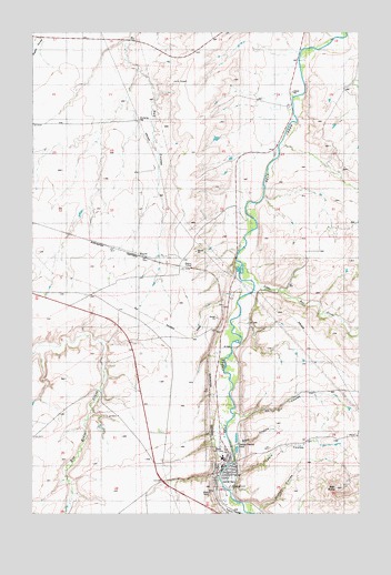
Belt, MT USGS Topographic Map
Click on map above to begin viewing in our Map Viewer.

This topographic map contains these locations and features:
Feature Name Type Latitude Longitude GNIS ID View Map
19N06E01____01 WellWellN47.4386°W110.9063°822927View Map
19N06E02DCDA01 WellWellN47.4330°W110.9230°822883View Map
19N06E03B___01 WellWellN47.4389°W110.9577°822931View Map
19N06E05____01 WellWellN47.4322°W110.9950°822873View Map
19N06E05____02 WellWellN47.4322°W110.9950°822874View Map
19N06E10____01 WellWellN47.4205°W110.9516°822798View Map
19N06E11____01 WellWellN47.4225°W110.9305°822811View Map
19N06E11____02 WellWellN47.4225°W110.9305°822812View Map
19N06E11ACDA01 WellWellN47.4258°W110.9247°822833View Map
19N06E14____01 WellWellN47.4077°W110.9300°822718View Map
19N06E14____02 WellWellN47.4077°W110.9300°822719View Map
19N06E14____03 WellWellN47.4077°W110.9300°822720View Map
19N06E14____04 WellWellN47.4077°W110.9300°822721View Map
19N06E15____01 WellWellN47.4061°W110.9513°822704View Map
19N06E15____02 WellWellN47.4061°W110.9513°822705View Map
19N06E15____03 WellWellN47.4061°W110.9513°822706View Map
19N06E21____01 WellWellN47.3897°W110.9730°822613View Map
19N06E21____02 WellWellN47.3897°W110.9730°822614View Map
19N06E22D___01 WellWellN47.3883°W110.9458°822607View Map
19N06E23BADA01 WellWellN47.4008°W110.9277°822676View Map
19N06E26ACAD01 WellWellN47.3841°W110.9233°822585View Map
19N06E26ACCC01 WellWellN47.3816°W110.9275°822559View Map
20N06E13D___01 WellWellN47.4939°W110.9013°823380View Map
20N06E14BCA_01 WellWellN47.4997°W110.9355°823422View Map
20N06E15A___01 WellWellN47.4975°W110.9477°823399View Map
20N06E24A___01 WellWellN47.4864°W110.9022°823344View Map
20N06E25D___01 WellWellN47.4644°W110.9011°823166View Map
20N06E25D___02 WellWellN47.4644°W110.9011°823167View Map
20N06E26____01 WellWellN47.4661°W110.9305°823179View Map
20N06E32____01 WellWellN47.4464°W110.9950°822972View Map
20N06E32A___01 WellWellN47.4502°W110.9905°823009View Map
20N06E33DAC_01 WellWellN47.4522°W110.9211°823029View Map
20N06E35DDB_01 WellWellN47.4475°W110.9197°822982View Map
20N07E18D___01 WellWellN47.4944°W110.8802°823382View Map
B and M CouleeValleyN47.3922°W110.9236°805887View Map
BeltPopulated PlaceN47.3861°W110.9255°779676View Map
BeltLocaleN47.3869°W110.9302°1762287View Map
Belt ButteSummitN47.3811°W110.8844°768693View Map
Belt Community ChurchChurchN47.3861°W110.9255°1761829View Map
Belt Post OfficePost OfficeN47.3861°W110.9235°1762278View Map
Belt Public LibraryBuildingN47.3861°W110.9255°1761737View Map
Belt Rural Fire DistrictBuildingN47.3861°W110.9215°2548898View Map
Belt SchoolSchoolN47.3900°W110.9280°1761861View Map
Belt Volunteer Fire DepartmentBuildingN47.3882°W110.9285°2546715View Map
Beltane Post Office (historical)Post OfficeN47.3755°W110.9258°1762277View Map
Belton (historical)Populated PlaceN47.3755°W110.9263°1762286View Map
Beulah (historical)LocaleN47.4416°W110.9591°1762283View Map
Castner ParkParkN47.3830°W110.9247°805822View Map
Castner Post Office (historical)Post OfficeN47.3866°W110.9175°1762441View Map
East Belt MineMineN47.4011°W110.9202°800728View Map
Fort Ponderosa RV ParkLocaleN47.3833°W110.9591°1761869View Map
French CouleeValleyN47.3764°W110.9272°771629View Map
Graham CouleeValleyN47.3761°W110.9138°771897View Map
Lewis CouleeValleyN47.3864°W110.9216°773318View Map
Little Belt CreekStreamN47.4400°W110.9197°786239View Map
Little Lower Belt School (historical)SchoolN47.4314°W110.9141°1761896View Map
Lower Belt CemeteryCemeteryN47.4972°W110.8980°1762327View Map
Montclair United Methodist ChurchChurchN47.3855°W110.9258°1761827View Map
Orr CouleeValleyN47.3994°W110.9219°774982View Map
Saint Lukes Episcopal Church (historical)ChurchN47.3894°W110.9272°1761824View Map
Saint Marks Catholic ChurchChurchN47.3889°W110.9272°1761826View Map
Scandinavian Methodist Episcopal Church (historical)ChurchN47.3847°W110.9266°1761823View Map
The Church of Jesus Christ of Latter Day SaintsChurchN47.3861°W110.9255°1761828View Map
Town of BeltCivilN47.3874°W110.9278°2409827View Map
Valley Baptist ChurchChurchN47.3875°W110.9238°1761825View Map
WaynePopulated PlaceN47.4419°W110.9591°802232View Map
Wayne (historical)LocaleN47.4419°W110.9591°1762411View Map
Wayne Post Office (historical)Post OfficeN47.4419°W110.9591°1762447View Map
Wayne TunnelTunnelN47.4391°W110.9430°778160View Map

Note: Coordinates in the location and feature list above are referenced to NAD83 datum.


Copyright (C) 2008-2025 Ryan Niemi / Sunset Dynamics ... All Rights Reserved