TopoQuest Logo
Do you find TopoQuest useful?
Help keep TopoQuest running and adding new maps/features by donating!
Bitcoin:  19c7KJd3qBynnjoSw5npx9KScwjBe4ifkT
Litecoin:  LXs6TkuXGGXo1vDsWCkWVdjQX94eUKd6ui
Home View Maps Find Maps Find Places Resources & Links


Waltham, Montana Topographic Map

USGS Map Title: Waltham, MT
USGS Map MRC: 47110E8
DRG (GeoTIFF) Download: o47110e8.tif


Neighboring USGS Topographic Map Quads:


  Floweree, MT  
47111F1
 

  Lander Crossing, MT  
47110F8
 

  Rice Reservoir, MT  
47110F7
 

  Morony Dam, MT  
47111E1
 

  Waltham, MT  
47110E8
 

  Highwood, MT  
47110E7
 

  Fife, MT  
47111D1
 

  Belt, MT  
47110D8
 

  Belt NE, MT  
47110D7


Map MRC Location:

N48°
W111°
N48°
W110°
H8 H7 H6 H5 H4 H3 H2 H1
G8 G7 G6 G5 G4 G3 G2 G1
F8 F7 F6 F5 F4 F3 F2 F1
E8 E7 E6 E5 E4 E3 E2 E1
D8 D7 D6 D5 D4 D3 D2 D1
C8 C7 C6 C5 C4 C3 C2 C1
B8 B7 B6 B5 B4 B3 B2 B1
A8 A7 A6 A5 A4 A3 A2 A1
N47°
W111°
N47°
W110°

Waltham, MT USGS 1:24K Topographic Map Preview:
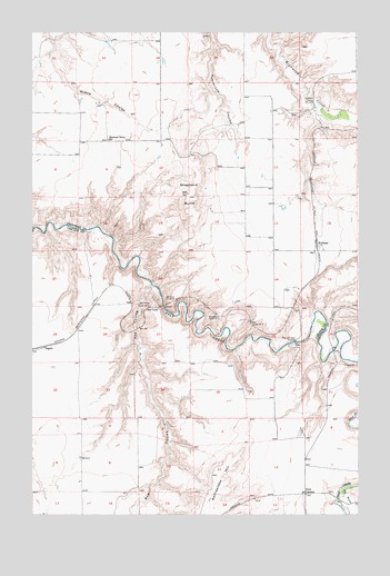
Waltham, MT USGS Topographic Map
Click on map above to begin viewing in our Map Viewer.

This topographic map contains these locations and features:
Feature Name Type Latitude Longitude GNIS ID View Map
21N06E10ABCC01 WellWellN47.5941°W110.9505°823948View Map
21N06E24BAAA01 WellWellN47.5680°W110.9091°823807View Map
Amphitheater Tunnel Number 4TunnelN47.5516°W110.9288°799281View Map
Belt CreekPopulated PlaceN47.5530°W110.9575°768694View Map
Belt Creek BridgeBridgeN47.5041°W110.8836°1761795View Map
Belt Creek Tunnel Number 5TunnelN47.5552°W110.9469°768695View Map
Big Willow CreekStreamN47.5069°W110.8780°779895View Map
Bowman School (historical)SchoolN47.5555°W110.9689°1761921View Map
Clingan (historical)LocaleN47.5527°W110.9577°1762396View Map
Four CornersLocaleN47.5052°W110.8958°771549View Map
Four Corners School (historical)SchoolN47.5052°W110.8958°1761920View Map
Lacey Tunnel Number 3TunnelN47.5494°W110.9169°773168View Map
Pack and Lacey CrossingPopulated PlaceN47.5447°W110.9000°775052View Map
Peterson Ranch AirportAirportN47.6079°W110.9067°806445View Map
Rattlesnake HillSummitN47.5050°W110.9333°775592View Map
Red CouleeValleyN47.5594°W110.9552°775630View Map
Red Coulee School (historical)SchoolN47.5139°W110.9911°1761918View Map
Red Coulee Tunnel Number 6TunnelN47.5539°W110.9541°775631View Map
RogersPopulated PlaceN47.5433°W110.9964°775912View Map
Shepherd ButteSummitN47.5825°W110.9405°776472View Map
Shepherd Butte School (historical)SchoolN47.5972°W110.9716°776473View Map
Shepherd CrossingPopulated PlaceN47.6069°W110.8927°776474View Map
WalthamPopulated PlaceN47.5697°W110.8908°778095View Map
Waltham (historical)LocaleN47.5697°W110.8908°1750389View Map
Waltham Post Office (historical)Post OfficeN47.5697°W110.8908°1750388View Map
Waltham School (historical)SchoolN47.5686°W110.8891°1750300View Map
Wetzel School (historical)SchoolN47.5039°W110.8961°1761919View Map

Note: Coordinates in the location and feature list above are referenced to NAD83 datum.


Copyright (C) 2008-2025 Ryan Niemi / Sunset Dynamics ... All Rights Reserved