TopoQuest Logo
Do you find TopoQuest useful?
Help keep TopoQuest running and adding new maps/features by donating!
Bitcoin:  19c7KJd3qBynnjoSw5npx9KScwjBe4ifkT
Litecoin:  LXs6TkuXGGXo1vDsWCkWVdjQX94eUKd6ui
Home View Maps Find Maps Find Places Resources & Links


Mosheim, Tennessee Topographic Map

USGS Map Title: Mosheim, TN
USGS Map MRC: 36082B8
DRG (GeoTIFF) Download: o36082b8.tif


Neighboring USGS Topographic Map Quads:


  Bulls Gap, TN  
36083C1
 

  McCloud, TN  
36082C8
 

  Baileyton, TN  
36082C7
 

  Mohawk, TN  
36083B1
 

  Mosheim, TN  
36082B8
 

  Greeneville, TN  
36082B7
 

  Parrottsville, TN  
36083A1
 

  Cedar Creek, TN  
36082A8
 

  Davy Crockett Lake, TN  
36082A7


Map MRC Location:

N37°
W83°
N37°
W82°
H8 H7 H6 H5 H4 H3 H2 H1
G8 G7 G6 G5 G4 G3 G2 G1
F8 F7 F6 F5 F4 F3 F2 F1
E8 E7 E6 E5 E4 E3 E2 E1
D8 D7 D6 D5 D4 D3 D2 D1
C8 C7 C6 C5 C4 C3 C2 C1
B8 B7 B6 B5 B4 B3 B2 B1
A8 A7 A6 A5 A4 A3 A2 A1
N36°
W83°
N36°
W82°

Mosheim, TN USGS 1:24K Topographic Map Preview:
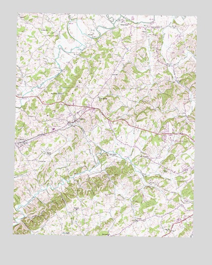
Mosheim, TN USGS Topographic Map
Click on map above to begin viewing in our Map Viewer.

This topographic map contains these locations and features:
Feature Name Type Latitude Longitude GNIS ID View Map
AlbanyPopulated PlaceN36.2420°W82.9110°1314570View Map
Big RidgeRidgeN36.1979°W82.9696°1277364View Map
Big SpringSpringN36.2053°W82.9706°1643131View Map
Big Spring ChurchChurchN36.2051°W82.9699°1277411View Map
Brookside School (historical)SchoolN36.2187°W82.8893°1643122View Map
Brown ProspectMineN36.2284°W82.9454°1649902View Map
Brown Springs ChurchChurchN36.2034°W82.9427°1305459View Map
Burkey PondLakeN36.1634°W82.8951°1279055View Map
Carpenters Chapel (historical)ChurchN36.2190°W82.9957°1643136View Map
Carter ChapelChurchN36.2451°W82.9227°1279810View Map
Cedar HillPopulated PlaceN36.1293°W82.8902°1647158View Map
Cedar Hill ChurchChurchN36.1284°W82.8910°1280071View Map
Cherokee EstatesPopulated PlaceN36.1807°W82.8960°1309227View Map
Cold SpringSpringN36.1734°W82.9700°1643125View Map
Colvard ProspectMineN36.2215°W82.9446°1649904View Map
Combs PondLakeN36.1262°W82.9640°1281035View Map
Commissioner District 7CivilN36.1346°W82.9348°2464609View Map
Crazy CreekStreamN36.1837°W82.8757°1281589View Map
Cuerton Dial BranchStreamN36.2034°W82.9949°1281809View Map
DulaneyPopulated PlaceN36.1337°W82.9149°1283121View Map
Dulaney BranchStreamN36.1615°W82.9479°1283122View Map
Fairview School (historical)SchoolN36.2351°W82.9027°1309224View Map
Flaglor AirportAirportN36.2376°W82.9697°2675541View Map
Gap CreekStreamN36.1618°W82.9013°1285142View Map
Gass CreekStreamN36.2223°W82.8929°1285224View Map
Gethsemane School (historical)SchoolN36.2243°W82.9502°1309269View Map
GilbreathPopulated PlaceN36.2368°W82.9802°1647161View Map
Gilbreath School (historical)SchoolN36.2376°W82.9804°1309270View Map
Glenwood Elementary SchoolSchoolN36.1251°W82.9340°1648345View Map
Grassy CreekStreamN36.2457°W82.9118°1285885View Map
Greene County Industrial ParkLocaleN36.1557°W82.8888°1309228View Map
Greene Vocational CenterSchoolN36.1529°W82.8827°1309229View Map
Hartman BranchStreamN36.1509°W82.9721°1287054View Map
Hartman BranchStreamN36.1693°W82.9207°1287055View Map
Hartman ChurchChurchN36.1395°W82.9557°1287057View Map
Hartman Mine Number OneMineN36.1718°W82.8793°1649891View Map
Hartman Mine Number TwoMineN36.1720°W82.8827°1649890View Map
Hartmans School (historical)SchoolN36.1362°W82.9649°1309230View Map
Hartshaw SubdivisionPopulated PlaceN36.1854°W82.8957°1309226View Map
Hawkins CemeteryCemeteryN36.2034°W82.9990°1287179View Map
Hoover CreekStreamN36.2437°W82.8932°1269650View Map
Huff BranchStreamN36.1309°W82.9974°1288634View Map
Hull MillPopulated PlaceN36.2159°W82.9332°1315275View Map
Lick BranchStreamN36.2312°W82.9710°1291196View Map
Lick CreekStreamN36.1968°W82.9999°1291219View Map
MarvinPopulated PlaceN36.2482°W82.9988°1314269View Map
Marvin United Methodist ChurchChurchN36.2490°W82.9988°1320070View Map
McNew BranchStreamN36.1573°W82.9588°1293444View Map
Memento (historical)Populated PlaceN36.2468°W82.9290°1309223View Map
MidwayPopulated PlaceN36.1768°W82.9968°1293729View Map
Midway Post OfficePost OfficeN36.1779°W82.9932°1649894View Map
Midway United Methodist ChurchChurchN36.1745°W82.9971°1320071View Map
MosheimPopulated PlaceN36.1895°W82.9585°1294485View Map
Mosheim BranchStreamN36.1654°W82.9427°1294486View Map
Mosheim Division (historical)CensusN36.2084°W82.9649°1648721View Map
Mosheim Elementary SchoolSchoolN36.1937°W82.9565°1309231View Map
Mosheim Fire DepartmentBuildingN36.1896°W82.9593°2654351View Map
Mosheim Post OfficePost OfficeN36.1890°W82.9783°1649893View Map
Mosheim Volunteer Fire DepartmentBuildingN36.1883°W82.9509°2654546View Map
Mount PleasantPopulated PlaceN36.1695°W82.9068°1315555View Map
Mount Pleasant School (historical)SchoolN36.1695°W82.9060°1643123View Map
New Bethel Cumberland Presbyterian ChurchChurchN36.1954°W82.8835°1326440View Map
New Bethel School (historical)SchoolN36.1957°W82.8840°1309225View Map
Possum CreekStreamN36.2029°W82.8771°1298295View Map
Puncheon Camp CreekStreamN36.2465°W82.9207°1647740View Map
RaderPopulated PlaceN36.1709°W82.9318°1298804View Map
Rader and Rader Dairy FarmLocaleN36.1986°W82.8925°2635265View Map
Ramsey ChapelChurchN36.1707°W82.9790°1298890View Map
Ramsey HollowValleyN36.1352°W82.9907°1298894View Map
Sinai ChurchChurchN36.2407°W82.9829°1270361View Map
Snow Camp BranchStreamN36.2462°W82.9624°1270775View Map
Solomon BranchStreamN36.1459°W82.9854°1270807View Map
Susong CemeteryCemeteryN36.1662°W82.9835°1271895View Map
Tipton ProspectMineN36.2268°W82.9496°1649922View Map
Tipton SpringSpringN36.2284°W82.9545°1309222View Map
Town of MosheimCivilN36.1956°W82.9650°2406200View Map
Trail of the Lonesome PineTrailN36.2229°W82.8813°1016213View Map
West Greene High SchoolSchoolN36.1848°W82.9688°1309232View Map

Note: Coordinates in the location and feature list above are referenced to NAD83 datum.


Copyright (C) 2008-2024 Ryan Niemi / Sunset Dynamics ... All Rights Reserved