TopoQuest Logo
Do you find TopoQuest useful?
Help keep TopoQuest running and adding new maps/features by donating!
Bitcoin:  19c7KJd3qBynnjoSw5npx9KScwjBe4ifkT
Litecoin:  LXs6TkuXGGXo1vDsWCkWVdjQX94eUKd6ui
Home View Maps Find Maps Find Places Resources & Links


Mott Island, Michigan Topographic Map

USGS Map Title: Mott Island, MI
USGS Map MRC: 48088A5
DRG (GeoTIFF) Download: o48088a5.tif


Neighboring USGS Topographic Map Quads:


  Belle Harbor, MI  
48088B5
 

  Rock Harbor Lodge, MI  
48088B4


  Mott Island, MI  
48088A5


Map MRC Location:

N49°
W89°
N49°
W88°
H8 H7 H6 H5 H4 H3 H2 H1
G8 G7 G6 G5 G4 G3 G2 G1
F8 F7 F6 F5 F4 F3 F2 F1
E8 E7 E6 E5 E4 E3 E2 E1
D8 D7 D6 D5 D4 D3 D2 D1
C8 C7 C6 C5 C4 C3 C2 C1
B8 B7 B6 B5 B4 B3 B2 B1
A8 A7 A6 A5 A4 A3 A2 A1
N48°
W89°
N48°
W88°

Mott Island, MI USGS 1:24K Topographic Map Preview:
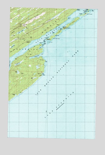
Mott Island, MI USGS Topographic Map
Click on map above to begin viewing in our Map Viewer.

This topographic map contains these locations and features:
Feature Name Type Latitude Longitude GNIS ID View Map
Baker PointCapeN48.0749°W88.6162°620486View Map
Benson CreekStreamN48.0918°W88.5956°621126View Map
Boreal Research StationLocaleN48.1229°W88.5145°1618477View Map
Burnt IslandIslandN48.0918°W88.5704°622313View Map
Caribou ArchArchN48.0964°W88.5628°2701940View Map
Caribou Island CampgroundLocaleN48.0940°W88.5723°622715View Map
Cemetery IslandIslandN48.0960°W88.5706°622967View Map
Cemetery Island CemeteryCemeteryN48.0967°W88.5700°2107466View Map
Conglomerate BayBayN48.0785°W88.5851°623693View Map
Daisy Farm CampgroundLocaleN48.0910°W88.5965°624280View Map
Daisy Farm TrailTrailN48.0977°W88.6148°1618517View Map
Davidson IslandIslandN48.1249°W88.5140°624329View Map
Dollar BayBayN48.1043°W88.5548°1618479View Map
East Caribou IslandIslandN48.1015°W88.5553°625161View Map
Epidote LakeLakeN48.0408°W88.6146°625616View Map
Epidote MineMineN48.0432°W88.6098°625617View Map
Forbes LakeLakeN48.0877°W88.6202°626222View Map
Gilberts HoleBayN48.0985°W88.5601°626810View Map
Indian Head PointCapeN48.0899°W88.5812°1618478View Map
Inner Hill IslandIslandN48.1190°W88.5223°629048View Map
Lake JohnLakeN48.0575°W88.5887°629312View Map
Lake OjibwayLakeN48.1017°W88.6091°633971View Map
Lea CoveBayN48.0613°W88.5779°630239View Map
Lorelei LaneChannelN48.1213°W88.5162°1618482View Map
Lucky Bay MineMineN48.0615°W88.5840°631199View Map
Mad IslandIslandN48.1235°W88.5098°631306View Map
Middle IslandsIslandN48.0910°W88.5767°632256View Map
Middle Islands PassageChannelN48.0918°W88.5745°632257View Map
Mine PointCapeN48.0735°W88.5751°632446View Map
Mott IslandIslandN48.1108°W88.5374°632763View Map
Mount OjibwaySummitN48.1092°W88.6059°633972View Map
Mount Ojibway TrailTrailN48.1015°W88.6003°1618476View Map
Mount SaginawSummitN48.0617°W88.6083°636505View Map
Newt LakeLakeN48.0629°W88.6124°633375View Map
Outer Hill IslandIslandN48.1196°W88.5176°634226View Map
Rabbit IslandIslandN48.1002°W88.5631°635581View Map
Ransom HillSummitN48.0968°W88.6066°635643View Map
Ransom MineMineN48.0952°W88.5948°635646View Map
Rock HarborBayN48.1207°W88.5334°1618303View Map
Rock Harbor LighthouseLocaleN48.0897°W88.5794°2112189View Map
Rock Harbor TrailTrailN48.1038°W88.5670°1618304View Map
Saginaw MineMineN48.0743°W88.5784°636501View Map
Saginaw PointCapeN48.0599°W88.5792°636502View Map
Siskowit MineMineN48.1093°W88.5551°638013View Map
Star IslandIslandN48.1215°W88.5170°638737View Map
Starvation PointCapeN48.1143°W88.5445°638756View Map
Sumner LakeLakeN48.0708°W88.6123°639065View Map
Threemile CampgroundLocaleN48.1227°W88.5153°1614825View Map
Tonkin BayBayN48.0868°W88.5806°1614953View Map
Township of HoughtonCivilN48.0481°W88.5362°1626493View Map
West Caribou IslandIslandN48.0963°W88.5665°1616088View Map

Note: Coordinates in the location and feature list above are referenced to NAD83 datum.


Copyright (C) 2008-2024 Ryan Niemi / Sunset Dynamics ... All Rights Reserved