TopoQuest Logo
Do you find TopoQuest useful?
Help keep TopoQuest running and adding new maps/features by donating!
Bitcoin:  19c7KJd3qBynnjoSw5npx9KScwjBe4ifkT
Litecoin:  LXs6TkuXGGXo1vDsWCkWVdjQX94eUKd6ui
Home View Maps Find Maps Find Places Resources & Links


Rock Harbor Lodge, Michigan Topographic Map

USGS Map Title: Rock Harbor Lodge, MI
USGS Map MRC: 48088B4
DRG (GeoTIFF) Download: o48088b4.tif


Neighboring USGS Topographic Map Quads:


  Belle Harbor, MI  
48088B5
 

  Rock Harbor Lodge, MI  
48088B4


  Mott Island, MI  
48088A5


Map MRC Location:

N49°
W89°
N49°
W88°
H8 H7 H6 H5 H4 H3 H2 H1
G8 G7 G6 G5 G4 G3 G2 G1
F8 F7 F6 F5 F4 F3 F2 F1
E8 E7 E6 E5 E4 E3 E2 E1
D8 D7 D6 D5 D4 D3 D2 D1
C8 C7 C6 C5 C4 C3 C2 C1
B8 B7 B6 B5 B4 B3 B2 B1
A8 A7 A6 A5 A4 A3 A2 A1
N48°
W89°
N48°
W88°

Rock Harbor Lodge, MI USGS 1:24K Topographic Map Preview:
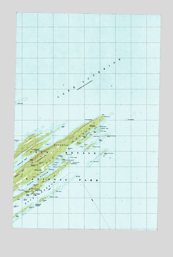
Rock Harbor Lodge, MI USGS Topographic Map
Click on map above to begin viewing in our Map Viewer.

This topographic map contains these locations and features:
Feature Name Type Latitude Longitude GNIS ID View Map
Annie IslandIslandN48.1732°W88.4384°1618508View Map
Bailey IslandIslandN48.1540°W88.4803°620450View Map
Bat IslandIslandN48.1463°W88.4648°620727View Map
Battleship IslandIslandN48.1746°W88.4984°620761View Map
Blake PointCapeN48.1901°W88.4240°621561View Map
Bobs IslandIslandN48.1677°W88.4556°1618506View Map
Boys IslandIslandN48.1813°W88.4328°621834View Map
Canoe RocksBarN48.1974°W88.4987°1617379View Map
Center IslandIslandN48.1413°W88.4917°622978View Map
Daybeacon Stoll MemorialParkN48.1627°W88.4509°1617975View Map
Dog IslandIslandN48.1796°W88.4351°1618512View Map
Duncan Bay Narrows CampgroundLocaleN48.1693°W88.4773°624981View Map
Edwards IslandIslandN48.1721°W88.4334°625396View Map
Elizabeth IslandIslandN48.1831°W88.4269°2097220View Map
Emerson IslandIslandN48.1635°W88.4626°1618510View Map
Five Foot ReefBarN48.1888°W88.4042°626109View Map
Flag IslandIslandN48.1643°W88.4312°626129View Map
Gale IslandIslandN48.1646°W88.4612°626598View Map
Glenns IslandIslandN48.1607°W88.4609°1618505View Map
Grass PointCapeN48.1690°W88.4787°627222View Map
Gull RockBarN48.1554°W88.4473°627522View Map
Hidden LakeLakeN48.1587°W88.4745°628213View Map
Hog IslandIslandN48.1577°W88.4717°1618502View Map
Horn IslandIslandN48.1560°W88.4765°628589View Map
Howe IslandIslandN48.1649°W88.4587°1618513View Map
Locke PointCapeN48.1829°W88.4628°630853View Map
Lone Tree IslandIslandN48.1374°W88.4995°630897View Map
Long IslandIslandN48.1782°W88.4337°630913View Map
Lookout LouiseLocaleN48.1654°W88.4809°631024View Map
Lucky IslandIslandN48.1729°W88.4434°1618507View Map
Merritt IslandIslandN48.1843°W88.4278°632138View Map
Merritt LaneChannelN48.1793°W88.4384°632140View Map
Merritt Lane CampgroundLocaleN48.1846°W88.4301°632141View Map
Minong IslandIslandN48.1635°W88.4573°632472View Map
Monument RockPillarN48.1622°W88.4790°632613View Map
Moose PointCapeN48.1463°W88.4903°632669View Map
Newman IslandIslandN48.1668°W88.4578°633370View Map
North Government IslandIslandN48.1793°W88.4212°633580View Map
Park Place IslandIslandN48.1503°W88.4831°2097219View Map
Pete IslandIslandN48.1740°W88.4717°634693View Map
Porter IslandIslandN48.1746°W88.4442°635305View Map
Raspberry IslandIslandN48.1421°W88.4737°635655View Map
Red Rock PointCapeN48.1713°W88.4553°635716View Map
Rock Harbor LodgePopulated PlaceN48.1457°W88.4837°636080View Map
Rock Harbor Post Office (historical)Post OfficeN48.1457°W88.4837°1926606View Map
Savage IslandIslandN48.1618°W88.4662°1618511View Map
Scoville PointCapeN48.1621°W88.4540°637488View Map
Shaw IslandIslandN48.1327°W88.4970°637688View Map
Smith IslandIslandN48.1663°W88.4523°638154View Map
Smithwick ChannelChannelN48.1390°W88.4815°638181View Map
Smithwick IslandIslandN48.1365°W88.4884°638182View Map
Smithwick MineMineN48.1471°W88.4826°1618490View Map
Snug HarborBayN48.1460°W88.4865°1616973View Map
South Government IslandIslandN48.1688°W88.4234°638357View Map
Split IslandIslandN48.1774°W88.4248°638517View Map
Stoll TrailTrailN48.1543°W88.4659°1618504View Map
Sucker BayBayN48.1765°W88.4398°1618509View Map
The PalisadesCliffN48.1882°W88.4295°1614719View Map
Third IslandIslandN48.1824°W88.4253°1614731View Map
Tobin HarborBayN48.1443°W88.4978°1614903View Map
Tobin-Rock Harbor CampgroundLocaleN48.1454°W88.4881°1614910View Map
Wheelock IslandIslandN48.1590°W88.4701°1618503View Map

Note: Coordinates in the location and feature list above are referenced to NAD83 datum.


Copyright (C) 2008-2025 Ryan Niemi / Sunset Dynamics ... All Rights Reserved