TopoQuest Logo
Do you find TopoQuest useful?
Help keep TopoQuest running and adding new maps/features by donating!
Bitcoin:  19c7KJd3qBynnjoSw5npx9KScwjBe4ifkT
Litecoin:  LXs6TkuXGGXo1vDsWCkWVdjQX94eUKd6ui
Home View Maps Find Maps Find Places Resources & Links


Belle Harbor, Michigan Topographic Map

USGS Map Title: Belle Harbor, MI
USGS Map MRC: 48088B5
DRG (GeoTIFF) Download: o48088b5.tif


Neighboring USGS Topographic Map Quads:


  Belle Harbor, MI  
48088B5
 

  Rock Harbor Lodge, MI  
48088B4


  Mott Island, MI  
48088A5


Map MRC Location:

N49°
W89°
N49°
W88°
H8 H7 H6 H5 H4 H3 H2 H1
G8 G7 G6 G5 G4 G3 G2 G1
F8 F7 F6 F5 F4 F3 F2 F1
E8 E7 E6 E5 E4 E3 E2 E1
D8 D7 D6 D5 D4 D3 D2 D1
C8 C7 C6 C5 C4 C3 C2 C1
B8 B7 B6 B5 B4 B3 B2 B1
A8 A7 A6 A5 A4 A3 A2 A1
N48°
W89°
N48°
W88°

Belle Harbor, MI USGS 1:24K Topographic Map Preview:
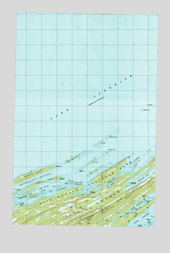
Belle Harbor, MI USGS Topographic Map
Click on map above to begin viewing in our Map Viewer.

This topographic map contains these locations and features:
Feature Name Type Latitude Longitude GNIS ID View Map
Amygdaloid ChannelChannelN48.1460°W88.6217°1618258View Map
Amygdaloid IslandIslandN48.1510°W88.6206°1618259View Map
Belle HarborBayN48.1474°W88.5965°621051View Map
Belle IsleIslandN48.1524°W88.5895°621052View Map
Belle Isle CampgroundLocaleN48.1524°W88.5853°621054View Map
Burnt IslandIslandN48.1468°W88.5820°622314View Map
Captain Kidd IslandIslandN48.1646°W88.5715°622705View Map
Chippers IslandIslandN48.1502°W88.5720°1618486View Map
Clay IslandIslandN48.1446°W88.5923°623393View Map
Congdon ShoalBarN48.1932°W88.5134°623692View Map
Cork IslandIslandN48.1513°W88.5767°623836View Map
Crystal CoveBayN48.1588°W88.5915°624168View Map
Dead Horse RocksBarN48.1574°W88.5676°624409View Map
Dean IslandIslandN48.1574°W88.5528°624426View Map
Diamond IslandIslandN48.1693°W88.5403°624633View Map
Duncan BayBayN48.1582°W88.5026°624979View Map
Duncan Bay CampgroundLocaleN48.1504°W88.5223°624980View Map
Eagle IslandIslandN48.1496°W88.5706°1618487View Map
Fire IslandIslandN48.1410°W88.5103°625981View Map
Fisher IslandIslandN48.1493°W88.5253°1618481View Map
Five Finger BayBayN48.1665°W88.5126°626108View Map
Fryett IslandIslandN48.1446°W88.5978°1618480View Map
Green IslandIslandN48.1624°W88.5565°627300View Map
Hancock BeachBeachN48.1317°W88.6181°2123798View Map
Heron IslandIslandN48.1263°W88.5031°628141View Map
Hill PointCapeN48.1643°W88.5267°628283View Map
Horner IslandIslandN48.1418°W88.6076°628592View Map
Johnson IslandIslandN48.1479°W88.5845°629336View Map
Lake AhmikLakeN48.1491°W88.5395°619876View Map
Lane CoveBayN48.1457°W88.5592°630125View Map
Lane Cove CampgroundLocaleN48.1446°W88.5567°1618484View Map
Lane Cove TrailTrailN48.1293°W88.5648°630126View Map
Lauren Grove ParkParkN48.1325°W88.6031°2123799View Map
Moose LakeLakeN48.1428°W88.5127°632667View Map
Mount FranklinSummitN48.1267°W88.5665°626428View Map
Mount Franklin TrailTrailN48.1282°W88.5445°1618456View Map
Net IslandIslandN48.1735°W88.5498°633304View Map
Patterson LakeLakeN48.1426°W88.5513°634472View Map
Picnic IslandIslandN48.1357°W88.5156°1618488View Map
Robinson BayBayN48.1374°W88.6084°636046View Map
Steamboat IslandIslandN48.1774°W88.5426°638765View Map
Stockly BayBayN48.1515°W88.5392°638857View Map
Tallman IslandIslandN48.1388°W88.5112°1614552View Map
The KeyholeChannelN48.1452°W88.6181°1618483View Map
Tobin CreekStreamN48.1277°W88.5376°1614902View Map
Tobin Harbor TrailTrailN48.1360°W88.5120°1614904View Map
Tookers IslandIslandN48.1290°W88.5031°1614959View Map
Tookers Island CampgroundLocaleN48.1290°W88.5031°1614960View Map

Note: Coordinates in the location and feature list above are referenced to NAD83 datum.


Copyright (C) 2008-2024 Ryan Niemi / Sunset Dynamics ... All Rights Reserved