TopoQuest Logo
Do you find TopoQuest useful?
Help keep TopoQuest running and adding new maps/features by donating!
Bitcoin:  19c7KJd3qBynnjoSw5npx9KScwjBe4ifkT
Litecoin:  LXs6TkuXGGXo1vDsWCkWVdjQX94eUKd6ui
Home View Maps Find Maps Find Places Resources & Links


Mound City, Kansas Topographic Map

USGS Map Title: Mound City, KS
USGS Map MRC: 38094B7
DRG (GeoTIFF) Download: o38094b7.tif


Neighboring USGS Topographic Map Quads:


  Parker, KS  
38094C8
 

  La Cygne, KS  
38094C7
 

  Boicourt, KS  
38094C6
 

  Mound City NW, KS  
38094B8
 

  Mound City, KS  
38094B7
 

  Pleasanton, KS  
38094B6
 

  Mapleton, KS  
38094A8
 

  Mantey, KS  
38094A7
 

  Prescott, KS  
38094A6


Map MRC Location:

N39°
W95°
N39°
W94°
H8 H7 H6 H5 H4 H3 H2 H1
G8 G7 G6 G5 G4 G3 G2 G1
F8 F7 F6 F5 F4 F3 F2 F1
E8 E7 E6 E5 E4 E3 E2 E1
D8 D7 D6 D5 D4 D3 D2 D1
C8 C7 C6 C5 C4 C3 C2 C1
B8 B7 B6 B5 B4 B3 B2 B1
A8 A7 A6 A5 A4 A3 A2 A1
N38°
W95°
N38°
W94°

Mound City, KS USGS 1:24K Topographic Map Preview:
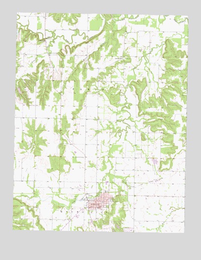
Mound City, KS USGS Topographic Map
Click on map above to begin viewing in our Map Viewer.

This topographic map contains these locations and features:
Feature Name Type Latitude Longitude GNIS ID View Map
Alexander BranchStreamN38.1450°W94.8677°477904View Map
Beachner Grain Elevator Number 25LocaleN38.1357°W94.8170°2695331View Map
Cornerstone Fellowship ChurchChurchN38.1392°W94.8210°2690452View Map
Fairbanks CemeteryCemeteryN38.1967°W94.8608°477917View Map
FarlinvillePopulated PlaceN38.2334°W94.8539°477914View Map
First Baptist ChurchChurchN38.1422°W94.8074°2689943View Map
Fisher CemeteryCemeteryN38.2042°W94.7503°2574870View Map
Fisher CemeteryCemeteryN38.2041°W94.7501°477916View Map
Hazel BranchStreamN38.2464°W94.8011°477915View Map
Jayhawk - Linn High SchoolSchoolN38.1332°W94.8285°481162View Map
Jayhawk Elementary SchoolSchoolN38.1385°W94.8134°481163View Map
Kingdom Hall of Jehovah's WitnessesChurchN38.1431°W94.8164°2688713View Map
Lake De LagoReservoirN38.2048°W94.8721°480021View Map
Lake De Lago DamDamN38.2067°W94.8736°480022View Map
Linn CountyCivilN38.2123°W94.8429°485018View Map
Linn County CourthouseBuildingN38.1420°W94.8104°2695479View Map
Linn County District Court Judicial District Number 6BuildingN38.1417°W94.8105°2503886View Map
Linn County FairgroundsParkN38.1445°W94.8280°481164View Map
Linn County JailBuildingN38.1422°W94.8109°2504353View Map
Linn County Rural Fire District 1 Station 910BuildingN38.1430°W94.8151°2111549View Map
Linn County Sheriff's OfficeBuildingN38.1421°W94.8110°2503842View Map
Linnville CemeteryCemeteryN38.2247°W94.7969°477912View Map
Linnville School (historical)SchoolN38.2245°W94.7980°477913View Map
Mary Sommerville LibraryBuildingN38.1423°W94.8137°2694855View Map
Moneka (historical)LocaleN38.1486°W94.8197°482535View Map
Mound CityPopulated PlaceN38.1428°W94.8136°477909View Map
Mound City CemeteryCemeteryN38.1459°W94.8120°2770059View Map
Mound City Cemetery Soldiers' LotCemeteryN38.1458°W94.8135°2770060View Map
Mound City Christian ChurchChurchN38.1440°W94.8128°2690454View Map
Mound City Fire DepartmentBuildingN38.1428°W94.8107°2111652View Map
Mound City Historic ParkBuildingN38.1429°W94.8176°2694231View Map
Mound City Methodist ChurchChurchN38.1430°W94.8093°2689495View Map
Mound City Police DepartmentBuildingN38.1428°W94.8105°2504113View Map
Mound City Post OfficePost OfficeN38.1428°W94.8134°2693866View Map
Mound City Town HallBuildingN38.1428°W94.8105°2693191View Map
Mound City Wastewater Treatment PlantLocaleN38.1537°W94.8075°2692129View Map
Mount Carmel CemeteryCemeteryN38.1791°W94.7801°477911View Map
Park CemeteryCemeteryN38.1385°W94.8573°477910View Map
Sacred Heart Catholic ChurchChurchN38.1420°W94.8182°2690453View Map
Sugar Valley Lakes Golf ClubLocaleN38.1273°W94.8075°2694509View Map
Sugar Valley Shopping CenterLocaleN38.1389°W94.8202°481781View Map
The Church of Jesus Christ of Latter Day SaintsChurchN38.1376°W94.8243°2690407View Map
Timber LakeReservoirN38.2082°W94.8661°480024View Map
Timber Lake DamDamN38.2084°W94.8669°480023View Map
Township of ParisCivilN38.2123°W94.8252°477697View Map
Turkey CreekStreamN38.2353°W94.8469°477918View Map

Note: Coordinates in the location and feature list above are referenced to NAD83 datum.


Copyright (C) 2008-2025 Ryan Niemi / Sunset Dynamics ... All Rights Reserved