TopoQuest Logo
Do you find TopoQuest useful?
Help keep TopoQuest running and adding new maps/features by donating!
Bitcoin:  19c7KJd3qBynnjoSw5npx9KScwjBe4ifkT
Litecoin:  LXs6TkuXGGXo1vDsWCkWVdjQX94eUKd6ui
Home View Maps Find Maps Find Places Resources & Links


Pleasanton, Kansas Topographic Map

USGS Map Title: Pleasanton, KS
USGS Map MRC: 38094B6
DRG (GeoTIFF) Download: o38094b6.tif


Neighboring USGS Topographic Map Quads:


  La Cygne, KS  
38094C7
 

  Boicourt, KS  
38094C6
 

  Amoret, MO  
38094C5
 

  Mound City, KS  
38094B7
 

  Pleasanton, KS  
38094B6
 

  Worland, MO  
38094B5
 

  Mantey, KS  
38094A7
 

  Prescott, KS  
38094A6
 

  Hume, MO  
38094A5


Map MRC Location:

N39°
W95°
N39°
W94°
H8 H7 H6 H5 H4 H3 H2 H1
G8 G7 G6 G5 G4 G3 G2 G1
F8 F7 F6 F5 F4 F3 F2 F1
E8 E7 E6 E5 E4 E3 E2 E1
D8 D7 D6 D5 D4 D3 D2 D1
C8 C7 C6 C5 C4 C3 C2 C1
B8 B7 B6 B5 B4 B3 B2 B1
A8 A7 A6 A5 A4 A3 A2 A1
N38°
W95°
N38°
W94°

Pleasanton, KS USGS 1:24K Topographic Map Preview:
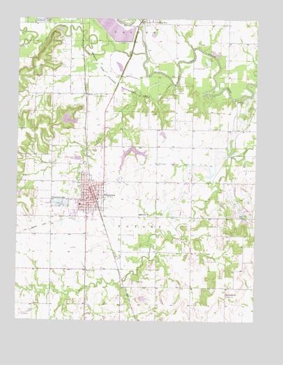
Pleasanton, KS USGS Topographic Map
Click on map above to begin viewing in our Map Viewer.

This topographic map contains these locations and features:
Feature Name Type Latitude Longitude GNIS ID View Map
Big Sugar CreekStreamN38.2356°W94.6838°477702View Map
Bykota Southern Baptist ChurchChurchN38.1691°W94.7128°2688613View Map
City of PleasantonCivilN38.1800°W94.7075°2396236View Map
Emergystat AmbulanceBuildingN38.1672°W94.7132°2754319View Map
Eureka CemeteryCemeteryN38.2045°W94.6486°477929View Map
Fairmount ChurchChurchN38.1363°W94.6400°477928View Map
First Baptist ChurchChurchN38.1708°W94.7134°2688665View Map
First Christian ChurchChurchN38.1796°W94.7123°2688674View Map
First Presbyterian ChurchChurchN38.1756°W94.7115°2690582View Map
Gilmore AirportAirportN38.1275°W94.7482°481316View Map
Green Valley CemeteryCemeteryN38.2179°W94.7099°477931View Map
Green Valley SchoolLocaleN38.2184°W94.7141°477930View Map
Holmes CemeteryCemeteryN38.1411°W94.6872°477921View Map
Lakeside ParkParkN38.1736°W94.7308°477925View Map
Lamb - Mills CemeteryCemeteryN38.1502°W94.6772°477933View Map
Linn County AirportAirportN38.1694°W94.6900°2770187View Map
Linn County Health DepartmentBuildingN38.1759°W94.7099°2695028View Map
Linn County Historical MuseumBuildingN38.1719°W94.7102°2694331View Map
Linn County Rural Fire District 1 Station 920BuildingN38.1708°W94.7064°2111548View Map
Linn County SpeedwayLocaleN38.1476°W94.7108°2692844View Map
Littell CemeteryCemeteryN38.1358°W94.6397°477922View Map
Little Sugar CreekStreamN38.2409°W94.7427°477937View Map
Marais des Cygnes National Wildlife RefugeParkN38.2255°W94.6453°2765387View Map
Mine Creek Battlefield ParkParkN38.1409°W94.7311°485512View Map
Mound Valley SchoolSchoolN38.1903°W94.7319°477923View Map
Muddy CreekStreamN38.2234°W94.6697°477936View Map
PleasantonPopulated PlaceN38.1778°W94.7113°477924View Map
Pleasanton Assembly of God ChurchChurchN38.1793°W94.7135°2690621View Map
Pleasanton CemeteryCemeteryN38.1669°W94.7173°477926View Map
Pleasanton Church of the NazareneChurchN38.1741°W94.7135°2690392View Map
Pleasanton City HallBuildingN38.1761°W94.7114°2693207View Map
Pleasanton City LakeReservoirN38.1957°W94.6892°481228View Map
Pleasanton City Lake DamDamN38.1967°W94.6886°479945View Map
Pleasanton Elementary SchoolSchoolN38.1738°W94.7191°2437457View Map
Pleasanton Fire DepartmentBuildingN38.1681°W94.7133°2111731View Map
Pleasanton Industrial ParkLocaleN38.1674°W94.7131°2692195View Map
Pleasanton Junior High / High SchoolSchoolN38.1746°W94.7194°2437487View Map
Pleasanton LakeReservoirN38.1741°W94.7289°477927View Map
Pleasanton Lake DamDamN38.1731°W94.7272°479946View Map
Pleasanton Lincoln LibraryBuildingN38.1758°W94.7099°2694669View Map
Pleasanton Police DepartmentBuildingN38.1682°W94.7133°2503900View Map
Pleasanton Post OfficePost OfficeN38.1748°W94.7095°2693922View Map
Pleasanton United Methodist ChurchChurchN38.1780°W94.7116°2689524View Map
Pleasanton Wastewater Treatment FacilityLocaleN38.1921°W94.7198°2692085View Map
Township of PotosiCivilN38.1792°W94.6846°477920View Map
Trading PostPopulated PlaceN38.2486°W94.6808°477932View Map
Turner CemeteryCemeteryN38.1645°W94.6449°477934View Map
Yeamans Fox Nest AirportAirportN38.2243°W94.6654°2651075View Map

Note: Coordinates in the location and feature list above are referenced to NAD83 datum.


Copyright (C) 2008-2024 Ryan Niemi / Sunset Dynamics ... All Rights Reserved