TopoQuest Logo
Do you find TopoQuest useful?
Help keep TopoQuest running and adding new maps/features by donating!
Bitcoin:  19c7KJd3qBynnjoSw5npx9KScwjBe4ifkT
Litecoin:  LXs6TkuXGGXo1vDsWCkWVdjQX94eUKd6ui
Home View Maps Find Maps Find Places Resources & Links


Mount Arter, Wyoming Topographic Map

USGS Map Title: Mount Arter, WY
USGS Map MRC: 42108G8
DRG (GeoTIFF) Download: o42108g8.tif


Neighboring USGS Topographic Map Quads:


  Moccasin Lake, WY  
42109H1
 

  Wind River, WY  
42108H8
 

  Ray Lake, WY  
42108H7
 

  Dickinson Park, WY  
42109G1
 

  Mount Arter, WY  
42108G8
 

  Mount Arter SE, WY  
42108G7
 

  Sweetwater Gap, WY  
42109F1
 

  Cony Mountain, WY  
42108F8
 

  Fossil Hill, WY  
42108F7


Map MRC Location:

N43°
W109°
N43°
W108°
H8 H7 H6 H5 H4 H3 H2 H1
G8 G7 G6 G5 G4 G3 G2 G1
F8 F7 F6 F5 F4 F3 F2 F1
E8 E7 E6 E5 E4 E3 E2 E1
D8 D7 D6 D5 D4 D3 D2 D1
C8 C7 C6 C5 C4 C3 C2 C1
B8 B7 B6 B5 B4 B3 B2 B1
A8 A7 A6 A5 A4 A3 A2 A1
N42°
W109°
N42°
W108°

Mount Arter, WY USGS 1:24K Topographic Map Preview:
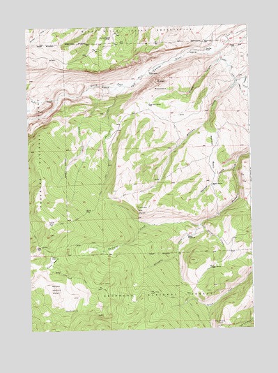
Mount Arter, WY USGS Topographic Map
Click on map above to begin viewing in our Map Viewer.

This topographic map contains these locations and features:
Feature Name Type Latitude Longitude GNIS ID View Map
Bragg CanyonValleyN42.8622°W108.8890°1598354View Map
Bragg MountainSummitN42.8505°W108.9248°1598355View Map
Brown Jug DitchCanalN42.8461°W108.8779°1604836View Map
Charcoal SpringSpringN42.8705°W108.9525°1598702View Map
Cole SpringSpringN42.7754°W108.8978°1598855View Map
Cole Spring CreekStreamN42.7930°W108.9040°1598857View Map
Cony BasinBasinN42.7780°W108.9873°1598882View Map
Cony PassGapN42.7850°W108.9929°1598884View Map
Cyclone PassGapN42.7944°W108.9882°1599099View Map
Fairfield HillSummitN42.7522°W108.8946°1599650View Map
Farlow HomesteadLocaleN42.7886°W108.9110°1599675View Map
Farlow TrailTrailN42.7863°W108.9682°1599676View Map
Hart RanchLocaleN42.8555°W108.9307°1600223View Map
Mexican Creek MineMineN42.8586°W108.8904°1746499View Map
Mormon BasinBasinN42.8225°W108.8962°1601559View Map
Mormon GulchValleyN42.8163°W108.8837°1601562View Map
Mormon SpringSpringN42.8091°W108.8974°1601563View Map
Mount ArterSummitN42.7672°W108.9857°1597814View Map
North Fork CanyonValleyN42.8641°W108.9015°1601748View Map
Paradise CreekStreamN42.8505°W108.9440°1602014View Map
Pine Bar RanchLocaleN42.8650°W108.8993°1602146View Map
Porcupine CreekStreamN42.7930°W108.9040°1602262View Map
Sand CreekStreamN42.8455°W108.9826°1602707View Map
Spring CreekStreamN42.8508°W108.9471°1603241View Map
Squaw Creek TrailTrailN42.7719°W108.9726°1604490View Map
Suicide PointCliffN42.7994°W108.9387°1603425View Map
Uncle Tom SpringSpringN42.8425°W108.9315°1603855View Map

Note: Coordinates in the location and feature list above are referenced to NAD83 datum.


Copyright (C) 2008-2025 Ryan Niemi / Sunset Dynamics ... All Rights Reserved