TopoQuest Logo
Do you find TopoQuest useful?
Help keep TopoQuest running and adding new maps/features by donating!
Bitcoin:  19c7KJd3qBynnjoSw5npx9KScwjBe4ifkT
Litecoin:  LXs6TkuXGGXo1vDsWCkWVdjQX94eUKd6ui
Home View Maps Find Maps Find Places Resources & Links


Mount Bradley, Montana Topographic Map

USGS Map Title: Mount Bradley, MT
USGS Map MRC: 48113B4
DRG (GeoTIFF) Download: o48113b4.tif


Neighboring USGS Topographic Map Quads:


  Essex, MT  
48113C5
 

  Blacktail, MT  
48113C4
 

  Summit, MT  
48113C3
 

  Nimrod, MT  
48113B5
 

  Mount Bradley, MT  
48113B4
 

  Red Plume Mountain, MT  
48113B3
 

  Circus Peak, MT  
48113A5
 

  Horseshoe Peak, MT  
48113A4
 

  Capitol Mountain, MT  
48113A3


Map MRC Location:

N49°
W114°
N49°
W113°
H8 H7 H6 H5 H4 H3 H2 H1
G8 G7 G6 G5 G4 G3 G2 G1
F8 F7 F6 F5 F4 F3 F2 F1
E8 E7 E6 E5 E4 E3 E2 E1
D8 D7 D6 D5 D4 D3 D2 D1
C8 C7 C6 C5 C4 C3 C2 C1
B8 B7 B6 B5 B4 B3 B2 B1
A8 A7 A6 A5 A4 A3 A2 A1
N48°
W114°
N48°
W113°

Mount Bradley, MT USGS 1:24K Topographic Map Preview:
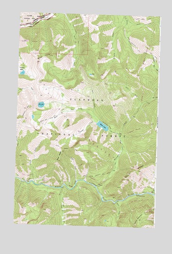
Mount Bradley, MT USGS Topographic Map
Click on map above to begin viewing in our Map Viewer.

This topographic map contains these locations and features:
Feature Name Type Latitude Longitude GNIS ID View Map
Big River TrailTrailN48.1430°W113.4031°779863View Map
Cabin CreekStreamN48.1513°W113.4448°780727View Map
Cascade CreekStreamN48.1858°W113.4290°780994View Map
Castle CreekStreamN48.1394°W113.4095°781018View Map
Cy CreekStreamN48.1469°W113.4595°782013View Map
Devil Creek TrailTrailN48.2372°W113.4493°782320View Map
Devils HumpSummitN48.2213°W113.4836°782335View Map
Ear CreekStreamN48.2016°W113.3818°782773View Map
Elk LakeLakeN48.1958°W113.4789°783091View Map
Forster MountainSummitN48.1935°W113.4923°783610View Map
Giefer LakeLakeN48.2145°W113.4359°783927View Map
Giefer Twentyfive Mile Creek TrailTrailN48.2305°W113.3943°783928View Map
Goal CreekStreamN48.1894°W113.4312°798987View Map
Granite CabinLocaleN48.1447°W113.3918°798988View Map
Granite CreekStreamN48.1447°W113.3770°784165View Map
Great Bear WildernessReserveN48.1454°W113.4702°798923View Map
Grizzly CreekStreamN48.2489°W113.4068°784349View Map
Lunch CreekStreamN48.1497°W113.4843°786716View Map
Lynx CreekStreamN48.1969°W113.3909°786735View Map
Moose CreekStreamN48.1794°W113.4093°787629View Map
Moose LakeLakeN48.1843°W113.4238°787654View Map
Mount BradleySummitN48.1687°W113.4594°780351View Map
Mount Bradley TrailTrailN48.1702°W113.4520°787736View Map
SingleshotPopulated PlaceN48.2472°W113.4807°790548View Map
Singleshot (historical)LocaleN48.2472°W113.4807°1796025View Map
Snake CreekStreamN48.2483°W113.4054°790756View Map
Snake Creek LoopTrailN48.2475°W113.3884°790757View Map
Spruce Park Moose Lake TrailTrailN48.1872°W113.4718°791349View Map
Twentyfive Mile CreekStreamN48.1483°W113.4273°792494View Map
Windy Hill (historical)LocaleN48.2472°W113.4807°1813143View Map

Note: Coordinates in the location and feature list above are referenced to NAD83 datum.


Copyright (C) 2008-2025 Ryan Niemi / Sunset Dynamics ... All Rights Reserved