TopoQuest Logo
Do you find TopoQuest useful?
Help keep TopoQuest running and adding new maps/features by donating!
Bitcoin:  19c7KJd3qBynnjoSw5npx9KScwjBe4ifkT
Litecoin:  LXs6TkuXGGXo1vDsWCkWVdjQX94eUKd6ui
Home View Maps Find Maps Find Places Resources & Links


Nimrod, Montana Topographic Map

USGS Map Title: Nimrod, MT
USGS Map MRC: 48113B5
DRG (GeoTIFF) Download: o48113b5.tif


Neighboring USGS Topographic Map Quads:


  Pinnacle, MT  
48113C6
 

  Essex, MT  
48113C5
 

  Blacktail, MT  
48113C4
 

  Felix Peak, MT  
48113B6
 

  Nimrod, MT  
48113B5
 

  Mount Bradley, MT  
48113B4
 

  Quintonkon, MT  
48113A6
 

  Circus Peak, MT  
48113A5
 

  Horseshoe Peak, MT  
48113A4


Map MRC Location:

N49°
W114°
N49°
W113°
H8 H7 H6 H5 H4 H3 H2 H1
G8 G7 G6 G5 G4 G3 G2 G1
F8 F7 F6 F5 F4 F3 F2 F1
E8 E7 E6 E5 E4 E3 E2 E1
D8 D7 D6 D5 D4 D3 D2 D1
C8 C7 C6 C5 C4 C3 C2 C1
B8 B7 B6 B5 B4 B3 B2 B1
A8 A7 A6 A5 A4 A3 A2 A1
N48°
W114°
N48°
W113°

Nimrod, MT USGS 1:24K Topographic Map Preview:
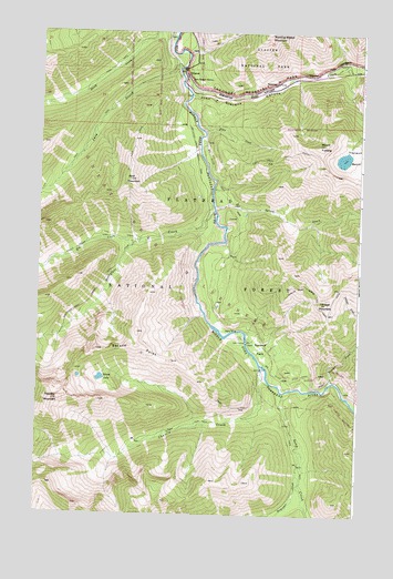
Nimrod, MT USGS Topographic Map
Click on map above to begin viewing in our Map Viewer.

This topographic map contains these locations and features:
Feature Name Type Latitude Longitude GNIS ID View Map
Bear CreekStreamN48.2336°W113.5662°779513View Map
Bergsicker CreekStreamN48.1355°W113.5232°779714View Map
Charlie CreekStreamN48.1636°W113.5382°781171View Map
Dirtyface CreekStreamN48.2038°W113.5568°782394View Map
Dirtyface-Logan Creek TrailTrailN48.1797°W113.6059°782395View Map
Edna CreekStreamN48.2247°W113.5620°782990View Map
Edna Creek TrailTrailN48.2169°W113.5329°782992View Map
Elk CreekStreamN48.1947°W113.5882°783068View Map
JavaLocaleN48.2380°W113.5723°798905View Map
Java CreekStreamN48.2408°W113.5698°785428View Map
Java MountainSummitN48.2117°W113.5903°785429View Map
Java Ranger StationLocaleN48.2375°W113.5682°785430View Map
Long CreekStreamN48.1569°W113.5298°786522View Map
Mount FurlongSummitN48.2210°W113.5157°783789View Map
NimrodPopulated PlaceN48.2388°W113.5684°788005View Map
Nimrod MineMineN48.2366°W113.5515°802985View Map
Red Sky MountainSummitN48.1544°W113.6194°789491View Map
Spruce CreekStreamN48.2050°W113.5568°791340View Map
Spruce LakeLakeN48.1602°W113.6005°791344View Map
Spruce LookoutLocaleN48.1594°W113.5601°791346View Map
Spruce ParkFlatN48.1683°W113.5384°791348View Map
Spruce Park Forest Service FacilityLocaleN48.1705°W113.5434°799056View Map
Spruce PointSummitN48.1675°W113.6022°791350View Map
Summit Rest AreaLocaleN48.2394°W113.5704°1795955View Map
Tranquil BasinBasinN48.2186°W113.5026°792331View Map
Vinegar CreekStreamN48.1594°W113.5107°792716View Map
Vinegar CreekStreamN48.1772°W113.5001°792717View Map
Vinegar MountainSummitN48.1799°W113.5135°792718View Map

Note: Coordinates in the location and feature list above are referenced to NAD83 datum.


Copyright (C) 2008-2024 Ryan Niemi / Sunset Dynamics ... All Rights Reserved