TopoQuest Logo
Do you find TopoQuest useful?
Help keep TopoQuest running and adding new maps/features by donating!
Bitcoin:  19c7KJd3qBynnjoSw5npx9KScwjBe4ifkT
Litecoin:  LXs6TkuXGGXo1vDsWCkWVdjQX94eUKd6ui
Home View Maps Find Maps Find Places Resources & Links


Mount Ellis, Montana Topographic Map

USGS Map Title: Mount Ellis, MT
USGS Map MRC: 45110E8
DRG (GeoTIFF) Download: o45110e8.tif


Neighboring USGS Topographic Map Quads:


  Bozeman, MT  
45111F1
 

  Kelly Creek, MT  
45110F8
 

  Bozeman Pass, MT  
45110F7
 

  Wheeler Mountain, MT  
45111E1
 

  Mount Ellis, MT  
45110E8
 

  Bald Knob, MT  
45110E7
 

  Mount Blackmore, MT  
45111D1
 

  Fridley Peak, MT  
45110D8
 

  Big Draw, MT  
45110D7


Map MRC Location:

N46°
W111°
N46°
W110°
H8 H7 H6 H5 H4 H3 H2 H1
G8 G7 G6 G5 G4 G3 G2 G1
F8 F7 F6 F5 F4 F3 F2 F1
E8 E7 E6 E5 E4 E3 E2 E1
D8 D7 D6 D5 D4 D3 D2 D1
C8 C7 C6 C5 C4 C3 C2 C1
B8 B7 B6 B5 B4 B3 B2 B1
A8 A7 A6 A5 A4 A3 A2 A1
N45°
W111°
N45°
W110°

Mount Ellis, MT USGS 1:24K Topographic Map Preview:
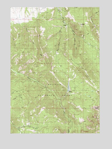
Mount Ellis, MT USGS Topographic Map
Click on map above to begin viewing in our Map Viewer.

This topographic map contains these locations and features:
Feature Name Type Latitude Longitude GNIS ID View Map
02S06E33ADAC01 WellWellN45.6227°W110.9808°810620View Map
02S06E33BDDC01 WellWellN45.6205°W110.9930°810604View Map
02S06E36CB__01 WellWellN45.6185°W110.9369°810584View Map
Bear Canyon Ski LodgeLocaleN45.6069°W110.9227°806760View Map
Chestnut MountainSummitN45.6055°W110.8822°781203View Map
Dean GulchValleyN45.5952°W110.9008°782173View Map
Francham MountainSummitN45.6083°W110.9019°793870View Map
Lick CreekStreamN45.5049°W110.9897°786096View Map
Mount EllisSummitN45.5774°W110.9561°783158View Map
Mystic LakeLakeN45.5454°W110.9194°787896View Map
Mystic Lake DamDamN45.5399°W110.9191°795995View Map
Mystic Lake Ranger StationLocaleN45.5413°W110.9188°787900View Map
New World GulchValleyN45.6088°W110.9255°787965View Map
Shoefelt GulchValleyN45.5955°W110.9108°790426View Map
South Fork Bozeman CreekStreamN45.5344°W110.9333°790914View Map

Note: Coordinates in the location and feature list above are referenced to NAD83 datum.


Copyright (C) 2008-2024 Ryan Niemi / Sunset Dynamics ... All Rights Reserved