TopoQuest Logo
Do you find TopoQuest useful?
Help keep TopoQuest running and adding new maps/features by donating!
Bitcoin:  19c7KJd3qBynnjoSw5npx9KScwjBe4ifkT
Litecoin:  LXs6TkuXGGXo1vDsWCkWVdjQX94eUKd6ui
Home View Maps Find Maps Find Places Resources & Links


La Porte, California Topographic Map

USGS Map Title: La Porte, CA
USGS Map MRC: 39120F8
DRG (GeoTIFF) Download: o39120f8.tif


Neighboring USGS Topographic Map Quads:


  Dogwood Peak, CA  
39121G1
 

  Onion Valley, CA  
39120G8
 

  Blue Nose Mountain, CA  
39120G7
 

  American House, CA  
39121F1
 

  La Porte, CA  
39120F8
 

  Mount Fillmore, CA  
39120F7
 

  Strawberry Valley, CA  
39121E1
 

  Goodyears Bar, CA  
39120E8
 

  Downieville, CA  
39120E7


Map MRC Location:

N40°
W121°
N40°
W120°
H8 H7 H6 H5 H4 H3 H2 H1
G8 G7 G6 G5 G4 G3 G2 G1
F8 F7 F6 F5 F4 F3 F2 F1
E8 E7 E6 E5 E4 E3 E2 E1
D8 D7 D6 D5 D4 D3 D2 D1
C8 C7 C6 C5 C4 C3 C2 C1
B8 B7 B6 B5 B4 B3 B2 B1
A8 A7 A6 A5 A4 A3 A2 A1
N39°
W121°
N39°
W120°

La Porte, CA USGS 1:24K Topographic Map Preview:
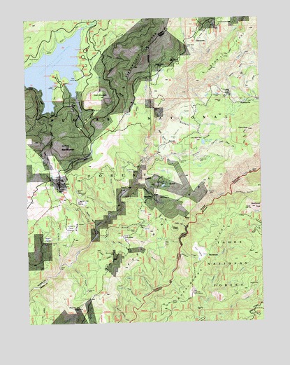
La Porte, CA USGS Topographic Map
Click on map above to begin viewing in our Map Viewer.

This topographic map contains these locations and features:
Feature Name Type Latitude Longitude GNIS ID View Map
Barnards DiggingsMineN39.6599°W120.9897°256536View Map
Bella Union RavineValleyN39.6254°W120.9475°256808View Map
Bellevue MineMineN39.7129°W120.9316°256812View Map
Bon Ton RavineValleyN39.6324°W120.9411°257331View Map
Caledonia MineMineN39.6913°W120.9186°257825View Map
California MineMineN39.6971°W120.8758°257831View Map
Cedar Grove RavineValleyN39.6896°W120.9386°258132View Map
China BarBarN39.6479°W120.9830°258297View Map
Clamper FlatFlatN39.6296°W120.9105°258390View Map
Clarks RavineValleyN39.6488°W120.9827°258416View Map
Claybank MineMineN39.6791°W120.9741°258422View Map
Clippership MineMineN39.6913°W120.9083°258465View Map
Craigs FlatFlatN39.6374°W120.9130°258866View Map
Craigs Flat Placer DiggingsMineN39.6369°W120.9142°2676123View Map
Creed RavineValleyN39.7352°W120.9605°258905View Map
Dark RavineValleyN39.6760°W120.9516°259064View Map
Davis Motor MineMineN39.6627°W120.9425°259097View Map
Deacon Long RavineValleyN39.6818°W120.9425°259107View Map
Deadwood RavineValleyN39.6771°W120.8913°259159View Map
Devils GateLocaleN39.6866°W120.8811°259312View Map
Devils Post PileSummitN39.6707°W120.8827°1658412View Map
East Branch Little Canyon CreekStreamN39.6368°W120.9033°259689View Map
East Branch Rabbit CreekStreamN39.6843°W120.9863°259692View Map
East Branch Slate CreekStreamN39.7177°W120.9186°259695View Map
Flume CampLocaleN39.6632°W120.9205°260218View Map
French CampLocaleN39.6793°W120.9497°260369View Map
Gardners PointCapeN39.6821°W120.9288°260482View Map
Gardners Point DamDamN39.6832°W120.9344°1664758View Map
Gibson CreekStreamN39.7349°W120.9052°260552View Map
GibsonvillePopulated PlaceN39.7402°W120.9088°1658608View Map
Gibsonville RidgeRidgeN39.7385°W120.9341°260556View Map
Goat MountainSummitN39.7179°W120.9602°260621View Map
Grass FlatPopulated PlaceN39.6757°W120.9352°1658652View Map
Happy Hollow RavineValleyN39.6632°W120.9161°261079View Map
Howland FlatPopulated PlaceN39.7149°W120.8866°1658792View Map
Illinois RidgeRidgeN39.6616°W120.9744°261692View Map
Independence MineMineN39.6779°W120.9722°261701View Map
Johnson RavineValleyN39.6374°W120.9350°261987View Map
Kenzie RavineValleyN39.7324°W120.9672°262147View Map
Knuts SpringSpringN39.7061°W120.9050°262233View Map
La PortePopulated PlaceN39.6821°W120.9841°262254View Map
La Porte Bald MountainSummitN39.6974°W120.9797°262255View Map
La Porte Census Designated PlaceCensusN39.6725°W120.9852°2408509View Map
La Porte Fire Protection DistrictBuildingN39.6832°W120.9895°2622127View Map
La Porte SchoolSchoolN39.6807°W120.9852°1701375View Map
Little Grass ValleyPopulated PlaceN39.7145°W120.9772°2413607View Map
Little Grass Valley Census Designated PlaceCensusN39.7252°W120.9591°2408619View Map
Little Grass Valley ReservoirReservoirN39.7292°W120.9902°262610View Map
Little Grass Valley TrailTrailN39.6977°W120.9875°262611View Map
Little Table RockSummitN39.6999°W120.9094°1658986View Map
Little Table Rock DamDamN39.6916°W120.8927°1664697View Map
Little Table Rock ReservoirReservoirN39.6916°W120.8927°1664698View Map
Lucky Hill MineMineN39.6382°W120.9694°263062View Map
Lucky Hill RavineValleyN39.6485°W120.9780°263063View Map
Maredith MillPopulated PlaceN39.6396°W120.8822°1659057View Map
Monumental MineMineN39.6704°W120.9133°263781View Map
MorristownPopulated PlaceN39.6524°W120.9047°1659181View Map
Morristown RavineValleyN39.6541°W120.9197°263849View Map
Morristown RidgeRidgeN39.6477°W120.9097°263850View Map
Morrs RavineValleyN39.6391°W120.9316°263852View Map
Mountain Boy MineMineN39.6538°W120.9541°263895View Map
Oats MeadowFlatN39.7218°W120.9747°1666187View Map
Old Mill CreekStreamN39.6263°W120.9072°264333View Map
Pacific MineMineN39.6788°W120.9027°264431View Map
Pancake RavineValleyN39.7185°W120.9741°264461View Map
Pats GulchValleyN39.6604°W120.9630°264555View Map
Pearson RavineValleyN39.7263°W120.8936°264601View Map
Pine Grove CemeteryCemeteryN39.7174°W120.8994°264758View Map
Pine Grove CreekStreamN39.7196°W120.9102°264760View Map
Pioneer Mine Placer DiggingsMineN39.6760°W120.9302°264809View Map
Plug PointSummitN39.6530°W120.8802°264855View Map
Port WineLocaleN39.6604°W120.9486°264959View Map
Port Wine RavineValleyN39.6596°W120.9575°264960View Map
Port Wine RidgeRidgeN39.6682°W120.9255°264961View Map
PotosiLocaleN39.7160°W120.8761°264999View Map
Potosi CreekStreamN39.7263°W120.8947°265000View Map
Poverty HillSummitN39.6310°W120.9741°265014View Map
Queen CityPopulated PlaceN39.6646°W120.9402°1659447View Map
Rabbit CreekStreamN39.6613°W120.9644°265118View Map
Reese RavineValleyN39.6630°W120.8758°265362View Map
Sacketts GulchValleyN39.7096°W120.9255°265704View Map
Saint LouisPopulated PlaceN39.6985°W120.9250°1659571View Map
Saint Louis CemeteryCemeteryN39.6966°W120.9313°265743View Map
Sawmill RavineValleyN39.6843°W120.9408°265885View Map
Sawmill RidgeRidgeN39.7349°W120.8936°265887View Map
Sears RavineValleyN39.7041°W120.9311°265957View Map
Secret DiggingsMineN39.6638°W120.9775°265972View Map
Sheep Ranch RavineValleyN39.6979°W120.8994°266078View Map
Spanish FlatFlatN39.6743°W120.9708°267550View Map
Spanish RavineValleyN39.6649°W120.9638°267554View Map
Stahis RavineValleyN39.6929°W120.9100°267658View Map
SugarloafSummitN39.7157°W120.8977°1659897View Map
Taber MineMineN39.7382°W120.9133°268046View Map
Table RockSummitN39.7038°W120.8824°268056View Map
Thistle ShaftLocaleN39.7302°W120.9302°268226View Map
Tooms CreekStreamN39.7271°W120.9963°1666198View Map
Union Keystone MineMineN39.7471°W120.8963°268586View Map
Upper Dutch DiggingsMineN39.6918°W120.9888°268606View Map
WahooLocaleN39.6682°W120.9158°268740View Map
Wallace CreekStreamN39.7099°W120.9286°268757View Map
West Coast MineMineN39.6596°W120.9266°268880View Map
Wisconsin RavineValleyN39.6696°W120.9572°269258View Map
Woods MineMineN39.7341°W120.9936°269304View Map
Yankee HillSummitN39.6877°W120.9452°1660208View Map

Note: Coordinates in the location and feature list above are referenced to NAD83 datum.


Copyright (C) 2008-2024 Ryan Niemi / Sunset Dynamics ... All Rights Reserved