TopoQuest Logo
Do you find TopoQuest useful?
Help keep TopoQuest running and adding new maps/features by donating!
Bitcoin:  19c7KJd3qBynnjoSw5npx9KScwjBe4ifkT
Litecoin:  LXs6TkuXGGXo1vDsWCkWVdjQX94eUKd6ui
Home View Maps Find Maps Find Places Resources & Links


Mount Hope, Kansas Topographic Map

USGS Map Title: Mount Hope, KS
USGS Map MRC: 37097G6
DRG (GeoTIFF) Download: o37097g6.tif


Neighboring USGS Topographic Map Quads:


  Haven, KS  
37097H7
 

  Patterson, KS  
37097H6
 

  Bentley, KS  
37097H5
 

  Haven SE, KS  
37097G7
 

  Mount Hope, KS  
37097G6
 

  Colwich, KS  
37097G5
 

  Cheney, KS  
37097F7
 

  Garden Plain, KS  
37097F6
 

  Goddard, KS  
37097F5


Map MRC Location:

N38°
W98°
N38°
W97°
H8 H7 H6 H5 H4 H3 H2 H1
G8 G7 G6 G5 G4 G3 G2 G1
F8 F7 F6 F5 F4 F3 F2 F1
E8 E7 E6 E5 E4 E3 E2 E1
D8 D7 D6 D5 D4 D3 D2 D1
C8 C7 C6 C5 C4 C3 C2 C1
B8 B7 B6 B5 B4 B3 B2 B1
A8 A7 A6 A5 A4 A3 A2 A1
N37°
W98°
N37°
W97°

Mount Hope, KS USGS 1:24K Topographic Map Preview:
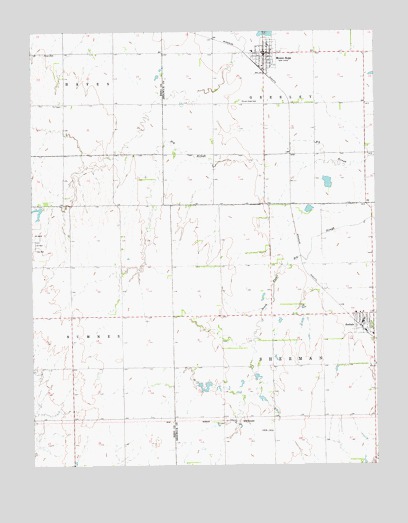
Mount Hope, KS USGS Topographic Map
Click on map above to begin viewing in our Map Viewer.

This topographic map contains these locations and features:
Feature Name Type Latitude Longitude GNIS ID View Map
AndalePopulated PlaceN37.7906°W97.6295°473809View Map
Andale Care CenterBuildingN37.7901°W97.6258°2510010View Map
Andale Elementary - Middle SchoolSchoolN37.7938°W97.6322°480871View Map
Andale High SchoolSchoolN37.7941°W97.6350°480870View Map
Andale Middle SchoolSchoolN37.7938°W97.6322°2497495View Map
Andale Police DepartmentBuildingN37.7914°W97.6299°2503889View Map
Andale Water TowerTowerN37.7939°W97.6254°2509618View Map
City of AndaleCivilN37.7915°W97.6275°2393951View Map
City of Mount HopeCivilN37.8735°W97.6617°2395122View Map
Dicks Mobile Home ParkPopulated PlaceN37.8685°W97.6699°2509681View Map
Haven Priest CemeteryCemeteryN37.8686°W97.7460°473811View Map
Mount HopePopulated PlaceN37.8686°W97.6650°473810View Map
Mount Hope CemeteryCemeteryN37.8547°W97.6748°473806View Map
Mount Hope City OfficesBuildingN37.8690°W97.6657°2510399View Map
Mount Hope Community Ambulance ServiceBuildingN37.8689°W97.6643°2696534View Map
Mount Hope Elementary SchoolSchoolN37.8692°W97.6707°480869View Map
Mount Hope Federated ChurchChurchN37.8685°W97.6666°2510390View Map
Mount Hope Fire DepartmentBuildingN37.8689°W97.6643°2111654View Map
Mount Hope Municipal CourtBuildingN37.8690°W97.6657°2510400View Map
Mount Hope Nursing CenterBuildingN37.8691°W97.6579°2510139View Map
Mount Hope Police DepartmentBuildingN37.8689°W97.6660°2504069View Map
Mount Hope Post OfficePost OfficeN37.8685°W97.6658°2509880View Map
Mount Hope Public LibraryBuildingN37.8684°W97.6652°2510373View Map
Mount Hope United Methodist ChurchChurchN37.8685°W97.6628°2510314View Map
Ost (historical)LocaleN37.7514°W97.7350°481964View Map
Saint Joseph CemeteryCemeteryN37.7949°W97.6302°2509525View Map
Sedgewick County Public Library - Andale DistrictBuildingN37.7909°W97.6301°2511095View Map
Sedgwick County Fire District 1 Station 31BuildingN37.7871°W97.6258°2111849View Map
Team Marketing Alliance Grain Elevator Number 28LocaleN37.8649°W97.6670°2695378View Map
Township of GreeleyCivilN37.8688°W97.6471°473826View Map
Township of ShermanCivilN37.7803°W97.6445°473812View Map

Note: Coordinates in the location and feature list above are referenced to NAD83 datum.


Copyright (C) 2008-2024 Ryan Niemi / Sunset Dynamics ... All Rights Reserved