TopoQuest Logo
Do you find TopoQuest useful?
Help keep TopoQuest running and adding new maps/features by donating!
Bitcoin:  19c7KJd3qBynnjoSw5npx9KScwjBe4ifkT
Litecoin:  LXs6TkuXGGXo1vDsWCkWVdjQX94eUKd6ui
Home View Maps Find Maps Find Places Resources & Links


Bentley, Kansas Topographic Map

USGS Map Title: Bentley, KS
USGS Map MRC: 37097H5
DRG (GeoTIFF) Download: o37097h5.tif


Neighboring USGS Topographic Map Quads:


  Burrton, KS  
38097A6
 

  Halstead, KS  
38097A5
 

  Zimmerdale, KS  
38097A4
 

  Patterson, KS  
37097H6
 

  Bentley, KS  
37097H5
 

  Sedgwick, KS  
37097H4
 

  Mount Hope, KS  
37097G6
 

  Colwich, KS  
37097G5
 

  Maize, KS  
37097G4


Map MRC Location:

N38°
W98°
N38°
W97°
H8 H7 H6 H5 H4 H3 H2 H1
G8 G7 G6 G5 G4 G3 G2 G1
F8 F7 F6 F5 F4 F3 F2 F1
E8 E7 E6 E5 E4 E3 E2 E1
D8 D7 D6 D5 D4 D3 D2 D1
C8 C7 C6 C5 C4 C3 C2 C1
B8 B7 B6 B5 B4 B3 B2 B1
A8 A7 A6 A5 A4 A3 A2 A1
N37°
W98°
N37°
W97°

Bentley, KS USGS 1:24K Topographic Map Preview:
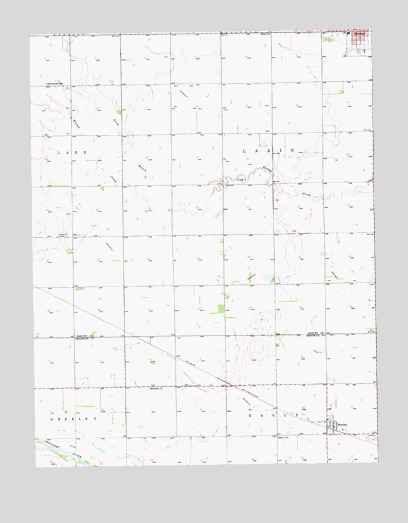
Bentley, KS USGS Topographic Map
Click on map above to begin viewing in our Map Viewer.

This topographic map contains these locations and features:
Feature Name Type Latitude Longitude GNIS ID View Map
BentleyPopulated PlaceN37.8861°W97.5170°473672View Map
Bentley City HallBuildingN37.8852°W97.5165°2510325View Map
Bentley Fire and Emergency Management ServicesBuildingN37.8851°W97.5162°2695500View Map
Bentley Police DepartmentBuildingN37.8852°W97.5162°2504259View Map
Bentley Post OfficePost OfficeN37.8852°W97.5165°2510488View Map
Bentley Primary SchoolSchoolN37.8875°W97.5182°1967154View Map
Bentley United Methodist ChurchChurchN37.8867°W97.5162°1967155View Map
Bethany Baptist ChurchChurchN37.8974°W97.5832°473671View Map
City of BentleyCivilN37.8868°W97.5148°2394139View Map
City of HalsteadCivilN37.9998°W97.5102°485586View Map
Enterprise School (historical)SchoolN37.9856°W97.6192°473673View Map
Grace Mennonite ChurchChurchN38.0000°W97.5376°473674View Map
Halstead Baptist ChurchChurchN37.9999°W97.5136°1967128View Map
Halstead High SchoolSchoolN37.9985°W97.5126°480845View Map
Halstead Middle SchoolSchoolN37.9987°W97.5089°2497611View Map
KMTW - TV (Wichita)BuildingN37.9394°W97.5118°2625251View Map
North Branch Kisiwa CreekStreamN37.9561°W97.5539°473676View Map
Township of LakinCivilN37.9553°W97.5375°473678View Map

Note: Coordinates in the location and feature list above are referenced to NAD83 datum.


Copyright (C) 2008-2024 Ryan Niemi / Sunset Dynamics ... All Rights Reserved