TopoQuest Logo
Do you find TopoQuest useful?
Help keep TopoQuest running and adding new maps/features by donating!
Bitcoin:  19c7KJd3qBynnjoSw5npx9KScwjBe4ifkT
Litecoin:  LXs6TkuXGGXo1vDsWCkWVdjQX94eUKd6ui
Home View Maps Find Maps Find Places Resources & Links


Mount Lebanon, Montana Topographic Map

USGS Map Title: Mount Lebanon, MT
USGS Map MRC: 48111G1
DRG (GeoTIFF) Download: o48111g1.tif


Neighboring USGS Topographic Map Quads:


  Hawley Hill, MT  
48111H2
 

  Bingham Lake, MT  
48111H1
 

  Laird School, MT  
48110H8
 

  Haystack Butte, MT  
48111G2
 

  Mount Lebanon, MT  
48111G1
 

  Vaver Reservoir, MT  
48110G8
 

  Blair Ranch, MT  
48111F2
 

  Lakey Ranch, MT  
48111F1
 

  Chester NW, MT  
48110F8


Map MRC Location:

N49°
W112°
N49°
W111°
H8 H7 H6 H5 H4 H3 H2 H1
G8 G7 G6 G5 G4 G3 G2 G1
F8 F7 F6 F5 F4 F3 F2 F1
E8 E7 E6 E5 E4 E3 E2 E1
D8 D7 D6 D5 D4 D3 D2 D1
C8 C7 C6 C5 C4 C3 C2 C1
B8 B7 B6 B5 B4 B3 B2 B1
A8 A7 A6 A5 A4 A3 A2 A1
N48°
W112°
N48°
W111°

Mount Lebanon, MT USGS 1:24K Topographic Map Preview:
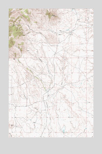
Mount Lebanon, MT USGS Topographic Map
Click on map above to begin viewing in our Map Viewer.

This topographic map contains these locations and features:
Feature Name Type Latitude Longitude GNIS ID View Map
35N05E15CAAC01 WellWellN48.7900°W111.0678°1636546View Map
35N05E20BACC01 WellWellN48.7808°W111.1144°1636510View Map
Bear ToothPillarN48.8261°W111.1186°768611View Map
Devils ChimneySummitN48.8611°W111.1158°770620View Map
East ButteSummitN48.8608°W111.1155°770994View Map
Iron CreekStreamN48.8544°W111.0911°772725View Map
McGuire HillSummitN48.7617°W111.1216°774022View Map
McTosh CouleeValleyN48.7939°W111.0691°774051View Map
Meissner DamDamN48.7550°W111.0441°795308View Map
Mount LebanonSummitN48.8681°W111.0608°773273View Map
Roke RanchLocaleN48.8494°W111.0355°775915View Map
Snoose CouleeValleyN48.7556°W111.0636°776704View Map
Tiber QuarryMineN48.8386°W111.1166°804043View Map
Tootsie CreekStreamN48.7788°W111.0686°777712View Map
Tootsie Creek Number 1 MineMineN48.8583°W111.1189°804041View Map
Tootsie Creek Number 2 MineMineN48.8528°W111.1100°804045View Map

Note: Coordinates in the location and feature list above are referenced to NAD83 datum.


Copyright (C) 2008-2025 Ryan Niemi / Sunset Dynamics ... All Rights Reserved