TopoQuest Logo
Do you find TopoQuest useful?
Help keep TopoQuest running and adding new maps/features by donating!
Bitcoin:  19c7KJd3qBynnjoSw5npx9KScwjBe4ifkT
Litecoin:  LXs6TkuXGGXo1vDsWCkWVdjQX94eUKd6ui
Home View Maps Find Maps Find Places Resources & Links


Blair Ranch, Montana Topographic Map

USGS Map Title: Blair Ranch, MT
USGS Map MRC: 48111F2
DRG (GeoTIFF) Download: o48111f2.tif


Neighboring USGS Topographic Map Quads:


  Grassy Butte, MT  
48111G3
 

  Haystack Butte, MT  
48111G2
 

  Mount Lebanon, MT  
48111G1
 

  Berkholder Reservoir, MT  
48111F3
 

  Blair Ranch, MT  
48111F2
 

  Lakey Ranch, MT  
48111F1
 

  McCarters Lake SE, MT  
48111E3
 

  North Lothair School, MT  
48111E2
 

  Tiber, MT  
48111E1


Map MRC Location:

N49°
W112°
N49°
W111°
H8 H7 H6 H5 H4 H3 H2 H1
G8 G7 G6 G5 G4 G3 G2 G1
F8 F7 F6 F5 F4 F3 F2 F1
E8 E7 E6 E5 E4 E3 E2 E1
D8 D7 D6 D5 D4 D3 D2 D1
C8 C7 C6 C5 C4 C3 C2 C1
B8 B7 B6 B5 B4 B3 B2 B1
A8 A7 A6 A5 A4 A3 A2 A1
N48°
W112°
N48°
W111°

Blair Ranch, MT USGS 1:24K Topographic Map Preview:
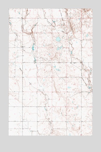
Blair Ranch, MT USGS Topographic Map
Click on map above to begin viewing in our Map Viewer.

This topographic map contains these locations and features:
Feature Name Type Latitude Longitude GNIS ID View Map
33N04E12AAAB01 WellWellN48.6386°W111.1441°1636098View Map
34N04E05AAAA01 WellWellN48.7400°W111.2308°1636334View Map
Antelope CouleeValleyN48.6678°W111.2005°768283View Map
Blair Number 2 DamDamN48.6967°W111.2108°795564View Map
Blair RanchLocaleN48.6980°W111.2105°769018View Map
Bourpe and Hamilton Number 1 DamDamN48.7167°W111.1758°795315View Map
Bourpe and Hamilton ReservoirReservoirN48.7198°W111.1769°795316View Map
Doesitall DamDamN48.7250°W111.1341°798529View Map
Eagle Creek ColonyPopulated PlaceN48.6980°W111.2105°1748631View Map
Eagle Creek School (historical)SchoolN48.6964°W111.1541°770958View Map
Grandview Oil and Gas FieldOilfieldN48.6994°W111.1980°771908View Map
Henry Hawks DamDamN48.7467°W111.1675°795562View Map
Liberty Elementary SchoolSchoolN48.6980°W111.2105°1748662View Map
Little Horse CreekStreamN48.7150°W111.1575°773454View Map
Skari and Sons Number 1 DamDamN48.6517°W111.1958°798530View Map
Trinity ChurchChurchN48.7125°W111.2297°777764View Map
Trommer Post Office (historical)Post OfficeN48.6314°W111.1841°1748620View Map
Trommer School (historical)SchoolN48.6314°W111.1841°1748682View Map

Note: Coordinates in the location and feature list above are referenced to NAD83 datum.


Copyright (C) 2008-2025 Ryan Niemi / Sunset Dynamics ... All Rights Reserved