TopoQuest Logo
Do you find TopoQuest useful?
Help keep TopoQuest running and adding new maps/features by donating!
Bitcoin:  19c7KJd3qBynnjoSw5npx9KScwjBe4ifkT
Litecoin:  LXs6TkuXGGXo1vDsWCkWVdjQX94eUKd6ui
Home View Maps Find Maps Find Places Resources & Links


Hawley Hill, Montana Topographic Map

USGS Map Title: Hawley Hill, MT
USGS Map MRC: 48111H2
DRG (GeoTIFF) Download: o48111h2.tif


Neighboring USGS Topographic Map Quads:


  Whitlash, MT  
48111H3
 

  Hawley Hill, MT  
48111H2
 

  Bingham Lake, MT  
48111H1
 

  Grassy Butte, MT  
48111G3
 

  Haystack Butte, MT  
48111G2
 

  Mount Lebanon, MT  
48111G1


Map MRC Location:

N49°
W112°
N49°
W111°
H8 H7 H6 H5 H4 H3 H2 H1
G8 G7 G6 G5 G4 G3 G2 G1
F8 F7 F6 F5 F4 F3 F2 F1
E8 E7 E6 E5 E4 E3 E2 E1
D8 D7 D6 D5 D4 D3 D2 D1
C8 C7 C6 C5 C4 C3 C2 C1
B8 B7 B6 B5 B4 B3 B2 B1
A8 A7 A6 A5 A4 A3 A2 A1
N48°
W112°
N48°
W111°

Hawley Hill, MT USGS 1:24K Topographic Map Preview:
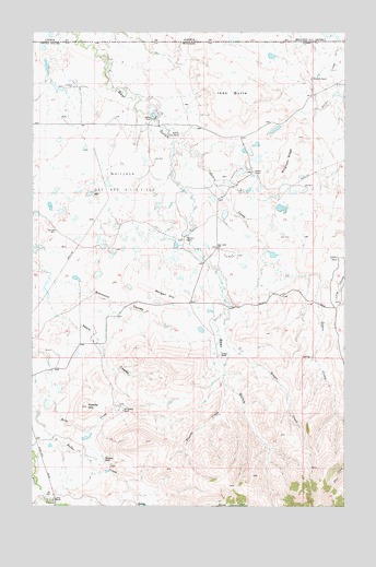
Hawley Hill, MT USGS Topographic Map
Click on map above to begin viewing in our Map Viewer.

This topographic map contains these locations and features:
Feature Name Type Latitude Longitude GNIS ID View Map
36N04E05CDAC01 WellWellN48.9019°W111.2428°1636980View Map
36N04E08BAAC01 WellWellN48.8986°W111.2439°1636967View Map
36N04E09CDDB01 SpringSpringN48.8867°W111.2211°1636933View Map
36N04E17CAA01_ WellWellN48.8769°W111.2428°1636893View Map
37N04E01DDDA01 WellWellN48.9878°W111.1397°1637310View Map
37N04E04CBDA01 WellWellN48.9917°W111.2219°1637336View Map
37N04E09DADA01 WellWellN48.9770°W111.2052°1637262View Map
37N04E10CBCA01 WellWellN48.9772°W111.2022°1637269View Map
37N04E11DCCD01 WellWellN48.9725°W111.1694°1637247View Map
37N04E12ABCA01 WellWellN48.9847°W111.1480°1637303View Map
37N04E14ADAC01 WellWellN48.9672°W111.1627°1637222View Map
37N04E14DDAB01 WellWellN48.9611°W111.1627°1637200View Map
37N04E15DCDB01 WellWellN48.9586°W111.1897°1637194View Map
37N04E22DCAB01 WellWellN48.9461°W111.1908°1637143View Map
37N04E23CCDD01 WellWellN48.9431°W111.1769°1637133View Map
37N04E26BDCC01 WellWellN48.9364°W111.1750°1637104View Map
37N04E35CDDD01 WellWellN48.9145°W111.1730°1637028View Map
37N05E30BAD01_ WellWellN48.9406°W111.1291°1637120View Map
Bear Gulch School (historical)SchoolN48.9433°W111.1769°768597View Map
Bengor CreekStreamN48.9272°W111.1730°768700View Map
Betelguese DamDamN48.9417°W111.1541°798517View Map
Bingham RanchLocaleN48.9878°W111.1386°768863View Map
Bingham RidgeRidgeN48.9664°W111.1486°768864View Map
Closed Doors DamDamN48.9533°W111.1508°798520View Map
Dohrs CreekStreamN48.9742°W111.1964°770711View Map
Dolezal RanchLocaleN48.9142°W111.1753°770712View Map
Famolare DamDamN48.9400°W111.1941°798518View Map
Franks CreekStreamN48.9072°W111.1733°771611View Map
Hawley HillSummitN48.9014°W111.2283°772220View Map
Ikes ButteSummitN48.9783°W111.1766°772669View Map
Iverson RanchLocaleN48.9772°W111.2027°772748View Map
Lakey RanchLocaleN48.8772°W111.2419°785931View Map
Lauener RanchLocaleN48.9408°W111.1280°773251View Map
Menkar DamDamN48.9083°W111.1725°798523View Map
Morgan HillSummitN48.9292°W111.1919°774381View Map
Morrison RanchLocaleN48.9453°W111.1894°774398View Map
Mount Brown MineMineN48.8847°W111.1394°804046View Map
Old Hawley RanchLocaleN48.9000°W111.2147°774929View Map
Parsell DamDamN48.9383°W111.1675°795563View Map
Schafer RanchLocaleN48.9628°W111.1625°776259View Map
Thompson RanchLocaleN48.8872°W111.2222°777589View Map
W Parsell DamDamN48.9317°W111.1741°795321View Map
Wallace RanchLocaleN48.9731°W111.1952°778086View Map
Whitlash Gas and Oil FieldOilfieldN48.9617°W111.2416°778434View Map

Note: Coordinates in the location and feature list above are referenced to NAD83 datum.


Copyright (C) 2008-2025 Ryan Niemi / Sunset Dynamics ... All Rights Reserved