TopoQuest Logo
Do you find TopoQuest useful?
Help keep TopoQuest running and adding new maps/features by donating!
Bitcoin:  19c7KJd3qBynnjoSw5npx9KScwjBe4ifkT
Litecoin:  LXs6TkuXGGXo1vDsWCkWVdjQX94eUKd6ui
Home View Maps Find Maps Find Places Resources & Links


Mount Peter, Tennessee Topographic Map

USGS Map Title: Mount Peter, TN
USGS Map MRC: 35088C5
DRG (GeoTIFF) Download: o35088c5.tif


Neighboring USGS Topographic Map Quads:


  Henderson, TN  
35088D6
 

  Jacks Creek, TN  
35088D5
 

  Enville, TN  
35088D4
 

  Masseyville, TN  
35088C6
 

  Mount Peter, TN  
35088C5
 

  Leapwood, TN  
35088C4
 

  Rose Creek, TN  
35088B6
 

  Purdy, TN  
35088B5
 

  Stantonville, TN  
35088B4


Map MRC Location:

N36°
W89°
N36°
W88°
H8 H7 H6 H5 H4 H3 H2 H1
G8 G7 G6 G5 G4 G3 G2 G1
F8 F7 F6 F5 F4 F3 F2 F1
E8 E7 E6 E5 E4 E3 E2 E1
D8 D7 D6 D5 D4 D3 D2 D1
C8 C7 C6 C5 C4 C3 C2 C1
B8 B7 B6 B5 B4 B3 B2 B1
A8 A7 A6 A5 A4 A3 A2 A1
N35°
W89°
N35°
W88°

Mount Peter, TN USGS 1:24K Topographic Map Preview:
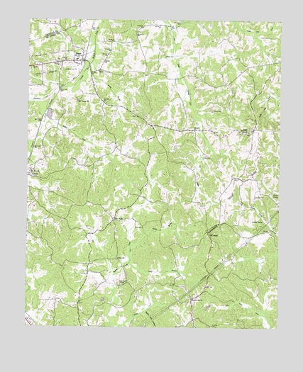
Mount Peter, TN USGS Topographic Map
Click on map above to begin viewing in our Map Viewer.

This topographic map contains these locations and features:
Feature Name Type Latitude Longitude GNIS ID View Map
Adamsville Division (historical)CensusN35.2923°W88.5089°1648843View Map
Alexander CemeteryCemeteryN35.3029°W88.5117°1275550View Map
Beaty CemeteryCemeteryN35.2906°W88.5678°1276701View Map
Beauty HillPopulated PlaceN35.2623°W88.5417°1647075View Map
Beauty Hill CemeteryCemeteryN35.2623°W88.5423°1308762View Map
Beauty Hill ChurchChurchN35.2617°W88.5431°1276704View Map
Billies CreekStreamN35.3356°W88.6159°1277464View Map
Brown BranchStreamN35.2820°W88.5739°1278507View Map
Bushel BranchStreamN35.3565°W88.5956°1279146View Map
City of FingerCivilN35.3569°W88.6174°2403610View Map
Commissioner District 1CivilN35.2965°W88.6016°2464260View Map
Dunn CemeteryCemeteryN35.2667°W88.5359°1283197View Map
FingerPopulated PlaceN35.3584°W88.5989°1284266View Map
Finger CemeteryCemeteryN35.3584°W88.6112°1308661View Map
Finger Division (historical)CensusN35.3206°W88.5834°1648846View Map
Finger Post OfficePost OfficeN35.3585°W88.6046°1649722View Map
Finger School (historical)SchoolN35.3590°W88.6012°1320089View Map
Finger Volunteer Fire DepartmentBuildingN35.3586°W88.6007°2653646View Map
Forty ForksPopulated PlaceN35.2937°W88.5823°1315072View Map
Forty Forks Baptist ChurchChurchN35.2915°W88.5853°1320090View Map
Hendrix CemeteryCemeteryN35.3190°W88.5342°1287400View Map
Hodges SpringSpringN35.3049°W88.5026°1287970View Map
Hogwallow CreekStreamN35.3484°W88.6023°1269648View Map
Jones CemeteryCemeteryN35.3292°W88.5164°1308676View Map
Jones Memorial ChurchChurchN35.3304°W88.5156°1289814View Map
Lanes Chapel CemeteryCemeteryN35.3320°W88.5645°1308678View Map
Lanes Chapel ChurchChurchN35.3317°W88.5642°1308679View Map
Larue BranchStreamN35.2762°W88.5748°1290650View Map
Liberty CemeteryCemeteryN35.2770°W88.5806°1308684View Map
Liberty ChurchChurchN35.2776°W88.5803°1291122View Map
Major Hill HollowValleyN35.2564°W88.5664°1292522View Map
Malone CemeteryCemeteryN35.3601°W88.5581°1292537View Map
McNairy County Fire Department Station 13 Beauty Hill Fire DepartmentBuildingN35.2669°W88.5463°2654003View Map
Mount Carmel CemeteryCemeteryN35.3426°W88.6003°1308707View Map
Mount Carmel ChurchChurchN35.3420°W88.6006°1294576View Map
Mount PeterSummitN35.2879°W88.5342°1294733View Map
Mount Zion CemeteryCemeteryN35.3140°W88.6237°1308714View Map
Mount Zion ChurchChurchN35.3131°W88.6239°1294874View Map
Plunk CemeteryCemeteryN35.3384°W88.5334°1297985View Map
Rose Hill CemeteryCemeteryN35.2673°W88.5789°1308738View Map
Rose Hill ChurchChurchN35.2673°W88.5784°1300079View Map
Sulphur SpringSpringN35.2935°W88.5079°1271789View Map

Note: Coordinates in the location and feature list above are referenced to NAD83 datum.


Copyright (C) 2008-2025 Ryan Niemi / Sunset Dynamics ... All Rights Reserved