TopoQuest Logo
Do you find TopoQuest useful?
Help keep TopoQuest running and adding new maps/features by donating!
Bitcoin:  19c7KJd3qBynnjoSw5npx9KScwjBe4ifkT
Litecoin:  LXs6TkuXGGXo1vDsWCkWVdjQX94eUKd6ui
Home View Maps Find Maps Find Places Resources & Links


Purdy, Tennessee Topographic Map

USGS Map Title: Purdy, TN
USGS Map MRC: 35088B5
DRG (GeoTIFF) Download: o35088b5.tif


Neighboring USGS Topographic Map Quads:


  Masseyville, TN  
35088C6
 

  Mount Peter, TN  
35088C5
 

  Leapwood, TN  
35088C4
 

  Rose Creek, TN  
35088B6
 

  Purdy, TN  
35088B5
 

  Stantonville, TN  
35088B4
 

  Chewalla, TN  
35088A6
 

  Guys, TN  
35088A5
 

  Michie, TN  
35088A4


Map MRC Location:

N36°
W89°
N36°
W88°
H8 H7 H6 H5 H4 H3 H2 H1
G8 G7 G6 G5 G4 G3 G2 G1
F8 F7 F6 F5 F4 F3 F2 F1
E8 E7 E6 E5 E4 E3 E2 E1
D8 D7 D6 D5 D4 D3 D2 D1
C8 C7 C6 C5 C4 C3 C2 C1
B8 B7 B6 B5 B4 B3 B2 B1
A8 A7 A6 A5 A4 A3 A2 A1
N35°
W89°
N35°
W88°

Purdy, TN USGS 1:24K Topographic Map Preview:
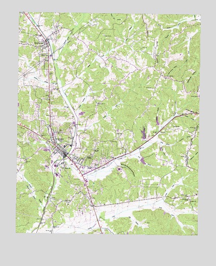
Purdy, TN USGS Topographic Map
Click on map above to begin viewing in our Map Viewer.

This topographic map contains these locations and features:
Feature Name Type Latitude Longitude GNIS ID View Map
Austin HollowValleyN35.1934°W88.5153°1276001View Map
Bethel SpringsPopulated PlaceN35.2337°W88.6064°1305159View Map
Bethel Springs CemeteryCemeteryN35.2331°W88.6067°1308634View Map
Bethel Springs Elementary SchoolSchoolN35.2348°W88.6084°1308635View Map
Bethel Springs Fire DepartmentBuildingN35.2257°W88.6047°2653691View Map
Bethel Springs First Baptist ChurchChurchN35.2326°W88.6050°1320086View Map
Bethel Springs Post OfficePost OfficeN35.2349°W88.6073°1649713View Map
Bethesda CemeteryCemeteryN35.1992°W88.5709°1308636View Map
Bethesda ChurchChurchN35.1990°W88.5698°1277144View Map
Brooks CemeteryCemeteryN35.2081°W88.5328°1278468View Map
Browder Schoolhouse HollowValleyN35.1647°W88.5544°1278503View Map
Bull BranchStreamN35.1348°W88.5573°1278943View Map
Chapel Hill CemeteryCemeteryN35.2373°W88.5662°1280251View Map
Commissioner District 6CivilN35.1415°W88.5379°2464555View Map
Crooked CreekStreamN35.1668°W88.5925°1281664View Map
Emmons HollowValleyN35.1767°W88.5169°1283760View Map
Factory BranchStreamN35.2431°W88.5156°1283956View Map
FalconPopulated PlaceN35.1448°W88.6014°1284049View Map
Falcon CemeteryCemeteryN35.1417°W88.5903°1308659View Map
Falcon ChurchChurchN35.1431°W88.5903°1284050View Map
Frost SpringSpringN35.2151°W88.5226°1284980View Map
Frost Spring HollowValleyN35.2202°W88.5135°1284981View Map
Hartman SpringSpringN35.2258°W88.6048°1287059View Map
Hendrix BranchStreamN35.2095°W88.5953°1287399View Map
Holmes HollowValleyN35.1760°W88.5258°1288133View Map
Joplin HollowValleyN35.1782°W88.5368°1289830View Map
Martin Camp HillSummitN35.1945°W88.5062°1292797View Map
McCullar CemeteryCemeteryN35.1642°W88.5714°1293220View Map
McNairy Central High SchoolSchoolN35.1623°W88.5545°1308696View Map
McNairy CountyCivilN35.1755°W88.5636°1639774View Map
McNairy County FarmLocaleN35.1820°W88.5539°1308697View Map
McNairy County LandfillLocaleN35.2178°W88.5164°2677900View Map
McNairy County Sheriff's DepartmentBuildingN35.1510°W88.5963°2765991View Map
McNairy Cypress Watershed Dam Number SeventeenDamN35.1684°W88.5367°1301637View Map
McNairy Regional EMSBuildingN35.1621°W88.5766°2697428View Map
McNairy Regional HospitalHospitalN35.1623°W88.5743°1308698View Map
Moss HollowValleyN35.1929°W88.5845°1294502View Map
Mount Zion ChurchChurchN35.1720°W88.5720°1294872View Map
North Fork Oxford CreekStreamN35.1420°W88.5331°1295907View Map
Oak Hill CemeteryCemeteryN35.1787°W88.6006°1308722View Map
Prospect CemeteryCemeteryN35.1454°W88.5050°1308733View Map
Prospect ChurchChurchN35.1451°W88.5053°1298577View Map
Prospect ChurchChurchN35.1690°W88.5737°1298578View Map
PurdyPopulated PlaceN35.2267°W88.5306°1298706View Map
Purdy CemeteryCemeteryN35.2312°W88.5403°1298707View Map
Purdy School (historical)SchoolN35.2254°W88.5309°1320099View Map
Robert Sibley AirportAirportN35.2049°W88.5003°1301319View Map
Rock SpringSpringN35.1865°W88.5179°1299782View Map
Sandy CreekStreamN35.2056°W88.5939°1300745View Map
SelmerPopulated PlaceN35.1701°W88.5923°1301051View Map
Selmer ChurchChurchN35.1623°W88.5920°1301052View Map
Selmer Division (historical)CensusN35.1670°W88.6031°1648848View Map
Selmer Elementary SchoolSchoolN35.1648°W88.5942°1308743View Map
Selmer Fire Department HeadquartersBuildingN35.1518°W88.5954°2653797View Map
Selmer Fire Department Substation 2BuildingN35.1763°W88.5989°2654218View Map
Selmer Middle SchoolSchoolN35.1743°W88.5925°1308744View Map
Selmer Police DepartmentBuildingN35.1712°W88.5913°2765965View Map
Selmer Post OfficePost OfficeN35.1696°W88.5936°2766119View Map
Sibley BranchStreamN35.1781°W88.5289°1270246View Map
Simpson BranchStreamN35.1398°W88.6050°1270329View Map
South Fork Oxford CreekStreamN35.1420°W88.5331°1270881View Map
Sulphur BranchStreamN35.1842°W88.5278°1271764View Map
Tacker CreekStreamN35.2492°W88.5806°1272033View Map
Tanyard BranchStreamN35.2470°W88.5042°1272098View Map
Tatum BranchStreamN35.2304°W88.5589°1272173View Map
Town of Bethel SpringsCivilN35.2347°W88.6118°2405254View Map
Town of SelmerCivilN35.1707°W88.5958°2407311View Map
Turkey CreekStreamN35.1826°W88.5839°1272997View Map
Twin Springs DamDamN35.1784°W88.5384°1301641View Map
Twin Springs LakeReservoirN35.1784°W88.5384°1301640View Map
Union Grove CemeteryCemeteryN35.1462°W88.5070°1308754View Map
Union Grove ChurchChurchN35.1459°W88.5067°1273221View Map
Warren CemeteryCemeteryN35.1776°W88.5606°1273823View Map
WDTM-AM (Selmer)TowerN35.1909°W88.5892°1639832View Map
Wolf BranchStreamN35.1704°W88.5445°1274928View Map

Note: Coordinates in the location and feature list above are referenced to NAD83 datum.


Copyright (C) 2008-2024 Ryan Niemi / Sunset Dynamics ... All Rights Reserved