TopoQuest Logo
Do you find TopoQuest useful?
Help keep TopoQuest running and adding new maps/features by donating!
Bitcoin:  19c7KJd3qBynnjoSw5npx9KScwjBe4ifkT
Litecoin:  LXs6TkuXGGXo1vDsWCkWVdjQX94eUKd6ui
Home View Maps Find Maps Find Places Resources & Links


Masseyville, Tennessee Topographic Map

USGS Map Title: Masseyville, TN
USGS Map MRC: 35088C6
DRG (GeoTIFF) Download: o35088c6.tif


Neighboring USGS Topographic Map Quads:


  Medon, TN  
35088D7
 

  Henderson, TN  
35088D6
 

  Jacks Creek, TN  
35088D5
 

  Silerton, TN  
35088C7
 

  Masseyville, TN  
35088C6
 

  Mount Peter, TN  
35088C5
 

  Hornsby, TN  
35088B7
 

  Rose Creek, TN  
35088B6
 

  Purdy, TN  
35088B5


Map MRC Location:

N36°
W89°
N36°
W88°
H8 H7 H6 H5 H4 H3 H2 H1
G8 G7 G6 G5 G4 G3 G2 G1
F8 F7 F6 F5 F4 F3 F2 F1
E8 E7 E6 E5 E4 E3 E2 E1
D8 D7 D6 D5 D4 D3 D2 D1
C8 C7 C6 C5 C4 C3 C2 C1
B8 B7 B6 B5 B4 B3 B2 B1
A8 A7 A6 A5 A4 A3 A2 A1
N35°
W89°
N35°
W88°

Masseyville, TN USGS 1:24K Topographic Map Preview:
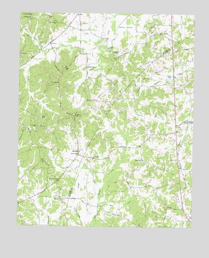
Masseyville, TN USGS Topographic Map
Click on map above to begin viewing in our Map Viewer.

This topographic map contains these locations and features:
Feature Name Type Latitude Longitude GNIS ID View Map
Cason CemeteryCemeteryN35.3515°W88.7050°1279853View Map
Cave Spring ChurchChurchN35.3340°W88.7226°1305741View Map
Cave Springs CemeteryCemeteryN35.3329°W88.7223°1644618View Map
Chester County Fire Department / Masseyville Volunteer Fire Department Station 550BuildingN35.2901°W88.7082°2654149View Map
Commissioner District 3CivilN35.3501°W88.7414°2464129View Map
Crown Point HillSummitN35.3695°W88.7242°1281758View Map
Fyre CemeteryCemeteryN35.3615°W88.7456°1285056View Map
Gail (historical)Populated PlaceN35.3515°W88.7362°1310566View Map
Halloway HillSummitN35.3723°W88.7439°1286605View Map
Haltoms Chapel CemeteryCemeteryN35.3515°W88.7492°1644622View Map
Halton ChapelChurchN35.3512°W88.7495°1286615View Map
Hickory Corner School (historical)SchoolN35.3429°W88.7014°1316678View Map
Hickory CornersPopulated PlaceN35.3434°W88.7026°1287565View Map
Hurst CemeteryCemeteryN35.2881°W88.7320°1288843View Map
Ivys Store (historical)LocaleN35.3501°W88.6773°1316680View Map
Laurel HillSummitN35.3148°W88.7103°1315359View Map
Little Hatchie CemeteryCemeteryN35.2773°W88.7214°1644630View Map
Little Hatchie ChurchChurchN35.2773°W88.7217°1291523View Map
Little Sugar CreekStreamN35.3537°W88.7292°1291680View Map
Logans LakeReservoirN35.3373°W88.6418°1291825View Map
Logans Lake DamDamN35.3381°W88.6423°1307101View Map
MasseyvillePopulated PlaceN35.2937°W88.7064°1292913View Map
Masseyville School (historical)SchoolN35.2926°W88.7070°1316687View Map
McNairyPopulated PlaceN35.3120°W88.6273°1293437View Map
McNairy County Fire Department Station 11 McNairy Fire DepartmentBuildingN35.3122°W88.6301°2653998View Map
McNairy Post OfficePost OfficeN35.3117°W88.6256°1649728View Map
Mitchell ChapelChurchN35.2920°W88.7073°1294102View Map
New Home ChurchChurchN35.3742°W88.7101°1295497View Map
New Salem CemeteryCemeteryN35.2609°W88.6389°1308720View Map
New Salem ChurchChurchN35.2612°W88.6389°1295634View Map
Old Friendship Baptist ChurchChurchN35.3620°W88.6492°1644638View Map
Old Friendship CemeteryCemeteryN35.3623°W88.6487°1644639View Map
Old Friendship SchoolSchoolN35.3631°W88.6492°1296312View Map
Phillip SchoolSchoolN35.3570°W88.7278°1297322View Map
Pine Bluff CemeteryCemeteryN35.3087°W88.7378°1297512View Map
Pleasant Hill ChurchChurchN35.2904°W88.6959°1297862View Map
Refuge CemeteryCemeteryN35.2890°W88.6617°1308735View Map
Refuge ChurchChurchN35.2890°W88.6626°1299194View Map
RobertsonPopulated PlaceN35.2656°W88.7187°1299657View Map
Roger CemeteryCemeteryN35.3387°W88.6928°1299975View Map
Rose HillSummitN35.3431°W88.7176°1300073View Map
Sheffield BranchStreamN35.3165°W88.6253°1269976View Map
Smith CemeteryCemeteryN35.3167°W88.6770°1270596View Map
Smith PondReservoirN35.3140°W88.7338°1270702View Map
Swaim CreekStreamN35.2570°W88.6923°1648514View Map
Thomas BottomBasinN35.3673°W88.6748°1272460View Map
Thomas LakeReservoirN35.3522°W88.6789°1272494View Map
Wamble CemeteryCemeteryN35.3692°W88.7059°1273758View Map
Weaver CemeteryCemeteryN35.3631°W88.7012°1273988View Map

Note: Coordinates in the location and feature list above are referenced to NAD83 datum.


Copyright (C) 2008-2025 Ryan Niemi / Sunset Dynamics ... All Rights Reserved