TopoQuest Logo
Do you find TopoQuest useful?
Help keep TopoQuest running and adding new maps/features by donating!
Bitcoin:  19c7KJd3qBynnjoSw5npx9KScwjBe4ifkT
Litecoin:  LXs6TkuXGGXo1vDsWCkWVdjQX94eUKd6ui
Home View Maps Find Maps Find Places Resources & Links


Mount Roothaan, Idaho Topographic Map

USGS Map Title: Mount Roothaan, ID
USGS Map MRC: 48116E6
DRG (GeoTIFF) Download: o48116e6.tif


Neighboring USGS Topographic Map Quads:


  Priest Lake NE, ID  
48116F7
 

  The Wigwams, ID  
48116F6
 

  Roman Nose, ID  
48116F5
 

  Priest Lake SE, ID  
48116E7
 

  Mount Roothaan, ID  
48116E6
 

  Dodge Peak, ID  
48116E5
 

  Coolin, ID  
48116D7
 

  Mount Casey, ID  
48116D6
 

  Colburn, ID  
48116D5


Map MRC Location:

N49°
W117°
N49°
W116°
H8 H7 H6 H5 H4 H3 H2 H1
G8 G7 G6 G5 G4 G3 G2 G1
F8 F7 F6 F5 F4 F3 F2 F1
E8 E7 E6 E5 E4 E3 E2 E1
D8 D7 D6 D5 D4 D3 D2 D1
C8 C7 C6 C5 C4 C3 C2 C1
B8 B7 B6 B5 B4 B3 B2 B1
A8 A7 A6 A5 A4 A3 A2 A1
N48°
W117°
N48°
W116°

Mount Roothaan, ID USGS 1:24K Topographic Map Preview:
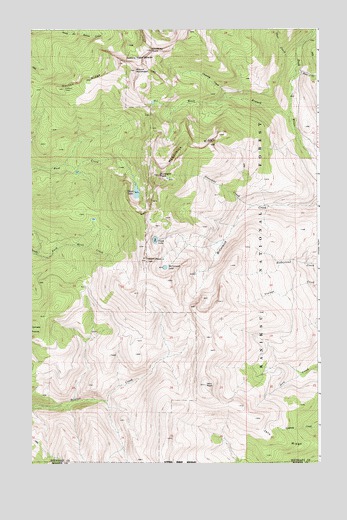
Mount Roothaan, ID USGS Topographic Map
Click on map above to begin viewing in our Map Viewer.

This topographic map contains these locations and features:
Feature Name Type Latitude Longitude GNIS ID View Map
Chimney CreekStreamN48.6058°W116.6647°379281View Map
Chimney Rock Middle CairnSummitN48.6194°W116.6983°394310View Map
Fault LakeLakeN48.5644°W116.6964°381614View Map
Gunsight CreekStreamN48.5685°W116.6619°398491View Map
Horton RidgeRidgeN48.6077°W116.7358°383434View Map
Hunt LakeLakeN48.5781°W116.7043°383559View Map
Hunt PeakSummitN48.5588°W116.6994°397806View Map
Jeru ParkSummitN48.5230°W116.6746°395825View Map
Jeru RidgeRidgeN48.5046°W116.6321°383902View Map
McCormick LakeLakeN48.5565°W116.6922°386584View Map
McCormick RidgeRidgeN48.5910°W116.6794°386585View Map
Mount RoothaanSummitN48.6133°W116.7080°393935View Map
Thor CreekStreamN48.6130°W116.6349°392046View Map
West Branch Pack RiverStreamN48.5994°W116.6369°393017View Map
Zuni CreekStreamN48.6119°W116.6358°393790View Map

Note: Coordinates in the location and feature list above are referenced to NAD83 datum.


Copyright (C) 2008-2024 Ryan Niemi / Sunset Dynamics ... All Rights Reserved