TopoQuest Logo
Do you find TopoQuest useful?
Help keep TopoQuest running and adding new maps/features by donating!
Bitcoin:  19c7KJd3qBynnjoSw5npx9KScwjBe4ifkT
Litecoin:  LXs6TkuXGGXo1vDsWCkWVdjQX94eUKd6ui
Home View Maps Find Maps Find Places Resources & Links


Mount Sterling, Wisconsin Topographic Map

USGS Map Title: Mount Sterling, WI
USGS Map MRC: 43090C8
DRG (GeoTIFF) Download: o43090c8.tif


Neighboring USGS Topographic Map Quads:


  Retreat, WI  
43091D1
 

  Rising Sun, WI  
43090D8
 

  Readstown, WI  
43090D7
 

  Ferryville, WI  
43091C1
 

  Mount Sterling, WI  
43090C8
 

  Gays Mills, WI  
43090C7
 

  Eastman, WI  
43091B1
 

  Crowley Ridge, WI  
43090B8
 

  Steuben, WI  
43090B7


Map MRC Location:

N44°
W91°
N44°
W90°
H8 H7 H6 H5 H4 H3 H2 H1
G8 G7 G6 G5 G4 G3 G2 G1
F8 F7 F6 F5 F4 F3 F2 F1
E8 E7 E6 E5 E4 E3 E2 E1
D8 D7 D6 D5 D4 D3 D2 D1
C8 C7 C6 C5 C4 C3 C2 C1
B8 B7 B6 B5 B4 B3 B2 B1
A8 A7 A6 A5 A4 A3 A2 A1
N43°
W91°
N43°
W90°

Mount Sterling, WI USGS 1:24K Topographic Map Preview:
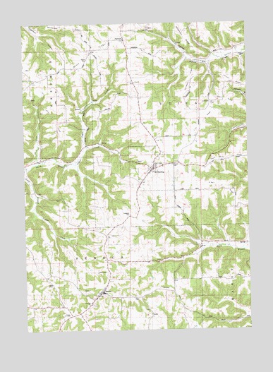
Mount Sterling, WI USGS Topographic Map
Click on map above to begin viewing in our Map Viewer.

This topographic map contains these locations and features:
Feature Name Type Latitude Longitude GNIS ID View Map
2 ReservoirReservoirN43.3616°W90.9068°1793436View Map
Blackhawk-Kickapoo Project G8735.2 DamDamN43.3616°W90.9068°1793435View Map
Boma RidgeRidgeN43.3575°W90.9671°1562047View Map
Boma School (historical)SchoolN43.3572°W90.9712°1846332View Map
Brockway School (historical)SchoolN43.3361°W90.9349°1846336View Map
Eitsert CemeteryCemeteryN43.3602°W90.9640°1564480View Map
Evergreen CemeteryCemeteryN43.2966°W90.9412°1564745View Map
FairviewPopulated PlaceN43.3680°W90.9429°1564811View Map
Fairview QuarryMineN43.3733°W90.9294°2633677View Map
Freeman SchoolSchoolN43.3508°W90.9954°1565297View Map
Gays Mills RidgeRidgeN43.3200°W90.8801°1565450View Map
Gindler School (historical)SchoolN43.3528°W90.8929°1846373View Map
Gunderson RidgeRidgeN43.3478°W90.9068°1565940View Map
Halls Branch School (historical)SchoolN43.2789°W90.9118°1846376View Map
Helgerson RidgeRidgeN43.3703°W90.9101°1566278View Map
Howe RidgeRidgeN43.3428°W90.8876°1566773View Map
Joy HollowValleyN43.3198°W90.9928°1567298View Map
Lilly RidgeRidgeN43.3330°W90.9004°1568042View Map
Lower Copper Creek School (historical)SchoolN43.3191°W90.9912°1846399View Map
Lysne School (historical)SchoolN43.3336°W90.9654°1846404View Map
Mickelson RidgeRidgeN43.3750°W90.9812°1569406View Map
Mount SterlingPopulated PlaceN43.3153°W90.9287°1569847View Map
Mount Sterling Lutheran CemeteryCemeteryN43.3177°W90.9257°1846412View Map
Norwegian School (historical)SchoolN43.2919°W90.9668°1846419View Map
O'Neil RidgeRidgeN43.3066°W90.8868°1570595View Map
O'Neil Ridge School (historical)SchoolN43.3030°W90.8823°1846424View Map
Pioneer CemeteryCemeteryN43.3175°W90.9171°1846428View Map
Saint Patricks CemeteryCemeteryN43.2602°W90.9629°1846449View Map
Saint Patricks ChurchChurchN43.2603°W90.9637°1573411View Map
Schurz School (historical)SchoolN43.2653°W90.9565°1846455View Map
SenecaPopulated PlaceN43.2650°W90.9585°1573899View Map
Seneca Elementary SchoolSchoolN43.2652°W90.9571°2715792View Map
Seneca High SchoolSchoolN43.2652°W90.9571°2715754View Map
Seneca Junior High SchoolSchoolN43.2652°W90.9571°2715764View Map
Seneca Volunteer Fire DepartmentBuildingN43.2653°W90.9592°2698194View Map
Sime RidgeRidgeN43.3353°W90.9796°1574171View Map
Stony Point School (historical)SchoolN43.2883°W90.9543°1846462View Map
Town of SenecaCivilN43.2607°W90.9980°1584121View Map
Town of UticaCivilN43.3648°W90.9007°1584322View Map
Upper Copper CreekStreamN43.3247°W90.9657°1575957View Map
Utica ChurchChurchN43.3505°W90.9382°1576009View Map
Utica Lutheran CemeteryCemeteryN43.3508°W90.9376°1846476View Map
Village of Mount SterlingCivilN43.3162°W90.9292°1583768View Map
West Ridge OrchardLocaleN43.3158°W90.9042°2627664View Map

Note: Coordinates in the location and feature list above are referenced to NAD83 datum.


Copyright (C) 2008-2025 Ryan Niemi / Sunset Dynamics ... All Rights Reserved