TopoQuest Logo
Do you find TopoQuest useful?
Help keep TopoQuest running and adding new maps/features by donating!
Bitcoin:  19c7KJd3qBynnjoSw5npx9KScwjBe4ifkT
Litecoin:  LXs6TkuXGGXo1vDsWCkWVdjQX94eUKd6ui
Home View Maps Find Maps Find Places Resources & Links


Ferryville, Wisconsin Topographic Map

USGS Map Title: Ferryville, WI
USGS Map MRC: 43091C1
DRG (GeoTIFF) Download: o43091c1.tif


Neighboring USGS Topographic Map Quads:


  De Soto, WI  
43091D2
 

  Retreat, WI  
43091D1
 

  Rising Sun, WI  
43090D8
 

  Lansing, IA  
43091C2
 

  Ferryville, WI  
43091C1
 

  Mount Sterling, WI  
43090C8
 

  Harpers Ferry, IA  
43091B2
 

  Eastman, WI  
43091B1
 

  Crowley Ridge, WI  
43090B8


Map MRC Location:

N44°
W92°
N44°
W91°
H8 H7 H6 H5 H4 H3 H2 H1
G8 G7 G6 G5 G4 G3 G2 G1
F8 F7 F6 F5 F4 F3 F2 F1
E8 E7 E6 E5 E4 E3 E2 E1
D8 D7 D6 D5 D4 D3 D2 D1
C8 C7 C6 C5 C4 C3 C2 C1
B8 B7 B6 B5 B4 B3 B2 B1
A8 A7 A6 A5 A4 A3 A2 A1
N43°
W92°
N43°
W91°

Ferryville, WI USGS 1:24K Topographic Map Preview:
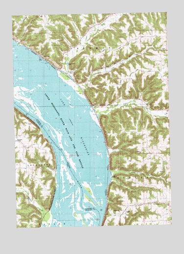
Ferryville, WI USGS Topographic Map
Click on map above to begin viewing in our Map Viewer.

This topographic map contains these locations and features:
Feature Name Type Latitude Longitude GNIS ID View Map
Buck CreekStreamN43.3300°W91.0757°1562322View Map
Buck Creek School (historical)SchoolN43.3500°W91.0260°1846337View Map
Capoli SloughGutN43.3244°W91.1185°1562711View Map
Cold Spring HollowValleyN43.2773°W91.0478°1563239View Map
Cold Spring LandingLocaleN43.2783°W91.0482°1846346View Map
Columbus LakeLakeN43.3273°W91.1070°1563285View Map
Copper CreekStreamN43.3152°W91.0607°1563386View Map
Crooked SloughGutN43.2652°W91.0717°2746962View Map
Dickson CemeteryCemeteryN43.2577°W91.0368°1568850View Map
FerryvillePopulated PlaceN43.3505°W91.1021°1564924View Map
Ferryville CemeteryCemeteryN43.3414°W91.0779°1846363View Map
Ferryville Post OfficePost OfficeN43.3485°W91.0983°2768314View Map
Ferryville Volunteer Fire DepartmentBuildingN43.3424°W91.0863°2698175View Map
Heytmans StationLocaleN43.3014°W91.1235°1825206View Map
Hobbs HollowValleyN43.2938°W91.0496°1566497View Map
Island Number One Hundred Fifty-One (historical)IslandN43.2933°W91.0715°1846421View Map
Island Number One Hundred Fifty-SixIslandN43.2636°W91.0571°1846420View Map
Kettle HollowValleyN43.2806°W91.0471°1567437View Map
Lake WinneshiekLakeN43.3273°W91.1070°1576884View Map
Lost ChannelChannelN43.2669°W91.0582°1846398View Map
Mount Hope RidgeRidgeN43.2622°W91.0229°1569816View Map
Mount Hope School (historical)SchoolN43.2628°W91.0168°1846411View Map
North Branch Copper CreekStreamN43.3141°W91.0040°1570368View Map
Oak Grove SchoolSchoolN43.2872°W91.0062°1570624View Map
Oak Grove School (historical)SchoolN43.2878°W91.0060°1846422View Map
Oak RidgeRidgeN43.2869°W91.0285°1570676View Map
Pool 9 IslandIslandN43.3024°W91.0894°2778771View Map
South Branch Copper CreekStreamN43.3141°W91.0037°1574401View Map
Sugar CreekStreamN43.3358°W91.0854°1575020View Map
Sugar Creek Bluff State Natural AreaParkN43.3464°W91.0782°2059859View Map
Town of FreemanCivilN43.3745°W91.0776°1583244View Map
Turkey Bluff AirportAirportN43.3721°W91.1163°1581974View Map
Village of FerryvilleCivilN43.3516°W91.0936°1583201View Map
Wexford CreekStreamN43.2505°W91.0979°462958View Map

Note: Coordinates in the location and feature list above are referenced to NAD83 datum.


Copyright (C) 2008-2025 Ryan Niemi / Sunset Dynamics ... All Rights Reserved