TopoQuest Logo
Do you find TopoQuest useful?
Help keep TopoQuest running and adding new maps/features by donating!
Bitcoin:  19c7KJd3qBynnjoSw5npx9KScwjBe4ifkT
Litecoin:  LXs6TkuXGGXo1vDsWCkWVdjQX94eUKd6ui
Home View Maps Find Maps Find Places Resources & Links


Mount Zion, Wisconsin Topographic Map

USGS Map Title: Mount Zion, WI
USGS Map MRC: 43090C6
DRG (GeoTIFF) Download: o43090c6.tif


Neighboring USGS Topographic Map Quads:


  Readstown, WI  
43090D7
 

  Sugar Grove, WI  
43090D6
 

  Sabin, WI  
43090D5
 

  Gays Mills, WI  
43090C7
 

  Mount Zion, WI  
43090C6
 

  Boaz, WI  
43090C5
 

  Steuben, WI  
43090B7
 

  Boscobel, WI  
43090B6
 

  Blue River, WI  
43090B5


Map MRC Location:

N44°
W91°
N44°
W90°
H8 H7 H6 H5 H4 H3 H2 H1
G8 G7 G6 G5 G4 G3 G2 G1
F8 F7 F6 F5 F4 F3 F2 F1
E8 E7 E6 E5 E4 E3 E2 E1
D8 D7 D6 D5 D4 D3 D2 D1
C8 C7 C6 C5 C4 C3 C2 C1
B8 B7 B6 B5 B4 B3 B2 B1
A8 A7 A6 A5 A4 A3 A2 A1
N43°
W91°
N43°
W90°

Mount Zion, WI USGS 1:24K Topographic Map Preview:
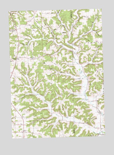
Mount Zion, WI USGS Topographic Map
Click on map above to begin viewing in our Map Viewer.

This topographic map contains these locations and features:
Feature Name Type Latitude Longitude GNIS ID View Map
Beebe HollowValleyN43.2870°W90.6375°1561492View Map
Brady Stock FarmLocaleN43.3247°W90.6598°1957359View Map
Dry HollowValleyN43.2684°W90.6876°1564119View Map
Ellsworth Home Stock FarmLocaleN43.2847°W90.6596°1957930View Map
English RunStreamN43.3383°W90.6765°1564667View Map
ExcelsiorPopulated PlaceN43.2516°W90.6282°1564780View Map
Excelsior SchoolSchoolN43.2572°W90.6296°1564781View Map
Ferguson School (historical)SchoolN43.3683°W90.6454°1840585View Map
Fresh RidgeRidgeN43.2869°W90.7248°1565319View Map
Griffin HollowValleyN43.3735°W90.7464°1565901View Map
Grove Spring FarmLocaleN43.3380°W90.6568°1957371View Map
Heart Grove FarmLocaleN43.3519°W90.6349°1957373View Map
Hill FarmLocaleN43.2789°W90.6410°1957374View Map
Hillcrest OrchardLocaleN43.3258°W90.7456°2612097View Map
Horrigan RidgeRidgeN43.3022°W90.6868°1566706View Map
JimtownPopulated PlaceN43.3533°W90.6385°1577664View Map
Jimtown BranchStreamN43.3391°W90.6626°1567183View Map
Johnson HollowValleyN43.3134°W90.6868°1567228View Map
Leeward Farm AirportAirportN43.3528°W90.6810°1582211View Map
Lightfoot HollowValleyN43.2721°W90.6942°1568026View Map
Lightfoot RidgeRidgeN43.2719°W90.7129°1568027View Map
Long HollowValleyN43.3234°W90.6416°1568527View Map
Lower West Fork School (historical)SchoolN43.2669°W90.6812°1846401View Map
McCumber HollowValleyN43.3471°W90.7181°1569191View Map
McDilley RidgeRidgeN43.2769°W90.6821°1569200View Map
Monk School (historical)SchoolN43.3314°W90.7401°1846409View Map
MontgomeryvillePopulated PlaceN43.3564°W90.7399°1577732View Map
Montgomeryville CemeteryCemeteryN43.3572°W90.7454°1846410View Map
Mook CemeteryCemeteryN43.3275°W90.7396°1569687View Map
Mount ZionPopulated PlaceN43.2566°W90.7337°1569861View Map
Mount Zion SchoolSchoolN43.2639°W90.7360°1569869View Map
Murphy School (historical)SchoolN43.3464°W90.6907°1846413View Map
O'Connor BranchStreamN43.2708°W90.6279°1577314View Map
Orchard View SchoolSchoolN43.3253°W90.7490°1570852View Map
Pigeon RunStreamN43.3453°W90.6904°1571375View Map
Pleasant Ridge FarmLocaleN43.3444°W90.6290°1957399View Map
Plum RunStreamN43.3514°W90.6682°1571700View Map
Plum Run School (historical)SchoolN43.3714°W90.6851°1846432View Map
Ridge View FarmLocaleN43.3100°W90.6332°1958679View Map
Rolling GroundPopulated PlaceN43.3294°W90.7404°1572549View Map
Running Brook Stock FarmLocaleN43.2650°W90.6260°1957935View Map
Saint Philips ChurchChurchN43.3289°W90.7193°1573549View Map
Saint Philips RidgeRidgeN43.3208°W90.6904°1573550View Map
Saint Phillips CemeteryCemeteryN43.3280°W90.7196°1846452View Map
Seward School (historical)SchoolN43.3614°W90.7349°1846456View Map
Sleepy HollowValleyN43.3012°W90.7229°1574268View Map
TaveraPopulated PlaceN43.2841°W90.6457°1577851View Map
Tavera CemeteryCemeteryN43.2847°W90.6351°1575263View Map
Tiller School (historical)SchoolN43.3061°W90.6457°1840607View Map
Town of ClaytonCivilN43.3567°W90.7453°1582966View Map
Trout Brook Stock FarmLocaleN43.2878°W90.6410°1957936View Map
Turnmire Spring FarmLocaleN43.3200°W90.6476°1957616View Map
Union Hill CemeteryCemeteryN43.2558°W90.7312°1846472View Map
Upper Knapp Creek School (historical)SchoolN43.3355°W90.6568°1840610View Map
Upper West Fork School (historical)SchoolN43.3005°W90.7198°1846475View Map
Welsh HollowValleyN43.3078°W90.6554°1576423View Map
West Fork CemeteryCemeteryN43.2630°W90.6501°1576502View Map
West Fork Knapp CreekStreamN43.2558°W90.6404°1576505View Map
Wheatville School (historical)SchoolN43.2700°W90.7371°1846485View Map
Whitaker HollowValleyN43.2936°W90.7199°1576618View Map
Wolf RunStreamN43.3475°W90.7032°1576948View Map

Note: Coordinates in the location and feature list above are referenced to NAD83 datum.


Copyright (C) 2008-2025 Ryan Niemi / Sunset Dynamics ... All Rights Reserved