TopoQuest Logo
Do you find TopoQuest useful?
Help keep TopoQuest running and adding new maps/features by donating!
Bitcoin:  19c7KJd3qBynnjoSw5npx9KScwjBe4ifkT
Litecoin:  LXs6TkuXGGXo1vDsWCkWVdjQX94eUKd6ui
Home View Maps Find Maps Find Places Resources & Links


Muldon, Mississippi Topographic Map

USGS Map Title: Muldon, MS
USGS Map MRC: 33088F6
DRG (GeoTIFF) Download: o33088f6.tif


Neighboring USGS Topographic Map Quads:


  Trebloc, MS  
33088G7
 

  Prairie, MS  
33088G6
 

  Aberdeen, MS  
33088G5
 

  Palo Alto, MS  
33088F7
 

  Muldon, MS  
33088F6
 

  Strong, MS  
33088F5
 

  Cedar Bluff, MS  
33088E7
 

  West Point, MS  
33088E6
 

  Waverly, MS  
33088E5


Map MRC Location:

N34°
W89°
N34°
W88°
H8 H7 H6 H5 H4 H3 H2 H1
G8 G7 G6 G5 G4 G3 G2 G1
F8 F7 F6 F5 F4 F3 F2 F1
E8 E7 E6 E5 E4 E3 E2 E1
D8 D7 D6 D5 D4 D3 D2 D1
C8 C7 C6 C5 C4 C3 C2 C1
B8 B7 B6 B5 B4 B3 B2 B1
A8 A7 A6 A5 A4 A3 A2 A1
N33°
W89°
N33°
W88°

Muldon, MS USGS 1:24K Topographic Map Preview:
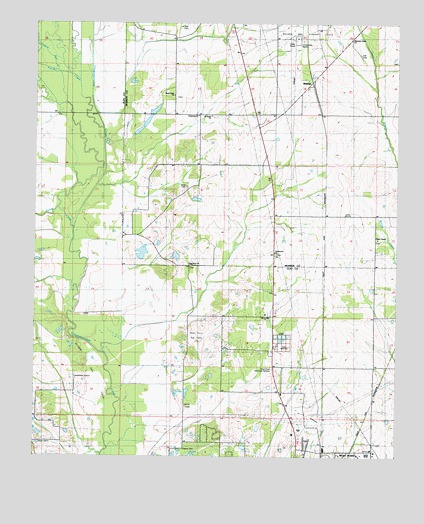
Muldon, MS USGS Topographic Map
Click on map above to begin viewing in our Map Viewer.

This topographic map contains these locations and features:
Feature Name Type Latitude Longitude GNIS ID View Map
Ben Lilly Pond DamDamN33.7185°W88.7150°682309View Map
Ben Lilly Pond DamDamN33.7201°W88.7117°682310View Map
Church of ChristChurchN33.6451°W88.6667°684745View Map
Crossroad Christian Methodist Episcopal ChurchChurchN33.7237°W88.6931°690955View Map
Death CreekStreamN33.6915°W88.7367°669183View Map
Evans Memorial LibraryBuildingN33.7340°W88.6545°687391View Map
First Assembly of God ChurchChurchN33.6254°W88.6598°684756View Map
Greenwood ChurchChurchN33.6840°W88.6664°670723View Map
Houlka CreekStreamN33.7198°W88.7270°693542View Map
Johnson Bell CreekStreamN33.7365°W88.7426°671914View Map
Kingdom Hall of Jehovahs WitnessesChurchN33.6254°W88.6584°684770View Map
Le Noir CemeteryCemeteryN33.7490°W88.6981°690772View Map
Lee ChurchChurchN33.6398°W88.6978°672380View Map
Mennonite ChurchChurchN33.6662°W88.6703°684777View Map
Mount Union Baptist Church of MuldonChurchN33.7496°W88.6364°674417View Map
Mountain Union CemeteryCemeteryN33.7390°W88.6250°674416View Map
MuldonPopulated PlaceN33.7323°W88.6539°674461View Map
Muldon Gas Storage FieldOilfieldN33.7459°W88.6570°690777View Map
New Hope Missionary Baptist ChurchChurchN33.6807°W88.6800°690779View Map
New Hope SchoolSchoolN33.6810°W88.6973°674753View Map
NorthgatePopulated PlaceN33.6293°W88.6556°684781View Map
Oakridge EstatesPopulated PlaceN33.6321°W88.6889°684784View Map
Old Aberdeen Road Church of ChristChurchN33.6268°W88.6323°684785View Map
Paines Chapel Missionary Baptist ChurchChurchN33.6879°W88.6317°690780View Map
Payne Chapel CemeteryCemeteryN33.6877°W88.6317°675386View Map
Pine AcresPopulated PlaceN33.6254°W88.6820°684789View Map
Rodgers (historical)Populated PlaceN33.7434°W88.6439°709378View Map
Rosenward SchoolSchoolN33.7223°W88.6942°676882View Map
Saint Mark Church of God in ChristChurchN33.7235°W88.6895°677135View Map
Siloam CemeteryCemeteryN33.6296°W88.7492°677781View Map
Siloam Gas FieldOilfieldN33.6501°W88.7306°684800View Map
Sunflower SchoolSchoolN33.6654°W88.6664°678418View Map
Sykes ChurchChurchN33.7023°W88.6981°678514View Map
Third Union CemeteryCemeteryN33.7290°W88.7017°709398View Map
Third Union Missionary Baptist ChurchChurchN33.7298°W88.7025°678677View Map
West Point Gas FieldOilfieldN33.6598°W88.6945°684820View Map
West Point Memorial GardensCemeteryN33.6503°W88.6658°684822View Map
West Point Seventh Day Adventist ChurchChurchN33.6307°W88.6581°684823View Map

Note: Coordinates in the location and feature list above are referenced to NAD83 datum.


Copyright (C) 2008-2025 Ryan Niemi / Sunset Dynamics ... All Rights Reserved