TopoQuest Logo
Do you find TopoQuest useful?
Help keep TopoQuest running and adding new maps/features by donating!
Bitcoin:  19c7KJd3qBynnjoSw5npx9KScwjBe4ifkT
Litecoin:  LXs6TkuXGGXo1vDsWCkWVdjQX94eUKd6ui
Home View Maps Find Maps Find Places Resources & Links


Prairie, Mississippi Topographic Map

USGS Map Title: Prairie, MS
USGS Map MRC: 33088G6
DRG (GeoTIFF) Download: o33088g6.tif


Neighboring USGS Topographic Map Quads:


  Buena Vista, MS  
33088H7
 

  Egypt, MS  
33088H6
 

  Wren, MS  
33088H5
 

  Trebloc, MS  
33088G7
 

  Prairie, MS  
33088G6
 

  Aberdeen, MS  
33088G5
 

  Palo Alto, MS  
33088F7
 

  Muldon, MS  
33088F6
 

  Strong, MS  
33088F5


Map MRC Location:

N34°
W89°
N34°
W88°
H8 H7 H6 H5 H4 H3 H2 H1
G8 G7 G6 G5 G4 G3 G2 G1
F8 F7 F6 F5 F4 F3 F2 F1
E8 E7 E6 E5 E4 E3 E2 E1
D8 D7 D6 D5 D4 D3 D2 D1
C8 C7 C6 C5 C4 C3 C2 C1
B8 B7 B6 B5 B4 B3 B2 B1
A8 A7 A6 A5 A4 A3 A2 A1
N33°
W89°
N33°
W88°

Prairie, MS USGS 1:24K Topographic Map Preview:
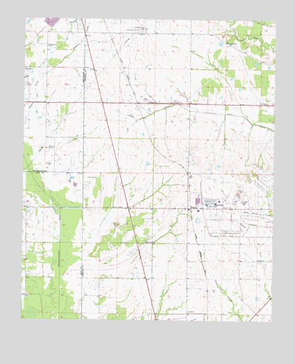
Prairie, MS USGS Topographic Map
Click on map above to begin viewing in our Map Viewer.

This topographic map contains these locations and features:
Feature Name Type Latitude Longitude GNIS ID View Map
Aberdeen-Prairie SchoolSchoolN33.7990°W88.6539°666130View Map
Ball AirportAirportN33.8730°W88.7236°680411View Map
Baptist Grove Missionary Baptist ChurchChurchN33.7823°W88.6887°666511View Map
Cedar Creek Volunteer Fire DepartmentBuildingN33.8748°W88.6359°2665697View Map
Cedar Grove Baptist ChurchChurchN33.8643°W88.6473°668202View Map
Chuquatonchee Structure 19 DamDamN33.8734°W88.7334°682381View Map
Coleman CemeteryCemeteryN33.8090°W88.7134°668675View Map
Ebenezer ChurchChurchN33.8409°W88.6753°669654View Map
Friendship ChurchChurchN33.8634°W88.7387°670237View Map
GibsonPopulated PlaceN33.8401°W88.6845°670375View Map
Gulf Ordnance Plant (historical)MilitaryN33.7972°W88.6431°2088763View Map
Ingehosia Farms Lake DamDamN33.8084°W88.7301°682349View Map
Mount Nebo Community CenterBuildingN33.7748°W88.6417°687439View Map
Mount Nebo Missionary Baptist ChurchChurchN33.7754°W88.6325°674096View Map
Mount Union Missionary Baptist ChurchChurchN33.7509°W88.6353°687440View Map
Mount Zion Christian ChurchChurchN33.8404°W88.6287°674391View Map
New Hope ChurchChurchN33.8215°W88.7353°674725View Map
Patterson CemeteryCemeteryN33.8151°W88.7364°675497View Map
PrairiePopulated PlaceN33.7968°W88.6675°676296View Map
Prairie Baptist ChurchChurchN33.7965°W88.6714°709376View Map
Prairie Methodist ChurchChurchN33.7965°W88.6689°687453View Map
Prairie Post OfficePost OfficeN33.7971°W88.6665°2768765View Map
Prairie SchoolSchoolN33.7957°W88.6625°709377View Map
Prairie Volunteer Fire DepartmentBuildingN33.7972°W88.6364°2666065View Map
Reedy CemeteryCemeteryN33.8162°W88.6642°687454View Map
Terrells (historical)Populated PlaceN33.7593°W88.6259°709396View Map
Zion Ridge Baptist ChurchChurchN33.8540°W88.7492°680042View Map

Note: Coordinates in the location and feature list above are referenced to NAD83 datum.


Copyright (C) 2008-2025 Ryan Niemi / Sunset Dynamics ... All Rights Reserved