TopoQuest Logo
Do you find TopoQuest useful?
Help keep TopoQuest running and adding new maps/features by donating!
Bitcoin:  19c7KJd3qBynnjoSw5npx9KScwjBe4ifkT
Litecoin:  LXs6TkuXGGXo1vDsWCkWVdjQX94eUKd6ui
Home View Maps Find Maps Find Places Resources & Links


Belfast, Arkansas Topographic Map

USGS Map Title: Belfast, AR
USGS Map MRC: 34092D4
DRG (GeoTIFF) Download: o34092d4.tif


Neighboring USGS Topographic Map Quads:


  Benton, AR  
34092E5
 

  Bryant, AR  
34092E4
 

  Spring Lake, AR  
34092E3
 

  Tull, AR  
34092D5
 

  Belfast, AR  
34092D4
 

  Cane Creek, AR  
34092D3
 

  Prattsville, AR  
34092C5
 

  Sheridan, AR  
34092C4
 

  Prague, AR  
34092C3


Map MRC Location:

N35°
W93°
N35°
W92°
H8 H7 H6 H5 H4 H3 H2 H1
G8 G7 G6 G5 G4 G3 G2 G1
F8 F7 F6 F5 F4 F3 F2 F1
E8 E7 E6 E5 E4 E3 E2 E1
D8 D7 D6 D5 D4 D3 D2 D1
C8 C7 C6 C5 C4 C3 C2 C1
B8 B7 B6 B5 B4 B3 B2 B1
A8 A7 A6 A5 A4 A3 A2 A1
N34°
W93°
N34°
W92°

Belfast, AR USGS 1:24K Topographic Map Preview:
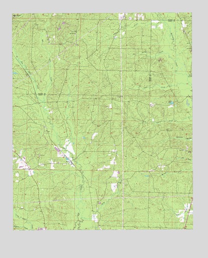
Belfast, AR USGS Topographic Map
Click on map above to begin viewing in our Map Viewer.

This topographic map contains these locations and features:
Feature Name Type Latitude Longitude GNIS ID View Map
Beard BranchStreamN34.4634°W92.3779°46245View Map
BelfastPopulated PlaceN34.4145°W92.4590°56925View Map
Boxley CreekStreamN34.4718°W92.3865°76405View Map
Caple CreekStreamN34.4595°W92.3779°47459View Map
Corinth CemeteryCemeteryN34.4015°W92.4213°48042View Map
Corinth ChurchChurchN34.4020°W92.4243°48050View Map
Crossroads CemeteryCemeteryN34.4518°W92.4265°48215View Map
Dry CreekStreamN34.4931°W92.3940°48640View Map
Dry Lost CreekStreamN34.4493°W92.4779°48668View Map
Fiser LakeReservoirN34.4215°W92.4693°81002View Map
Fiser Lake DamDamN34.4201°W92.4668°81001View Map
Jones CemeteryCemeteryN34.4181°W92.4810°50725View Map
Lake KayReservoirN34.4480°W92.3895°80240View Map
Lake Kay DamDamN34.4484°W92.3885°80239View Map
Mars Hill ChurchChurchN34.4884°W92.4554°51687View Map
Palestine ChurchChurchN34.4104°W92.4890°53136View Map
Palestine Community Volunteer Fire DepartmentBuildingN34.4140°W92.4592°2116925View Map
Skullbone CreekStreamN34.3751°W92.4888°54894View Map
Southwest Hospital HeliportAirportN34.4901°W92.4043°83752View Map
Township of FranklinCivilN34.4217°W92.4088°66608View Map
Township of SmithCivilN34.4905°W92.4548°69053View Map
Wet Lost CreekStreamN34.4493°W92.4779°56212View Map

Note: Coordinates in the location and feature list above are referenced to NAD83 datum.


Copyright (C) 2008-2024 Ryan Niemi / Sunset Dynamics ... All Rights Reserved