TopoQuest Logo
Do you find TopoQuest useful?
Help keep TopoQuest running and adding new maps/features by donating!
Bitcoin:  19c7KJd3qBynnjoSw5npx9KScwjBe4ifkT
Litecoin:  LXs6TkuXGGXo1vDsWCkWVdjQX94eUKd6ui
Home View Maps Find Maps Find Places Resources & Links


Sheridan, Arkansas Topographic Map

USGS Map Title: Sheridan, AR
USGS Map MRC: 34092C4
DRG (GeoTIFF) Download: o34092c4.tif


Neighboring USGS Topographic Map Quads:


  Tull, AR  
34092D5
 

  Belfast, AR  
34092D4
 

  Cane Creek, AR  
34092D3
 

  Prattsville, AR  
34092C5
 

  Sheridan, AR  
34092C4
 

  Prague, AR  
34092C3
 

  Leola, AR  
34092B5
 

  Millerville, AR  
34092B4
 

  Grapevine, AR  
34092B3


Map MRC Location:

N35°
W93°
N35°
W92°
H8 H7 H6 H5 H4 H3 H2 H1
G8 G7 G6 G5 G4 G3 G2 G1
F8 F7 F6 F5 F4 F3 F2 F1
E8 E7 E6 E5 E4 E3 E2 E1
D8 D7 D6 D5 D4 D3 D2 D1
C8 C7 C6 C5 C4 C3 C2 C1
B8 B7 B6 B5 B4 B3 B2 B1
A8 A7 A6 A5 A4 A3 A2 A1
N34°
W93°
N34°
W92°

Sheridan, AR USGS 1:24K Topographic Map Preview:
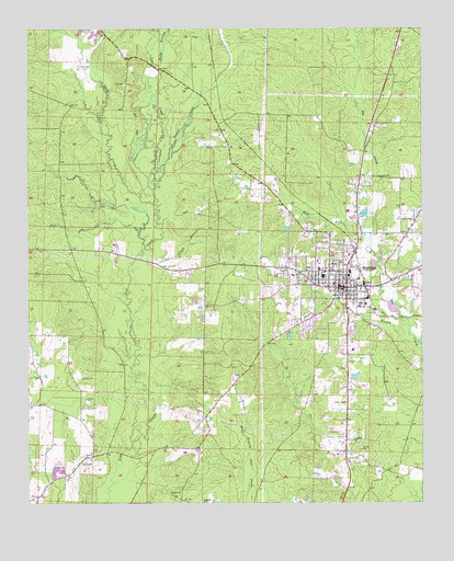
Sheridan, AR USGS Topographic Map
Click on map above to begin viewing in our Map Viewer.

This topographic map contains these locations and features:
Feature Name Type Latitude Longitude GNIS ID View Map
Calvary ChurchChurchN34.2665°W92.3968°47299View Map
Cherry Grove (historical)Populated PlaceN34.2520°W92.4127°60621View Map
City of SheridanCivilN34.2581°W92.4225°2405459View Map
Ephesus ChurchChurchN34.2501°W92.4449°48908View Map
Grant CountyCivilN34.2900°W92.4236°66856View Map
Grant County Sheriff's OfficeBuildingN34.3054°W92.4006°2118780View Map
Graves CreekStreamN34.3357°W92.4593°49600View Map
Kelly BranchStreamN34.3657°W92.4590°50796View Map
KGHT-AM (Sheridan)TowerN34.3059°W92.3852°85143View Map
KGHT-AM (Sheridan)TowerN34.2907°W92.3974°85145View Map
Lake BrownReservoirN34.2833°W92.3964°80247View Map
Lake Brown DamDamN34.2834°W92.3952°80246View Map
Little Creek ChurchChurchN34.3245°W92.3771°51248View Map
Little Lost CreekStreamN34.3293°W92.4607°51295View Map
Lost Creek CemeteryCemeteryN34.3098°W92.4199°51469View Map
Metropolitan Emergency Medical Service SheridanBuildingN34.3213°W92.3939°2119060View Map
Poe CemeteryCemeteryN34.3606°W92.4693°53636View Map
SheridanPopulated PlaceN34.3070°W92.4013°54764View Map
Sheridan Elementary SchoolSchoolN34.3140°W92.4124°60641View Map
Sheridan High SchoolSchoolN34.3117°W92.4077°60642View Map
Sheridan Intermediate SchoolSchoolN34.3141°W92.4109°2039297View Map
Sheridan Junior High SchoolSchoolN34.3109°W92.3982°60643View Map
Sheridan Police DepartmentBuildingN34.3042°W92.3898°2118786View Map
Sheridan Volunteer Fire StationBuildingN34.3044°W92.4032°2117117View Map
Simon BranchStreamN34.3145°W92.4660°54862View Map
SlabtownPopulated PlaceN34.2668°W92.3993°60644View Map
Town BranchStreamN34.2907°W92.3765°55613View Map
Township of Merry GreenCivilN34.3224°W92.4022°66610View Map
Turin (historical)Populated PlaceN34.2798°W92.4904°60646View Map
West Fork Big CreekStreamN34.3195°W92.3918°56178View Map
Whitworth LakeReservoirN34.3184°W92.3935°80242View Map
Whitworth Lake DamDamN34.3184°W92.3935°80241View Map

Note: Coordinates in the location and feature list above are referenced to NAD83 datum.


Copyright (C) 2008-2024 Ryan Niemi / Sunset Dynamics ... All Rights Reserved