TopoQuest Logo
Do you find TopoQuest useful?
Help keep TopoQuest running and adding new maps/features by donating!
Bitcoin:  19c7KJd3qBynnjoSw5npx9KScwjBe4ifkT
Litecoin:  LXs6TkuXGGXo1vDsWCkWVdjQX94eUKd6ui
Home View Maps Find Maps Find Places Resources & Links


Cane Creek, Arkansas Topographic Map

USGS Map Title: Cane Creek, AR
USGS Map MRC: 34092D3
DRG (GeoTIFF) Download: o34092d3.tif


Neighboring USGS Topographic Map Quads:


  Bryant, AR  
34092E4
 

  Spring Lake, AR  
34092E3
 

  Woodson, AR  
34092E2
 

  Belfast, AR  
34092D4
 

  Cane Creek, AR  
34092D3
 

  Redfield, AR  
34092D2
 

  Sheridan, AR  
34092C4
 

  Prague, AR  
34092C3
 

  Hardin, AR  
34092C2


Map MRC Location:

N35°
W93°
N35°
W92°
H8 H7 H6 H5 H4 H3 H2 H1
G8 G7 G6 G5 G4 G3 G2 G1
F8 F7 F6 F5 F4 F3 F2 F1
E8 E7 E6 E5 E4 E3 E2 E1
D8 D7 D6 D5 D4 D3 D2 D1
C8 C7 C6 C5 C4 C3 C2 C1
B8 B7 B6 B5 B4 B3 B2 B1
A8 A7 A6 A5 A4 A3 A2 A1
N34°
W93°
N34°
W92°

Cane Creek, AR USGS 1:24K Topographic Map Preview:
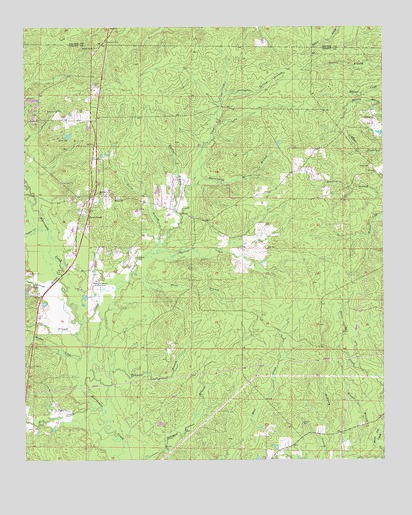
Cane Creek, AR USGS Topographic Map
Click on map above to begin viewing in our Map Viewer.

This topographic map contains these locations and features:
Feature Name Type Latitude Longitude GNIS ID View Map
Bethel ChurchChurchN34.4509°W92.3429°46446View Map
Cane CreekStreamN34.4143°W92.3549°47375View Map
Cane CreekPopulated PlaceN34.4432°W92.3538°57500View Map
Cane Creek Volunteer Fire DepartmentBuildingN34.4446°W92.3565°2116230View Map
Forest Tower ChurchChurchN34.4943°W92.3490°49172View Map
George CreekStreamN34.4351°W92.3285°49370View Map
Gum Springs CemeteryCemeteryN34.4762°W92.3674°49733View Map
Harrington Spring BranchStreamN34.4545°W92.3152°49888View Map
Ico (historical)Populated PlaceN34.4576°W92.3515°60629View Map
Irrington Spring BranchStreamN34.4812°W92.3054°50525View Map
Jackson CemeteryCemeteryN34.3859°W92.2788°50556View Map
Kelt CreekStreamN34.3907°W92.3515°50802View Map
KXIX-FM (Sheridan)TowerN34.4190°W92.3715°85425View Map
Logan CreekStreamN34.4420°W92.3696°51388View Map
Marlow ChurchChurchN34.4515°W92.3482°51681View Map
Marlow CreekStreamN34.4051°W92.3527°51682View Map
Obin (historical)Populated PlaceN34.4095°W92.3082°60635View Map
OrionPopulated PlaceN34.4743°W92.2532°58310View Map
Orion CemeteryCemeteryN34.4598°W92.2540°53070View Map
Poly BranchStreamN34.4115°W92.3565°53670View Map
Price BranchStreamN34.4295°W92.3371°53787View Map
Railroad BranchStreamN34.4287°W92.3621°53877View Map
Rosin BranchStreamN34.4359°W92.3304°54217View Map
South Marlow CemeteryCemeteryN34.4023°W92.3735°55034View Map
Township of SimpsonCivilN34.4344°W92.2934°66612View Map
Twomile BranchStreamN34.3990°W92.3513°55766View Map
Watson BranchStreamN34.4468°W92.3199°56107View Map

Note: Coordinates in the location and feature list above are referenced to NAD83 datum.


Copyright (C) 2008-2025 Ryan Niemi / Sunset Dynamics ... All Rights Reserved