TopoQuest Logo
Do you find TopoQuest useful?
Help keep TopoQuest running and adding new maps/features by donating!
Bitcoin:  19c7KJd3qBynnjoSw5npx9KScwjBe4ifkT
Litecoin:  LXs6TkuXGGXo1vDsWCkWVdjQX94eUKd6ui
Home View Maps Find Maps Find Places Resources & Links


Belgian Hill, Montana Topographic Map

USGS Map Title: Belgian Hill, MT
USGS Map MRC: 48112C1
DRG (GeoTIFF) Download: o48112c1.tif


Neighboring USGS Topographic Map Quads:


  Abbott Lake, MT  
48112D2
 

  Cactus Flat, MT  
48112D1
 

  Ledger NW, MT  
48111D8
 

  Valier East, MT  
48112C2
 

  Belgian Hill, MT  
48112C1
 

  Pioneer School, MT  
48111C8
 

  Lone Man Coulee East, MT  
48112B2
 

  Sam George Hill, MT  
48112B1
 

  Conrad, MT  
48111B8


Map MRC Location:

N49°
W113°
N49°
W112°
H8 H7 H6 H5 H4 H3 H2 H1
G8 G7 G6 G5 G4 G3 G2 G1
F8 F7 F6 F5 F4 F3 F2 F1
E8 E7 E6 E5 E4 E3 E2 E1
D8 D7 D6 D5 D4 D3 D2 D1
C8 C7 C6 C5 C4 C3 C2 C1
B8 B7 B6 B5 B4 B3 B2 B1
A8 A7 A6 A5 A4 A3 A2 A1
N48°
W113°
N48°
W112°

Belgian Hill, MT USGS 1:24K Topographic Map Preview:
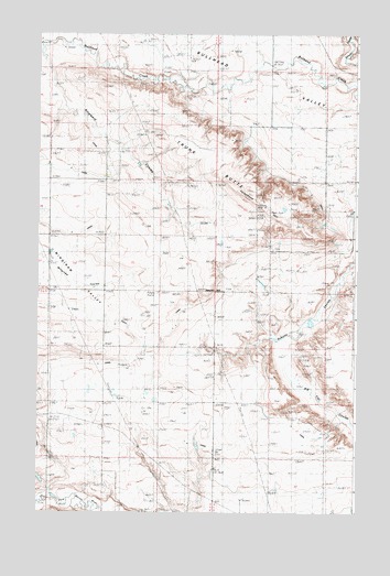
Belgian Hill, MT USGS Topographic Map
Click on map above to begin viewing in our Map Viewer.

This topographic map contains these locations and features:
Feature Name Type Latitude Longitude GNIS ID View Map
Barber CouleeValleyN48.2505°W112.0703°1748699View Map
Belgian Church (historical)ChurchN48.3183°W112.0325°768671View Map
Belgian Colony (historical)Populated PlaceN48.3166°W112.0342°1748810View Map
Belgian HillLocaleN48.3078°W112.0553°806128View Map
Belgian School (historical)SchoolN48.3189°W112.0075°768672View Map
Bullhead ValleyFlatN48.3722°W112.0750°769385View Map
KZIN-FM (Shelby)TowerN48.3283°W112.0350°806715View Map
L 2 CanalCanalN48.3119°W112.0545°773154View Map
L 9 CanalCanalN48.2672°W112.0431°773155View Map
L CanalCanalN48.2847°W112.0561°773156View Map
Munyon School (historical)SchoolN48.2789°W112.0561°774503View Map
Ringwald CouleeValleyN48.3703°W112.1248°775780View Map
Sacred Heart CemeteryCemeteryN48.3189°W112.0328°1748720View Map
Telephone HillSummitN48.3311°W112.0395°805916View Map
Trunk ButteRidgeN48.3483°W112.0678°777789View Map
Wingina (historical)Populated PlaceN48.3225°W112.1211°1748774View Map
Winginaw Valley School (historical)SchoolN48.3225°W112.1211°778597View Map

Note: Coordinates in the location and feature list above are referenced to NAD83 datum.


Copyright (C) 2008-2024 Ryan Niemi / Sunset Dynamics ... All Rights Reserved