TopoQuest Logo
Do you find TopoQuest useful?
Help keep TopoQuest running and adding new maps/features by donating!
Bitcoin:  19c7KJd3qBynnjoSw5npx9KScwjBe4ifkT
Litecoin:  LXs6TkuXGGXo1vDsWCkWVdjQX94eUKd6ui
Home View Maps Find Maps Find Places Resources & Links


Myrtle Park Meadows, Oregon Topographic Map

USGS Map Title: Myrtle Park Meadows, OR
USGS Map MRC: 43119H1
DRG (GeoTIFF) Download: o43119h1.tif


Neighboring USGS Topographic Map Quads:


  Five Hundred Flat, OR  
44119A2
 

  Rail Creek Butte, OR  
44119A1
 

  Silvies, OR  
44118A8
 

  West Myrtle Butte, OR  
43119H2
 

  Myrtle Park Meadows, OR  
43119H1
 

  Trout Creek, OR  
43118H8
 

  Landing Creek, OR  
43119G2
 

  Mosquito Flat, OR  
43119G1
 

  Devine Ridge North, OR  
43118G8


Map MRC Location:

N44°
W120°
N44°
W119°
H8 H7 H6 H5 H4 H3 H2 H1
G8 G7 G6 G5 G4 G3 G2 G1
F8 F7 F6 F5 F4 F3 F2 F1
E8 E7 E6 E5 E4 E3 E2 E1
D8 D7 D6 D5 D4 D3 D2 D1
C8 C7 C6 C5 C4 C3 C2 C1
B8 B7 B6 B5 B4 B3 B2 B1
A8 A7 A6 A5 A4 A3 A2 A1
N43°
W120°
N43°
W119°

Myrtle Park Meadows, OR USGS 1:24K Topographic Map Preview:
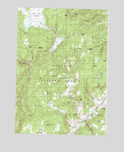
Myrtle Park Meadows, OR USGS Topographic Map
Click on map above to begin viewing in our Map Viewer.

This topographic map contains these locations and features:
Feature Name Type Latitude Longitude GNIS ID View Map
Aspen SpringSpringN43.8883°W119.0106°1137333View Map
Bellows CreekStreamN43.9040°W119.0130°1137902View Map
Bellows SpringSpringN43.9104°W119.0103°1137903View Map
Bennett CabinLocaleN43.8807°W119.0447°1137924View Map
Big Sage Hen SpringSpringN43.9324°W119.0783°1138063View Map
Boulder CreekStreamN43.9132°W119.0011°1138474View Map
Boulder SpringSpringN43.9241°W119.0103°1138496View Map
Burnt MountainSummitN43.8846°W119.0761°1157030View Map
Burnt MountainSummitN43.9043°W119.0611°1138997View Map
Burnt Mountain MeadowsFlatN43.8789°W119.0876°1139002View Map
Burnt Mountain SpringSpringN43.8763°W119.0870°1139003View Map
Chesmore SpringSpringN43.9028°W119.0064°1139606View Map
Clemens RanchLocaleN43.9713°W119.0733°1139818View Map
Cottonwood SpringSpringN43.9432°W119.0192°1140194View Map
Craddock MeadowsFlatN43.9331°W119.0113°1140350View Map
Craddock SpringSpringN43.9360°W119.0087°1140351View Map
Crane CreekStreamN43.9432°W119.1036°1140370View Map
Crane FlatsFlatN43.9660°W119.1141°1140377View Map
F L SpringSpringN43.8928°W119.1053°1141942View Map
Fawn CreekStreamN43.8993°W119.0183°1142041View Map
Fern SpringSpringN43.9932°W119.0578°1154224View Map
Gold CreekStreamN43.9677°W119.0724°1142808View Map
Gold HillSummitN43.9740°W119.0369°1142819View Map
H J SpringSpringN43.9605°W119.0421°1143181View Map
Hopper SpringSpringN43.9996°W119.0363°1154226View Map
Ice CreekStreamN43.9777°W119.0747°1154223View Map
L N SpringSpringN43.9306°W119.0419°1144722View Map
Little Sage Hen CreekStreamN43.8804°W119.0419°1145246View Map
Little Sage Hen FlatFlatN43.9046°W119.0772°1145247View Map
Little Sage Hen SpringSpringN43.9041°W119.0788°1154216View Map
Mike Robinson SpringSpringN43.8951°W119.0141°1891223View Map
Mud FlatFlatN43.9990°W119.0737°1133907View Map
Myrtle Park MeadowsFlatN43.9932°W119.1011°1146715View Map
Myrtle SpringSpringN43.9605°W119.1081°1146716View Map
Old Road Camp SpringSpringN43.9708°W119.0733°1154222View Map
Pheasant SpringSpringN43.9943°W119.0400°1154212View Map
Pipe Clamp SpringSpringN43.8946°W119.0427°1147764View Map
Rawhide SpringSpringN43.9069°W119.0505°1148251View Map
Sage Hen CreekStreamN43.8893°W119.0338°1148927View Map
Spear F SpringSpringN43.9102°W119.0367°1150107View Map
Stancliffe CreekStreamN43.8893°W119.0286°1639331View Map
Three E SpringSpringN43.9294°W119.0911°1151163View Map
West Myrtle CreekStreamN43.9413°W119.1072°1152136View Map
XI SpringSpringN43.9369°W119.0564°1152677View Map

Note: Coordinates in the location and feature list above are referenced to NAD83 datum.


Copyright (C) 2008-2025 Ryan Niemi / Sunset Dynamics ... All Rights Reserved