TopoQuest Logo
Do you find TopoQuest useful?
Help keep TopoQuest running and adding new maps/features by donating!
Bitcoin:  19c7KJd3qBynnjoSw5npx9KScwjBe4ifkT
Litecoin:  LXs6TkuXGGXo1vDsWCkWVdjQX94eUKd6ui
Home View Maps Find Maps Find Places Resources & Links


Silvies, Oregon Topographic Map

USGS Map Title: Silvies, OR
USGS Map MRC: 44118A8
DRG (GeoTIFF) Download: o44118a8.tif


Neighboring USGS Topographic Map Quads:


  Scotty Creek, OR  
44119B1
 

  Seneca, OR  
44118B8
 

  Big Canyon, OR  
44118B7
 

  Rail Creek Butte, OR  
44119A1
 

  Silvies, OR  
44118A8
 

  Jump-off Joe Mountain, OR  
44118A7
 

  Myrtle Park Meadows, OR  
43119H1
 

  Trout Creek, OR  
43118H8
 

  Calamity Butte, OR  
43118H7


Map MRC Location:

N45°
W119°
N45°
W118°
H8 H7 H6 H5 H4 H3 H2 H1
G8 G7 G6 G5 G4 G3 G2 G1
F8 F7 F6 F5 F4 F3 F2 F1
E8 E7 E6 E5 E4 E3 E2 E1
D8 D7 D6 D5 D4 D3 D2 D1
C8 C7 C6 C5 C4 C3 C2 C1
B8 B7 B6 B5 B4 B3 B2 B1
A8 A7 A6 A5 A4 A3 A2 A1
N44°
W119°
N44°
W118°

Silvies, OR USGS 1:24K Topographic Map Preview:
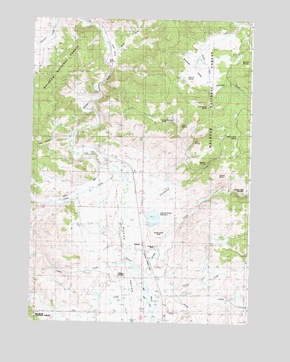
Silvies, OR USGS Topographic Map
Click on map above to begin viewing in our Map Viewer.

This topographic map contains these locations and features:
Feature Name Type Latitude Longitude GNIS ID View Map
Antelope ValleyValleyN44.1199°W118.8891°1137254View Map
Bennett DamDamN44.0482°W118.9043°1153907View Map
Bill Pete SpringSpringN44.1079°W118.8814°1138113View Map
Bridge CreekStreamN44.0204°W118.9355°1138612View Map
Camp CreekStreamN44.0610°W118.9530°1139223View Map
Charlie Smith ButteSummitN44.0377°W118.9261°1139577View Map
Cottonwood CreekStreamN44.0532°W118.9380°1140172View Map
Fisk GulchValleyN44.0752°W118.9777°1142184View Map
Flat CreekStreamN44.0040°W118.9313°1142232View Map
Funny Bug Basin SpringSpringN44.0828°W118.9272°1142538View Map
Hankins CemeteryCemeteryN44.0254°W118.9244°1133920View Map
Hankins RanchLocaleN44.0502°W118.9997°1156188View Map
Herman SpringSpringN44.1002°W118.9117°1143514View Map
House CreekStreamN44.0121°W118.9302°1143837View Map
Jack Andy CreekStreamN44.0090°W118.9988°1136973View Map
Jump CreekStreamN44.0257°W118.9455°1144424View Map
Lake Pons DamDamN44.0430°W118.9328°1155592View Map
Owens DitchCanalN44.0540°W118.9761°1152973View Map
Parasol ButteSummitN44.0607°W118.8933°1147426View Map
Poison CreekStreamN44.0171°W118.9211°1147823View Map
Ponderosa Ranch AirportAirportN44.0291°W118.9353°1133921View Map
Pronghorn ReservoirReservoirN44.0432°W118.9298°1133922View Map
Rann Post Office (historical)Post OfficeN44.0265°W118.9324°1164627View Map
S S SpringSpringN44.0754°W118.9075°1148885View Map
Scotty SpringSpringN44.0812°W118.9153°1149183View Map
SilviesPopulated PlaceN44.0329°W118.9352°1149514View Map
Silvies CemeteryCemeteryN44.0252°W118.9244°1156979View Map
Silvies LandingLocaleN44.0149°W118.9444°1149515View Map
Silvies Post Office (historical)Post OfficeN44.0329°W118.9352°1165949View Map
Silvies Valley RanchLocaleN44.0310°W118.9278°1138622View Map
Soda GulchValleyN44.1121°W118.9511°1149850View Map
Soda Smith SpringSpringN44.0893°W118.9006°1149852View Map
Soda SpringSpringN44.1077°W118.9574°1149856View Map
Soda ValleyValleyN44.1235°W118.9694°1149859View Map
Stevens SpringSpringN44.0659°W118.8997°1150417View Map
Thirty-Thirty SpringSpringN44.0768°W118.8834°1151070View Map

Note: Coordinates in the location and feature list above are referenced to NAD83 datum.


Copyright (C) 2008-2024 Ryan Niemi / Sunset Dynamics ... All Rights Reserved