TopoQuest Logo
Do you find TopoQuest useful?
Help keep TopoQuest running and adding new maps/features by donating!
Bitcoin:  19c7KJd3qBynnjoSw5npx9KScwjBe4ifkT
Litecoin:  LXs6TkuXGGXo1vDsWCkWVdjQX94eUKd6ui
Home View Maps Find Maps Find Places Resources & Links


Trout Creek, Oregon Topographic Map

USGS Map Title: Trout Creek, OR
USGS Map MRC: 43118H8
DRG (GeoTIFF) Download: o43118h8.tif


Neighboring USGS Topographic Map Quads:


  Rail Creek Butte, OR  
44119A1
 

  Silvies, OR  
44118A8
 

  Jump-off Joe Mountain, OR  
44118A7
 

  Myrtle Park Meadows, OR  
43119H1
 

  Trout Creek, OR  
43118H8
 

  Calamity Butte, OR  
43118H7
 

  Mosquito Flat, OR  
43119G1
 

  Devine Ridge North, OR  
43118G8
 

  Telephone Butte, OR  
43118G7


Map MRC Location:

N44°
W119°
N44°
W118°
H8 H7 H6 H5 H4 H3 H2 H1
G8 G7 G6 G5 G4 G3 G2 G1
F8 F7 F6 F5 F4 F3 F2 F1
E8 E7 E6 E5 E4 E3 E2 E1
D8 D7 D6 D5 D4 D3 D2 D1
C8 C7 C6 C5 C4 C3 C2 C1
B8 B7 B6 B5 B4 B3 B2 B1
A8 A7 A6 A5 A4 A3 A2 A1
N43°
W119°
N43°
W118°

Trout Creek, OR USGS 1:24K Topographic Map Preview:
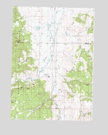
Trout Creek, OR USGS Topographic Map
Click on map above to begin viewing in our Map Viewer.

This topographic map contains these locations and features:
Feature Name Type Latitude Longitude GNIS ID View Map
Badger CanyonValleyN43.9621°W118.9602°1137392View Map
Big Trees SpringSpringN43.9092°W118.9756°1138092View Map
Buffalo DamDamN43.9753°W118.9589°1155531View Map
Buffalo LakeReservoirN43.9765°W118.9611°1154244View Map
Camp CreekStreamN43.9079°W118.9333°1139207View Map
Craddock RanchLocaleN43.9407°W118.9391°1156182View Map
Curry SpringSpringN43.9152°W118.9685°1140568View Map
Deadwood SpringSpringN43.8946°W118.9987°1140759View Map
Dog CreekStreamN43.9457°W118.9391°1141129View Map
Fuqua CreekStreamN43.8810°W118.9236°1142527View Map
Hall CreekStreamN43.9821°W118.9502°1143223View Map
Loco CanyonValleyN43.9421°W118.9569°1145318View Map
Loco SpringSpringN43.9397°W118.9785°1145319View Map
Log Pipe SpringSpringN43.8824°W118.9997°1154242View Map
Lost CreekStreamN43.9002°W118.9391°1145513View Map
Maitland SpringSpringN43.9156°W118.8834°1145761View Map
Middle Fork Trout CreekStreamN43.8815°W118.8899°1146163View Map
Mountain CreekStreamN43.9663°W118.9077°1146539View Map
Newell CreekStreamN43.9835°W118.9363°1146809View Map
Owen SpringSpringN43.9618°W118.9888°1147305View Map
Purdy RanchLocaleN43.9088°W118.9272°1133906View Map
Ranger SpringSpringN43.9099°W118.9859°1148212View Map
Roper SpringSpringN43.8881°W118.9287°1148727View Map
Scheckels DamDamN43.9932°W118.9044°1153920View Map
Scheckels Reservoir (historical)ReservoirN43.9954°W118.9004°1153921View Map
Sherwood LakeLakeN43.9596°W118.9830°1129742View Map
Silvies ValleyValleyN43.9221°W118.9594°1149517View Map
Silvies Valley RanchLocaleN43.9246°W118.9469°1149518View Map
Smith SpringSpringN43.9152°W118.9818°1156174View Map
Thorn CreekStreamN43.9824°W118.9594°1151124View Map
Trout CreekPopulated PlaceN43.9271°W118.9399°1151431View Map
Trout CreekStreamN43.9290°W118.9527°1151441View Map
West Side DitchCanalN43.9693°W118.9552°1154246View Map

Note: Coordinates in the location and feature list above are referenced to NAD83 datum.


Copyright (C) 2008-2024 Ryan Niemi / Sunset Dynamics ... All Rights Reserved