TopoQuest Logo
Do you find TopoQuest useful?
Help keep TopoQuest running and adding new maps/features by donating!
Bitcoin:  19c7KJd3qBynnjoSw5npx9KScwjBe4ifkT
Litecoin:  LXs6TkuXGGXo1vDsWCkWVdjQX94eUKd6ui
Home View Maps Find Maps Find Places Resources & Links


Naches, Washington Topographic Map

USGS Map Title: Naches, WA
USGS Map MRC: 46120F6
DRG (GeoTIFF) Download: o46120f6.tif


Neighboring USGS Topographic Map Quads:


  Milk Canyon, WA  
46120G7
 

  Wenas Lake, WA  
46120G6
 

  The Cottonwoods, WA  
46120G5
 

  Tieton, WA  
46120F7
 

  Naches, WA  
46120F6
 

  Selah, WA  
46120F5
 

  Tampico, WA  
46120E7
 

  Wiley City, WA  
46120E6
 

  Yakima West, WA  
46120E5


Map MRC Location:

N47°
W121°
N47°
W120°
H8 H7 H6 H5 H4 H3 H2 H1
G8 G7 G6 G5 G4 G3 G2 G1
F8 F7 F6 F5 F4 F3 F2 F1
E8 E7 E6 E5 E4 E3 E2 E1
D8 D7 D6 D5 D4 D3 D2 D1
C8 C7 C6 C5 C4 C3 C2 C1
B8 B7 B6 B5 B4 B3 B2 B1
A8 A7 A6 A5 A4 A3 A2 A1
N46°
W121°
N46°
W120°

Naches, WA USGS 1:24K Topographic Map Preview:
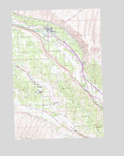
Naches, WA USGS Topographic Map
Click on map above to begin viewing in our Map Viewer.

This topographic map contains these locations and features:
Feature Name Type Latitude Longitude GNIS ID View Map
BonlowLocaleN46.7143°W120.6706°1511584View Map
CowichePopulated PlaceN46.6698°W120.7123°1512121View Map
Cowiche Census Designated PlaceCensusN46.6729°W120.7154°2584963View Map
Cowiche Post OfficePost OfficeN46.6713°W120.7139°2769166View Map
Cowiche SchoolSchoolN46.6573°W120.7103°1504215View Map
Dobie OrchardLocaleN46.6750°W120.6325°2703694View Map
EschbachPopulated PlaceN46.6696°W120.6312°1510947View Map
Eschbach Census Designated PlaceCensusN46.6671°W120.6338°2408088View Map
G and G OrchardsLocaleN46.6667°W120.6672°2703701View Map
Highland High SchoolSchoolN46.6745°W120.7118°1505511View Map
HoltzingerPopulated PlaceN46.6776°W120.7206°1512305View Map
Kelly DitchCanalN46.7204°W120.6715°1505937View Map
KRSE-FM (Yakima)TowerN46.7123°W120.6306°1534412View Map
KYKA-FM (Naches)TowerN46.6943°W120.6848°1534361View Map
Lateral CCanalN46.7143°W120.7292°1521928View Map
Lateral CCanalN46.6554°W120.6567°1506094View Map
Lateral GCanalN46.6690°W120.7295°1521931View Map
Lateral JCanalN46.6279°W120.6765°1506095View Map
Lowry DitchCanalN46.7271°W120.6787°1506365View Map
Marcus Whitman - Cowiche Elementary SchoolSchoolN46.6583°W120.6952°1531002View Map
Marcus Whitman SchoolSchoolN46.6348°W120.6359°1506466View Map
NachesPopulated PlaceN46.7310°W120.6995°1512494View Map
Naches HeightsSummitN46.6410°W120.6420°1506920View Map
Naches Post OfficePost OfficeN46.7318°W120.7044°2769224View Map
Naches Ranger District Fire ManagementBuildingN46.7298°W120.7038°2767938View Map
Naches Valley High SchoolSchoolN46.7293°W120.6951°1506921View Map
Naches Valley Intermediate SchoolSchoolN46.7300°W120.6941°1515302View Map
Naches Valley Middle SchoolSchoolN46.7291°W120.6968°1515304View Map
North Fork Cowiche CreekStreamN46.6473°W120.6817°1523762View Map
Selah Valley CanalCanalN46.7357°W120.6890°1525567View Map
South Fork Cowiche CreekStreamN46.6473°W120.6817°1534606View Map
TaskerPopulated PlaceN46.6957°W120.7440°1511362View Map
Town of NachesCivilN46.7273°W120.6944°2413032View Map
Upper Naches ValleyValleyN46.6846°W120.6551°1527642View Map
Wapatox CanalCanalN46.7373°W120.6973°1527793View Map
WeikelPopulated PlaceN46.6326°W120.6673°1511415View Map
Yakima County Fire District 1 Highland Fire Department CowicheBuildingN46.6712°W120.7110°2643422View Map
Yakima County Fire District 3 Station 13 Naches Fire DepartmentBuildingN46.7306°W120.7014°2643425View Map
Yakima County Fire District 9 Naches Heights Fire DepartmentBuildingN46.6506°W120.6511°2619389View Map
Yakima DivisionCivilN46.6359°W120.6387°1939683View Map

Note: Coordinates in the location and feature list above are referenced to NAD83 datum.


Copyright (C) 2008-2024 Ryan Niemi / Sunset Dynamics ... All Rights Reserved