TopoQuest Logo
Do you find TopoQuest useful?
Help keep TopoQuest running and adding new maps/features by donating!
Bitcoin:  19c7KJd3qBynnjoSw5npx9KScwjBe4ifkT
Litecoin:  LXs6TkuXGGXo1vDsWCkWVdjQX94eUKd6ui
Home View Maps Find Maps Find Places Resources & Links


Nassawadox, Virginia Topographic Map

USGS Map Title: Nassawadox, VA
USGS Map MRC: 37075D7
DRG (GeoTIFF) Download: o37075d7.tif


Neighboring USGS Topographic Map Quads:


  Jamesville, VA  
37075E8
 

  Exmore, VA  
37075E7


  Franktown, VA  
37075D8
 

  Nassawadox, VA  
37075D7
 

  Quinby Inlet, VA  
37075D6
 

  Cheriton, VA  
37075C8
 

  Cobb Island, VA  
37075C7
 

  Great Machipongo Inlet, VA  
37075C6


Map MRC Location:

N38°
W76°
N38°
W75°
H8 H7 H6 H5 H4 H3 H2 H1
G8 G7 G6 G5 G4 G3 G2 G1
F8 F7 F6 F5 F4 F3 F2 F1
E8 E7 E6 E5 E4 E3 E2 E1
D8 D7 D6 D5 D4 D3 D2 D1
C8 C7 C6 C5 C4 C3 C2 C1
B8 B7 B6 B5 B4 B3 B2 B1
A8 A7 A6 A5 A4 A3 A2 A1
N37°
W76°
N37°
W75°

Nassawadox, VA USGS 1:24K Topographic Map Preview:
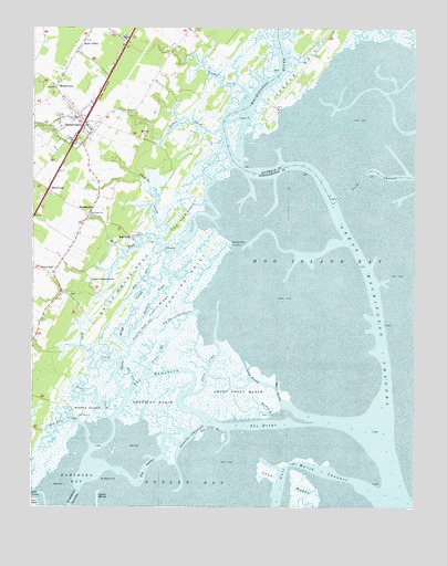
Nassawadox, VA USGS Topographic Map
Click on map above to begin viewing in our Map Viewer.

This topographic map contains these locations and features:
Feature Name Type Latitude Longitude GNIS ID View Map
Allen ChurchChurchN37.4837°W75.8680°1462404View Map
Big Sharpleys CreekStreamN37.4240°W75.8205°1463406View Map
Bog GutGutN37.4337°W75.8380°1463630View Map
Box Tree CreekStreamN37.3951°W75.8588°1463723View Map
Brickhouse NeckCapeN37.4293°W75.8460°1463804View Map
Broadwater Club House (historical)BuildingN37.4571°W75.8205°1739166View Map
Brownsville (historical)Populated PlaceN37.4671°W75.8230°1739167View Map
Buckhorn PointCapeN37.3804°W75.8497°1464006View Map
Castle RidgeRidgeN37.4265°W75.8333°1464524View Map
Castle Ridge CreekStreamN37.4037°W75.8441°1464525View Map
Cedar PointCapeN37.4754°W75.8066°1464640View Map
Collins EstatesPopulated PlaceN37.4690°W75.8677°1739192View Map
Crabbing MarshSwampN37.3999°W75.8355°1465376View Map
District 3CivilN37.3860°W75.7738°1927227View Map
District 6CivilN37.4978°W75.8682°1927281View Map
Eastern LeadGutN37.4282°W75.8347°1466125View Map
Ebb Stake MarshSwampN37.3940°W75.8144°1466132View Map
Eel GutGutN37.4082°W75.8416°1466192View Map
Fowling PointCapeN37.4340°W75.8235°1466816View Map
Fowling Point GutGutN37.4196°W75.8385°1466817View Map
Great GutGutN37.4135°W75.8333°1467433View Map
Great Machipongo ChannelChannelN37.4360°W75.7655°1467442View Map
Greens CreekStreamN37.4799°W75.8060°1467506View Map
Gull Marsh ChannelChannelN37.3862°W75.7871°1477914View Map
Harbor GutGutN37.3993°W75.7977°1467729View Map
Hare ValleyPopulated PlaceN37.4951°W75.8591°1496937View Map
Hare Valley EstatesPopulated PlaceN37.4993°W75.8491°1739209View Map
Heritage Hall at Nassawadox Nursing HomeBuildingN37.4733°W75.8639°2520003View Map
Hog Island BayBayN37.4412°W75.7558°1468105View Map
Holt CreekStreamN37.3768°W75.8716°1468177View Map
Kitts CreekStreamN37.3965°W75.8488°1469063View Map
Little JohnsontownPopulated PlaceN37.4335°W75.8558°1496986View Map
Long ProngGutN37.4062°W75.7996°1469836View Map
Machipongo RiverStreamN37.4646°W75.8085°1469988View Map
MarionvillePopulated PlaceN37.4526°W75.8547°1497005View Map
Marionville Post OfficePost OfficeN37.4548°W75.8539°1739225View Map
MiddletownPopulated PlaceN37.4840°W75.8674°1497016View Map
Mill CreekStreamN37.4118°W75.8469°1474253View Map
Montessori Childrens House of the Eastern ShoreSchoolN37.4756°W75.8625°2465253View Map
NassawadoxPopulated PlaceN37.4749°W75.8583°1471328View Map
Nassawadox EstatesPopulated PlaceN37.4801°W75.8435°1739229View Map
Nassawadox Post OfficePost OfficeN37.4745°W75.8577°1739230View Map
North ChannelChannelN37.4607°W75.7535°1474260View Map
Northampton Accomack Memorial Hospital HeliportAirportN37.4751°W75.8641°1498755View Map
Northampton Fire and RescueBuildingN37.4803°W75.8563°2086100View Map
Northampton Free LibraryBuildingN37.4727°W75.8556°2519918View Map
Outlet MarshSwampN37.3754°W75.8533°1471980View Map
Phillips CreekStreamN37.4440°W75.8338°1472258View Map
Point CreekStreamN37.4012°W75.8252°1472564View Map
Powells ChannelChannelN37.3921°W75.8227°1472742View Map
Red BankPopulated PlaceN37.4446°W75.8419°1473039View Map
Red Bank ChurchChurchN37.4510°W75.8560°1473040View Map
Red Bank CreekStreamN37.4485°W75.8216°1473041View Map
Riverside Shore Memorial HospitalHospitalN37.4754°W75.8641°1739238View Map
Sandy PointCapeN37.4426°W75.8094°1474032View Map
Sheps EndPopulated PlaceN37.4349°W75.8683°1474488View Map
Short ProngGutN37.4037°W75.7944°1474555View Map
Short Prong MarshSwampN37.4024°W75.8083°1474556View Map
The DeepsChannelN37.3949°W75.7996°1475569View Map
The HammocksIslandN37.4485°W75.8266°1475579View Map
The OutletChannelN37.3835°W75.8377°1475597View Map
The RamshornChannelN37.4079°W75.8358°1475604View Map
Thomas Wharf (historical)LocaleN37.4757°W75.8147°1739257View Map
Town of NassawadoxCivilN37.4763°W75.8592°2391322View Map
Upshur CreekStreamN37.4729°W75.8135°1476124View Map
Webbs IslandIslandN37.3985°W75.8572°1476428View Map
WeirwoodPopulated PlaceN37.4571°W75.8697°1476436View Map
Weirwood Post OfficePost OfficeN37.4576°W75.8672°1739263View Map
White CemeteryCemeteryN37.4767°W75.7994°2780439View Map
WoodstockPopulated PlaceN37.4762°W75.8474°1739266View Map

Note: Coordinates in the location and feature list above are referenced to NAD83 datum.


Copyright (C) 2008-2024 Ryan Niemi / Sunset Dynamics ... All Rights Reserved