TopoQuest Logo
Do you find TopoQuest useful?
Help keep TopoQuest running and adding new maps/features by donating!
Bitcoin:  19c7KJd3qBynnjoSw5npx9KScwjBe4ifkT
Litecoin:  LXs6TkuXGGXo1vDsWCkWVdjQX94eUKd6ui
Home View Maps Find Maps Find Places Resources & Links


Navarre, Florida Topographic Map

USGS Map Title: Navarre, FL
USGS Map MRC: 30086D7
DRG (GeoTIFF) Download: o30086d7.tif


Neighboring USGS Topographic Map Quads:


  Ward Basin, FL  
30086E8
 

  Harold SE, FL  
30086E7
 

  Holt SW, FL  
30086E6
 

  Holley, FL  
30086D8
 

  Navarre, FL  
30086D7
 

  Mary Esther, FL  
30086D6
 

  South of Holley, FL  
30086C8


Map MRC Location:

N31°
W87°
N31°
W86°
H8 H7 H6 H5 H4 H3 H2 H1
G8 G7 G6 G5 G4 G3 G2 G1
F8 F7 F6 F5 F4 F3 F2 F1
E8 E7 E6 E5 E4 E3 E2 E1
D8 D7 D6 D5 D4 D3 D2 D1
C8 C7 C6 C5 C4 C3 C2 C1
B8 B7 B6 B5 B4 B3 B2 B1
A8 A7 A6 A5 A4 A3 A2 A1
N30°
W87°
N30°
W86°

Navarre, FL USGS 1:24K Topographic Map Preview:
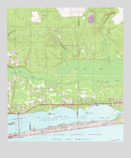
Navarre, FL USGS Topographic Map
Click on map above to begin viewing in our Map Viewer.

This topographic map contains these locations and features:
Feature Name Type Latitude Longitude GNIS ID View Map
Eglin Air Force Base Fire Station Santa Rosa IslandBuildingN30.3917°W86.8052°2644691View Map
Fort Walton Beach AirportAirportN30.4063°W86.8291°309713View Map
Holley Navarre Fire District Station 43BuildingN30.4321°W86.8733°2644230View Map
Holley Navarre Fire District Station 45BuildingN30.4035°W86.8617°2644204View Map
Lower Pritchard Long PointCapeN30.4010°W86.8311°286174View Map
Manatee PointCapeN30.3994°W86.7555°286363View Map
NavarrePopulated PlaceN30.4016°W86.8636°287558View Map
Navarre BeachBeachN30.3794°W86.8622°287559View Map
Navarre Beach State ParkParkN30.3821°W86.8611°1947463View Map
Panther CreekStreamN30.4294°W86.8063°288459View Map
Prairie CreekStreamN30.4324°W86.7633°289282View Map
Prairie PondsLakeN30.4897°W86.7848°297951View Map
Pullum Pad HeliportAirportN30.4024°W86.8663°309714View Map
Santa Rosa County Sheriff's Office - District 2 NavarreBuildingN30.4222°W86.8629°2754495View Map
Santa Rosa IslandIslandN30.3824°W86.8563°290662View Map
Upper Pritchard Long PointCapeN30.4021°W86.7902°292710View Map
Wynnehaven BeachPopulated PlaceN30.4102°W86.7822°293555View Map

Note: Coordinates in the location and feature list above are referenced to NAD83 datum.


Copyright (C) 2008-2025 Ryan Niemi / Sunset Dynamics ... All Rights Reserved