TopoQuest Logo
Do you find TopoQuest useful?
Help keep TopoQuest running and adding new maps/features by donating!
Bitcoin:  19c7KJd3qBynnjoSw5npx9KScwjBe4ifkT
Litecoin:  LXs6TkuXGGXo1vDsWCkWVdjQX94eUKd6ui
Home View Maps Find Maps Find Places Resources & Links


Ward Basin, Florida Topographic Map

USGS Map Title: Ward Basin, FL
USGS Map MRC: 30086E8
DRG (GeoTIFF) Download: o30086e8.tif


Neighboring USGS Topographic Map Quads:


  Milton North, FL  
30087F1
 

  Harold, FL  
30086F8
 

  Floridale, FL  
30086F7
 

  Milton South, FL  
30087E1
 

  Ward Basin, FL  
30086E8
 

  Harold SE, FL  
30086E7
 

  Garcon Point, FL  
30087D1
 

  Holley, FL  
30086D8
 

  Navarre, FL  
30086D7


Map MRC Location:

N31°
W87°
N31°
W86°
H8 H7 H6 H5 H4 H3 H2 H1
G8 G7 G6 G5 G4 G3 G2 G1
F8 F7 F6 F5 F4 F3 F2 F1
E8 E7 E6 E5 E4 E3 E2 E1
D8 D7 D6 D5 D4 D3 D2 D1
C8 C7 C6 C5 C4 C3 C2 C1
B8 B7 B6 B5 B4 B3 B2 B1
A8 A7 A6 A5 A4 A3 A2 A1
N30°
W87°
N30°
W86°

Ward Basin, FL USGS 1:24K Topographic Map Preview:
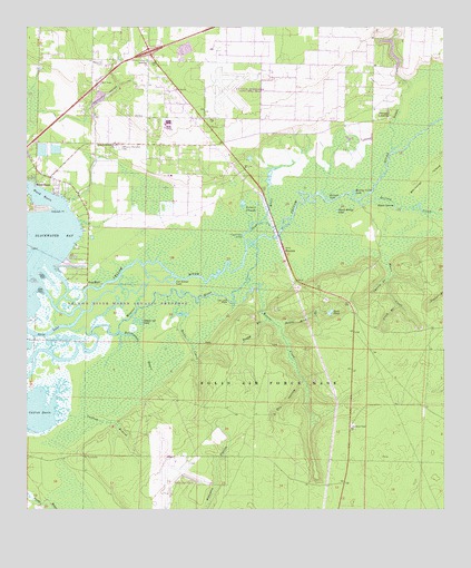
Ward Basin, FL USGS Topographic Map
Click on map above to begin viewing in our Map Viewer.

This topographic map contains these locations and features:
Feature Name Type Latitude Longitude GNIS ID View Map
Basin IslandIslandN30.5782°W86.8886°278152View Map
Boggy BranchStreamN30.5494°W86.9277°279151View Map
Boiling CreekStreamN30.5799°W86.9002°279187View Map
Boiling Creek LakeLakeN30.5825°W86.9028°279188View Map
BroxsonPopulated PlaceN30.5677°W86.9219°294697View Map
Buck PondReservoirN30.5515°W86.9085°279588View Map
Cat Island LakeLakeN30.5589°W86.9567°280130View Map
Catfish BasinBayN30.5261°W86.9967°280138View Map
Catfish BranchStreamN30.5255°W86.9914°280139View Map
Cherry BranchStreamN30.5596°W86.8914°280359View Map
Choctaw Naval Outlying FieldAirportN30.5126°W86.9554°2676722View Map
Dead RiverStreamN30.5685°W86.9336°281386View Map
Double Head BranchStreamN30.5477°W86.9241°281703View Map
Dry HollowValleyN30.5327°W86.9172°281796View Map
East Milton Census Designated PlaceCensusN30.6175°W86.9636°2583339View Map
East Milton DivisionCivilN30.6131°W86.9552°2648022View Map
East Milton Volunteer Fire Department Station 2BuildingN30.6027°W86.9475°2644235View Map
Faulks Ferry LandingLocaleN30.5713°W86.9344°295275View Map
Fitch BranchStreamN30.5530°W86.8888°282517View Map
Friendship CemeteryCemeteryN30.6046°W86.9855°301631View Map
Goggle-Eye LakeLakeN30.5488°W86.9666°283139View Map
Gulf Breeze-Harold DivisionCensusN30.5155°W86.9341°1935788View Map
Hickory Hammock ChurchChurchN30.5946°W86.9727°283955View Map
Hicks CreekStreamN30.5552°W86.9575°283972View Map
Moore CreekStreamN30.5766°W86.8805°287102View Map
Old Land PlaceLocaleN30.5538°W86.9389°295506View Map
Palmer SloughStreamN30.5735°W86.9325°288426View Map
Persimmon HollowValleyN30.6009°W86.9817°288728View Map
Petersen PointCapeN30.5780°W86.9902°288740View Map
Pine BluffPopulated PlaceN30.5596°W86.9783°295535View Map
Plank Bridge LakeLakeN30.5776°W86.9074°289020View Map
Rattlesnake BayouStreamN30.5460°W86.9725°289482View Map
Santa Rosa Naval Outlying FieldAirportN30.6112°W86.9391°2676723View Map
Skim LakeLakeN30.5464°W86.9931°291202View Map
Stergan LakeLakeN30.5807°W86.9096°291683View Map
Ward BasinPopulated PlaceN30.5852°W86.9969°295697View Map
Ward BasinBasinN30.5807°W86.9955°292864View Map
Weaver CreekStreamN30.5585°W86.9344°292964View Map
Weaver Creek Lookout TowerTowerN30.5216°W86.9025°293653View Map
Welcome CemeteryCemeteryN30.6166°W86.9772°293011View Map
Welcome ChurchChurchN30.6160°W86.9630°293013View Map
Williams Memorial CemeteryCemeteryN30.5941°W86.9713°293333View Map
Yellow RiverStreamN30.5574°W86.9952°164152View Map

Note: Coordinates in the location and feature list above are referenced to NAD83 datum.


Copyright (C) 2008-2025 Ryan Niemi / Sunset Dynamics ... All Rights Reserved