TopoQuest Logo
Do you find TopoQuest useful?
Help keep TopoQuest running and adding new maps/features by donating!
Bitcoin:  19c7KJd3qBynnjoSw5npx9KScwjBe4ifkT
Litecoin:  LXs6TkuXGGXo1vDsWCkWVdjQX94eUKd6ui
Home View Maps Find Maps Find Places Resources & Links


Naylor, Georgia Topographic Map

USGS Map Title: Naylor, GA
USGS Map MRC: 30083H1
DRG (GeoTIFF) Download: o30083h1.tif


Neighboring USGS Topographic Map Quads:


  Ray City, GA  
31083A2
 

  Lakeland, GA  
31083A1
 

  Sirmans, GA  
31082A8


  Naylor, GA  
30083H1


Map MRC Location:

N31°
W84°
N31°
W83°
H8 H7 H6 H5 H4 H3 H2 H1
G8 G7 G6 G5 G4 G3 G2 G1
F8 F7 F6 F5 F4 F3 F2 F1
E8 E7 E6 E5 E4 E3 E2 E1
D8 D7 D6 D5 D4 D3 D2 D1
C8 C7 C6 C5 C4 C3 C2 C1
B8 B7 B6 B5 B4 B3 B2 B1
A8 A7 A6 A5 A4 A3 A2 A1
N30°
W84°
N30°
W83°

Naylor, GA USGS 1:24K Topographic Map Preview:
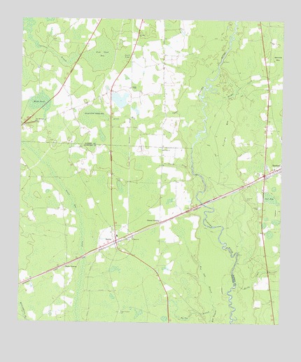
Naylor, GA USGS Topographic Map
Click on map above to begin viewing in our Map Viewer.

This topographic map contains these locations and features:
Feature Name Type Latitude Longitude GNIS ID View Map
Bennett BayFlatN30.9849°W83.0026°311080View Map
Carter ChapelChurchN30.9721°W83.0718°312375View Map
Carter LakeReservoirN30.9670°W83.0777°342185View Map
Carter Lake DamDamN30.9635°W83.0765°342184View Map
Carter School (historical)SchoolN30.9608°W83.0993°348094View Map
Cherry CreekStreamN30.9394°W83.0429°312614View Map
Christians Folly AirportAirportN30.9308°W83.0793°2443614View Map
Copeland BranchStreamN30.9880°W83.1163°312960View Map
Dixon Mill BridgeBridgeN30.9613°W83.0557°348095View Map
Dixon Mill CreekStreamN30.9635°W83.0382°313506View Map
Fish Pond BaySwampN30.9855°W83.0872°314146View Map
Foreman CemeteryCemeteryN30.9269°W83.0163°314262View Map
Friars BayFlatN30.9538°W83.0268°314381View Map
George Carter Island BaySwampN30.9575°W83.0898°314556View Map
Good Hope ChurchChurchN30.9472°W83.0565°314683View Map
Good Hope School (historical)SchoolN30.9544°W83.0576°348096View Map
Greens CrossingPopulated PlaceN30.9166°W83.0571°326308View Map
Hopewell School (historical)SchoolN30.9591°W83.1171°348097View Map
Hotchkiss BridgeBridgeN30.9363°W83.0490°346269View Map
James CemeteryCemeteryN30.9144°W83.0643°346275View Map
James E Branch Fire StationBuildingN30.9393°W83.0000°2604115View Map
Knight CreekStreamN30.9724°W83.0338°316493View Map
Lanier County Fire Department Station 2 StocktonBuildingN30.9372°W83.0056°2604471View Map
Monk PondSwampN30.9657°W83.1167°318392View Map
Monks CrossingPopulated PlaceN30.8988°W83.1029°332408View Map
NaylorPopulated PlaceN30.9088°W83.0782°332468View Map
Naylor SchoolSchoolN30.9108°W83.0782°346306View Map
Naylor Volunteer Fire DepartmentBuildingN30.9082°W83.0787°2604871View Map
New Hopewell ChurchChurchN30.9574°W83.1179°319450View Map
Owl BaySwampN30.9269°W83.0051°320135View Map
Red Oak BranchStreamN30.8827°W83.0315°321396View Map
Reedy CreekStreamN30.8924°W83.0215°321455View Map
Saint Louis ChurchChurchN30.9935°W83.0682°322145View Map
Saint Marys ChurchChurchN30.9102°W83.0704°322191View Map
Stockton Baptist ChurchChurchN30.9413°W83.0007°348101View Map
Sweet Prospect CemeteryCemeteryN30.8799°W83.0763°323814View Map
The RocksIslandN30.9833°W83.0288°324055View Map
Trail PondSwampN30.9851°W83.0755°324267View Map
Ty Ty BranchStreamN30.8810°W83.0313°324466View Map

Note: Coordinates in the location and feature list above are referenced to NAD83 datum.


Copyright (C) 2008-2024 Ryan Niemi / Sunset Dynamics ... All Rights Reserved