TopoQuest Logo
Do you find TopoQuest useful?
Help keep TopoQuest running and adding new maps/features by donating!
Bitcoin:  19c7KJd3qBynnjoSw5npx9KScwjBe4ifkT
Litecoin:  LXs6TkuXGGXo1vDsWCkWVdjQX94eUKd6ui
Home View Maps Find Maps Find Places Resources & Links


Bell Ranch, New Mexico Topographic Map

USGS Map Title: Bell Ranch, NM
USGS Map MRC: 35104E1
DRG (GeoTIFF) Download: o35104e1.tif


Neighboring USGS Topographic Map Quads:


  Montoya Point, NM  
35104F2
 

  Waggoner Ranch, NM  
35104F1
 

  Chinaberry Canyon, NM  
35103F8
 

  Minese Mesa, NM  
35104E2
 

  Bell Ranch, NM  
35104E1
 

  Campana, NM  
35103E8
 

  Conchas Dam, NM  
35104D2
 

  La Cinta Mesa, NM  
35104D1
 

  Carpenter Mesa NW, NM  
35103D8


Map MRC Location:

N36°
W105°
N36°
W104°
H8 H7 H6 H5 H4 H3 H2 H1
G8 G7 G6 G5 G4 G3 G2 G1
F8 F7 F6 F5 F4 F3 F2 F1
E8 E7 E6 E5 E4 E3 E2 E1
D8 D7 D6 D5 D4 D3 D2 D1
C8 C7 C6 C5 C4 C3 C2 C1
B8 B7 B6 B5 B4 B3 B2 B1
A8 A7 A6 A5 A4 A3 A2 A1
N35°
W105°
N35°
W104°

Bell Ranch, NM USGS 1:24K Topographic Map Preview:
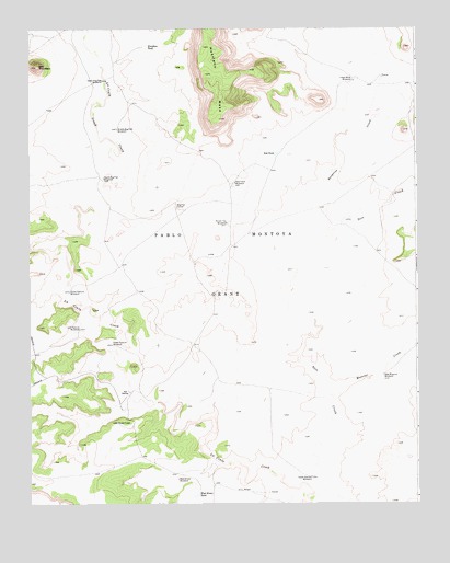
Bell Ranch, NM USGS Topographic Map
Click on map above to begin viewing in our Map Viewer.

This topographic map contains these locations and features:
Feature Name Type Latitude Longitude GNIS ID View Map
Bell MountainSummitN35.6150°W104.1222°897308View Map
Bell RanchLocaleN35.5292°W104.0936°886185View Map
Bell Ranch Headquarters AirportAirportN35.5456°W104.0826°936911View Map
Bell Ranch Post Office (historical)Post OfficeN35.5292°W104.0936°937211View Map
Big Flat CorralLocaleN35.5787°W104.0775°886305View Map
Bueyeros CreekStreamN35.5753°W104.0253°886857View Map
Creek Pasture WindmillLocaleN35.5417°W104.0986°888063View Map
Huerfano TankReservoirN35.6202°W104.0871°890247View Map
Lane Pasture WindmillLocaleN35.5462°W104.1089°890919View Map
Lower Mule WindmillLocaleN35.6112°W104.0203°891441View Map
Middle Big Flat WindmillLocaleN35.5987°W104.0964°891936View Map
Muertos CreekStreamN35.5284°W104.0269°892319View Map
New Farm WindmillLocaleN35.5845°W104.0583°892433View Map
New Muertos WindmillLocaleN35.5339°W104.0111°892451View Map
Red TankReservoirN35.5921°W104.0454°893811View Map
Round Top WindmillLocaleN35.5739°W104.0611°894196View Map
Seco CreekStreamN35.5006°W104.0347°894687View Map
South Big Flat WindmillLocaleN35.5859°W104.1011°895014View Map
South Pasture WindmillLocaleN35.5559°W104.1122°895100View Map
Upper Big Flat WindmillLocaleN35.6112°W104.1011°896007View Map
Upper Gavilan WindmillLocaleN35.5070°W104.0347°896021View Map
West Bronc TankReservoirN35.5026°W104.0714°896334View Map
West Bronc WindmillLocaleN35.5067°W104.0775°896335View Map

Note: Coordinates in the location and feature list above are referenced to NAD83 datum.


Copyright (C) 2008-2025 Ryan Niemi / Sunset Dynamics ... All Rights Reserved